Archiv - Nach Datum
Archiv - Nach Aktivität
-
Andere Tour (1)
- Kayaking (1)
-
Andere Wintertour (4)
- Schneeschuhtour (4)
-
Fahrradtour (137)
- Fahrradtour Straße (9)
- Fahrradtour gemischt (51)
-
Fußtour (740)
- Bergtour (363)
- Jogging (18)
- Spaziergang (89)
- Wanderung (270)
-
Skitour (4)
- Tourenskilauf (4)
Archiv - Nach Geografie
Peakbookfreunde


Gesammelte Listen
-
Bergen ≥ 50m pf. og ≥ 100 m.o.h.
(87/89)
 97%
97% -
Most dominating tops of the Bergen peninsula
(68/75)
90%
-
Utvalgte topper og turmål i Bergen
(316/350)
90%
-
Alle topper i Bergen
(357/398)
89%
-
Opptur Bergen
(100/113)
88%
-
De syv fjell rundt Bergen
(6/7)
85%
-
Sund ≥ 50m pf.
(14/18)
77%
-
Os ≥ 50m pf.
(25/34)
73%
-
Søyler (fastmerker) i Bergen
(68/100)
68%
-
Fjell ≥ 50m pf.
(21/32)
65%

Jogging around Damsgårdsfjellet
- Datum:
- 28.12.2012
- Tourcharakter:
- Jogging
- Tourlänge:
- 1:40h
- Entfernung:
- 14,1km
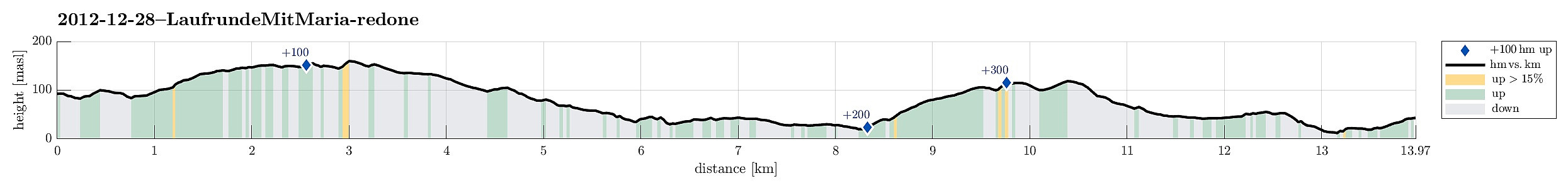 End-of-the-year-jogging around Damsgårdsfjellet! :-)
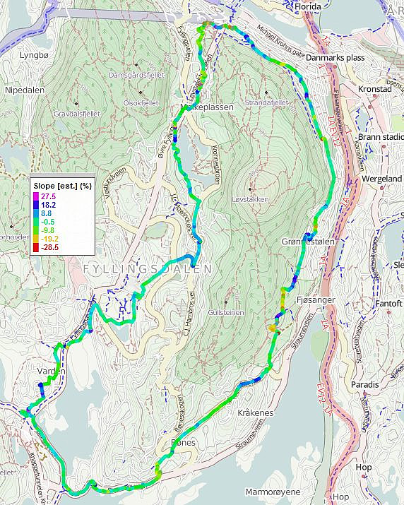
Across Melkeplassen
- Datum:
- 10.09.2012
- Tourcharakter:
- Fahrradtour
- Tourlänge:
- 0:30h
- Entfernung:
- 9,0km
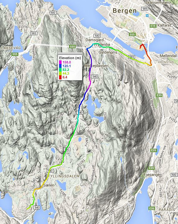 From Fyllingsdalen to Bergen via Melkeplassen.
Around-Nordåsvatnet cycling
- Datum:
- 09.09.2012
- Tourcharakter:
- Fahrradtour
- Tourlänge:
- 2:00h
- Entfernung:
- 40,9km
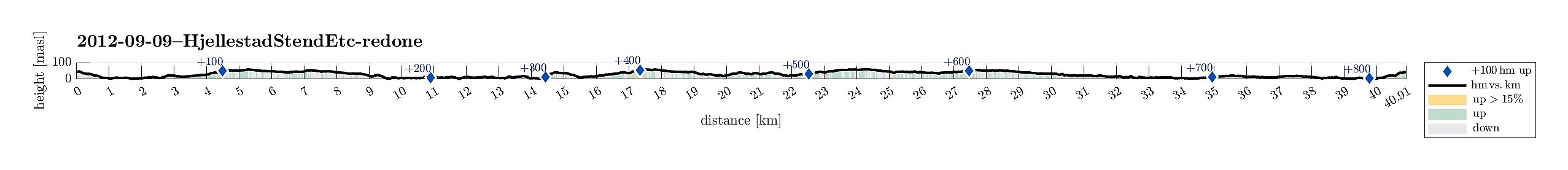 Medium-long cycling trip around Nordåsvatnet.
Gravdalsbakken cycling
- Datum:
- 02.09.2012
- Tourcharakter:
- Fahrradtour
- Tourlänge:
- 1:45h
- Entfernung:
- 27,0km
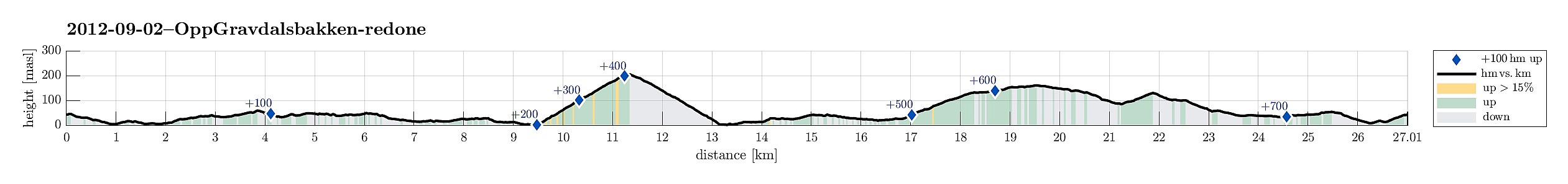 Bike ride with in-between challenge (Gravdalsbakken).
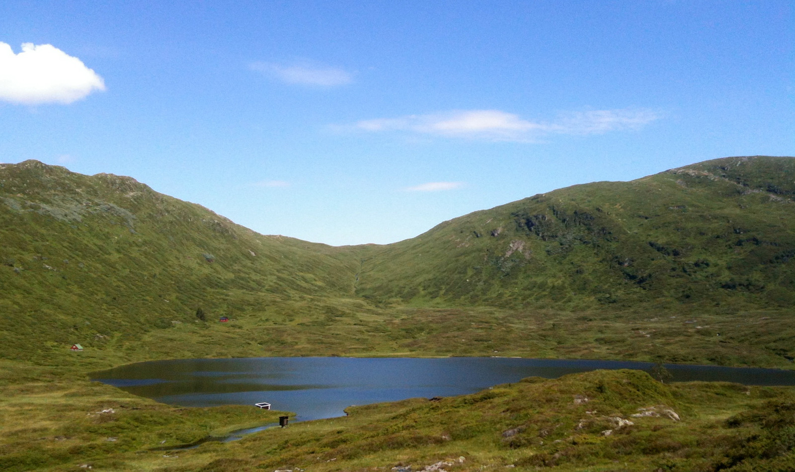
Reppadalen
- Datum:
- 28.07.2012
- Tourcharakter:
- Bergtour
- Tourlänge:
- 4:00h
- Entfernung:
- 10,1km
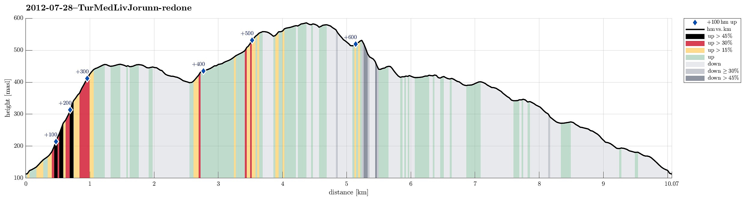 Very nice hike to Reppadalen! :-)
Selected photos are available as Google+ photo album .
Very nice hike to Reppadalen! :-)
Selected photos are available as Google+ photo album .
Jogging around Løvstakken
- Datum:
- 13.05.2012
- Tourcharakter:
- Jogging
- Tourlänge:
- 2:30h
- Entfernung:
- 20,1km
 Quite long jogging round (around Løvstakken)!
Kanadaskogen Walk
- Datum:
- 08.01.2012
- Tourcharakter:
- Wanderung
- Tourlänge:
- 1:30h
- Entfernung:
- 5,9km
 Nice walk in Kanadaskogen! :-)
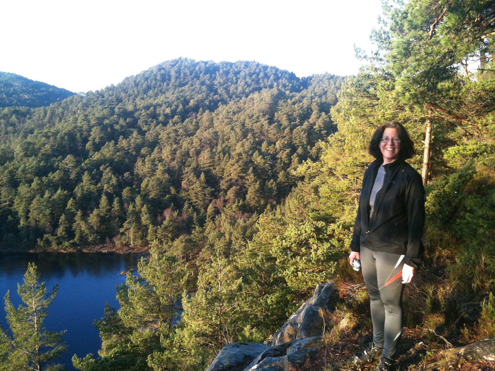
Løvstakken
- Datum:
- 30.12.2011
- Tourcharakter:
- Bergtour
- Tourlänge:
- 1:30h
- Entfernung:
- 10,8km
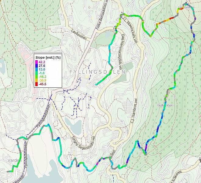 Walk via Gullsteinen to Løvstakken and retour.
Web page WestCoastPeaks.com provides useful information about Løvstakken .
Walk via Gullsteinen to Løvstakken and retour.
Web page WestCoastPeaks.com provides useful information about Løvstakken .
Fyllingsdalen Walk
- Datum:
- 27.12.2011
- Tourcharakter:
- Jogging
- Tourlänge:
- 1:45h
- Entfernung:
- 8,4km
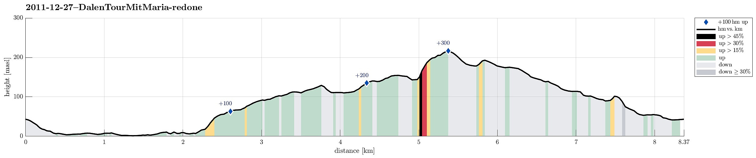 Nice after-xMas walk through parts of Fyllingsdalen
