Archive - Date
Archive - Activity
-
Bike trip (120)
- Bike trip - mixed (38)
- Bike trip - road (5)
-
Other trip (1)
- Kayaking (1)
-
Other winter trip (4)
- Snowshoe trip (4)
- Ski trip (4)
- Trip by foot (732)
Archive - Geography
Peakbook-Friends
Bergen city walk on May 17
- Date:
- 17.05.2024
- Characteristic:
- Walk
- Duration:
- 1:00h
- Distance:
- 4.2km
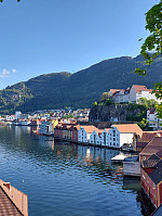 We were out early to see the early parts of the May 17 celebrations in Bergen. After enjoying the atmosphere and a nice coffee break in beautiful spring weather near Smålungeren, we walked towards Sandviken (via Torget, first, then along Bryggen to Bergenhus, before continuing along some streets further northwards).
Selected photos are available as Google photo album .
See also the related FB-page Hiking around Bergen, Norway .
From Varden to Melkeplassen via Gravdalsfjellet
- Date:
- 01.05.2024
- Characteristic:
- Hike
- Duration:
- 3:30h
- Distance:
- 8.2km
 The initial plan was to hike from Varden to Bergen via Gravdalsfjellet. We started northwards from Varden, reaching Langaheia in the east of Stora Krokatjørna soon after. We then "crossed over" the gravel road from Spelhaugen to Tennebekktjørna to continue to Eikelifjellet. North of Eikelifjellet, we then surrounded Nipetjørna in its northwest in order to take the steep way up to Gravdalsfjellet. We then continued along the main trail (into the direction of Damsgårdsfjellet). However, instead of ascending to Holefjellet "as usually", we took a slightly more southern route eastwards. This brought us to the ascent to Olsokfjellet (via its northwestern ridge). From Olsokfjellet, we then used one of the main trails (in northeastern direction) to get down to Melkeplassen. >>>
Bekhilderen at low tide
- Date:
- 20.04.2024
- Characteristic:
- Hillwalk
- Duration:
- 3:00h
- Distance:
- 6.8km
 Planning our timing just right, we decided to visit Bekhilderen at low tide. We parked along Telavågvegen and followed first the road Håvarden. This brought us to the old mill at Selståvågen. From there, we followed the trail first to Grunnevågen and then further, on the other, southern side, to Bekhilderen. After having some good time there, we returned, basically following the same route "backwards". :-)
Selected photos are available as Google photo album .
See also the related FB-page Hiking around Bergen, Norway .
Web page UT.no from the Norwegian Trekking Association recommends a similar hike .
From Bergen to Varden via Løvstakken
- Date:
- 15.04.2024
- Characteristic:
- Hike
- Duration:
- 4:00h
- Distance:
- 11.7km
 After work, I decided to move my body a little and walk home via Løvstakken. I crossed Puddefjorden via Småpudden and then ascended towards Juvdalen via Solheimslien. Right next to Strandafjellet, this brought me up to the heights north of Løvstakken. Following one of the main trails, there, I then continued to the top of Løvstakken. Continuing along the main trail southwards, I then crossed over Gulsteinen to get down to Bønes. Walking through Fjellsdalen and following some more roads I arrived at Nordåsvatnet. From there, it was then only back northwards to Varden along Sælevatnet.
Selected photos are available as Google photo album .
See also the related FB-page Hiking around Bergen, Norway .
Web page WestCoastPeaks.com provides useful information about Løvstakken .
From Kronstad to Høyteknologisenteret
- Date:
- 15.04.2024
- Characteristic:
- Walk
- Duration:
- 0:30h
- Distance:
- 1.7km
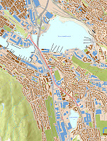 Instead of taking Bybanen, I decided to just walk from Kronstad to Høyteknologisenteret.
See also the related FB-page Hiking around Bergen, Norway .
Walk around Sælevatnet
- Date:
- 14.04.2024
- Characteristic:
- Hillwalk
- Duration:
- 2:00h
- Distance:
- 9.6km
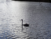 This time, the plan was to walk around Sælevatnet. I started from Varden and headed towards Bondegården in the north of Sælevatnet, first. I the surrounded Bondegården in its south (around Neset). On the other side, I then followed Sælenveien southwards, before I turned left to enter Stokkedalen via Løtveitveien. Looking east, I wondered whether it is possible to ascent towards Barhaugen via its very steep western flank. North of house #90 in Stokkedalen, I then found an opportunity to get up (not really a trail, but it looked as if others had done this before, still). This brought me up to Rekdalsveien, which I then followed southwards in order to connect to Barhaugen. At house #95, however, there's no way to proceed; I thus had to "go around" via Fjellsdalen. This >>>
Visiting Arboretet for Rhododendron Blossoms
- Date:
- 13.04.2024
- Characteristic:
- Walk
- Duration:
- 1:30h
- Distance:
- 4.5km
 We wished to see whether the rhododendra had started to blossom in Arboretet and indeed some of them had -- very nice! :-)
Selected photos are available as Google photo album .
See also the related FB-page Hiking around Bergen, Norway .
Arboretet can also be found on the Internet .
Short walk around Varden
- Date:
- 07.04.2024
- Characteristic:
- Walk
- Duration:
- 1:00h
- Distance:
- 2.7km
 Just a short walk around Varden.
See also the related FB-page Hiking around Bergen, Norway .
Short walk near Varden
- Date:
- 06.04.2024
- Characteristic:
- Walk
- Duration:
- 0:30h
- Distance:
- 2.5km
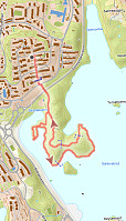 Short walk in the neighborhood to get some fresh air. No more, no less. :-)
See also the related FB-page Hiking around Bergen, Norway .
Spelhaugen from Varden
- Date:
- 05.04.2024
- Characteristic:
- Hillwalk
- Duration:
- 2:00h
- Distance:
- 6.1km
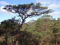 I had to get something from Spelhaugen and decided to walk there through Kanadaskogen.
Selected photos are available as Google photo album .
See also the related FB-page Hiking around Bergen, Norway .


