Archiv - Nach Datum
Archiv - Nach Aktivität
-
Andere Tour (1)
- Kayaking (1)
-
Andere Wintertour (4)
- Schneeschuhtour (4)
-
Fahrradtour (137)
- Fahrradtour Straße (9)
- Fahrradtour gemischt (51)
-
Fußtour (740)
- Bergtour (363)
- Jogging (18)
- Spaziergang (89)
- Wanderung (270)
-
Skitour (4)
- Tourenskilauf (4)
Archiv - Nach Geografie
Peakbookfreunde


Gesammelte Listen
-
Bergen ≥ 50m pf. og ≥ 100 m.o.h.
(87/89)
 97%
97% -
Most dominating tops of the Bergen peninsula
(68/75)
90%
-
Utvalgte topper og turmål i Bergen
(316/350)
90%
-
Alle topper i Bergen
(357/398)
89%
-
Opptur Bergen
(100/113)
88%
-
De syv fjell rundt Bergen
(6/7)
85%
-
Sund ≥ 50m pf.
(14/18)
77%
-
Os ≥ 50m pf.
(25/34)
73%
-
Søyler (fastmerker) i Bergen
(68/100)
68%
-
Fjell ≥ 50m pf.
(21/32)
65%

Feråsen, Sørås, and Skeisåsen -- an evening cycling round
- Datum:
- 02.09.2015
- Tourcharakter:
- Fahrradtour gemischt
- Tourlänge:
- 2:30h
- Entfernung:
- 28,3km
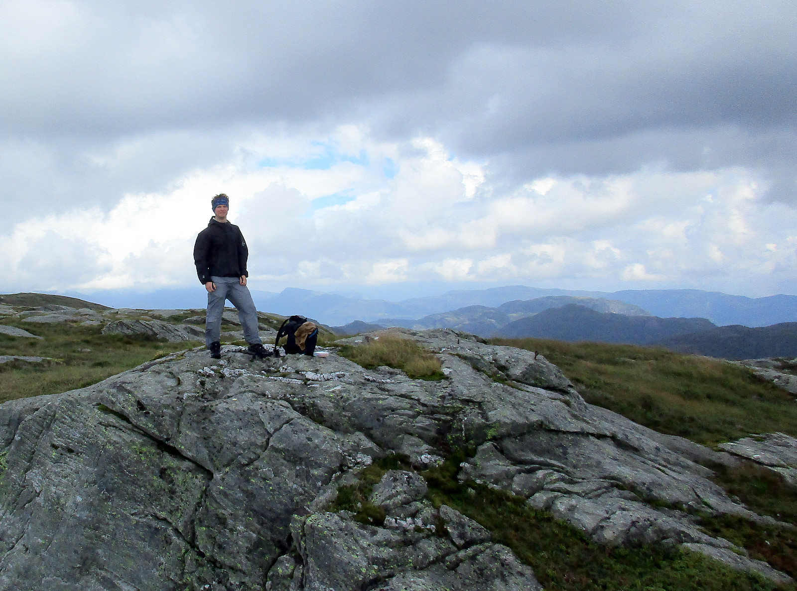
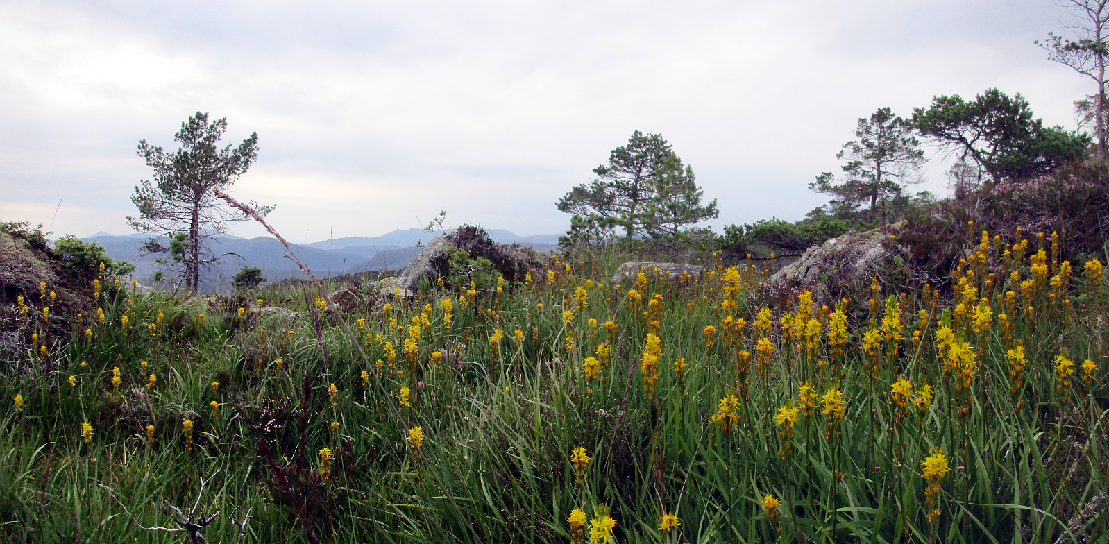
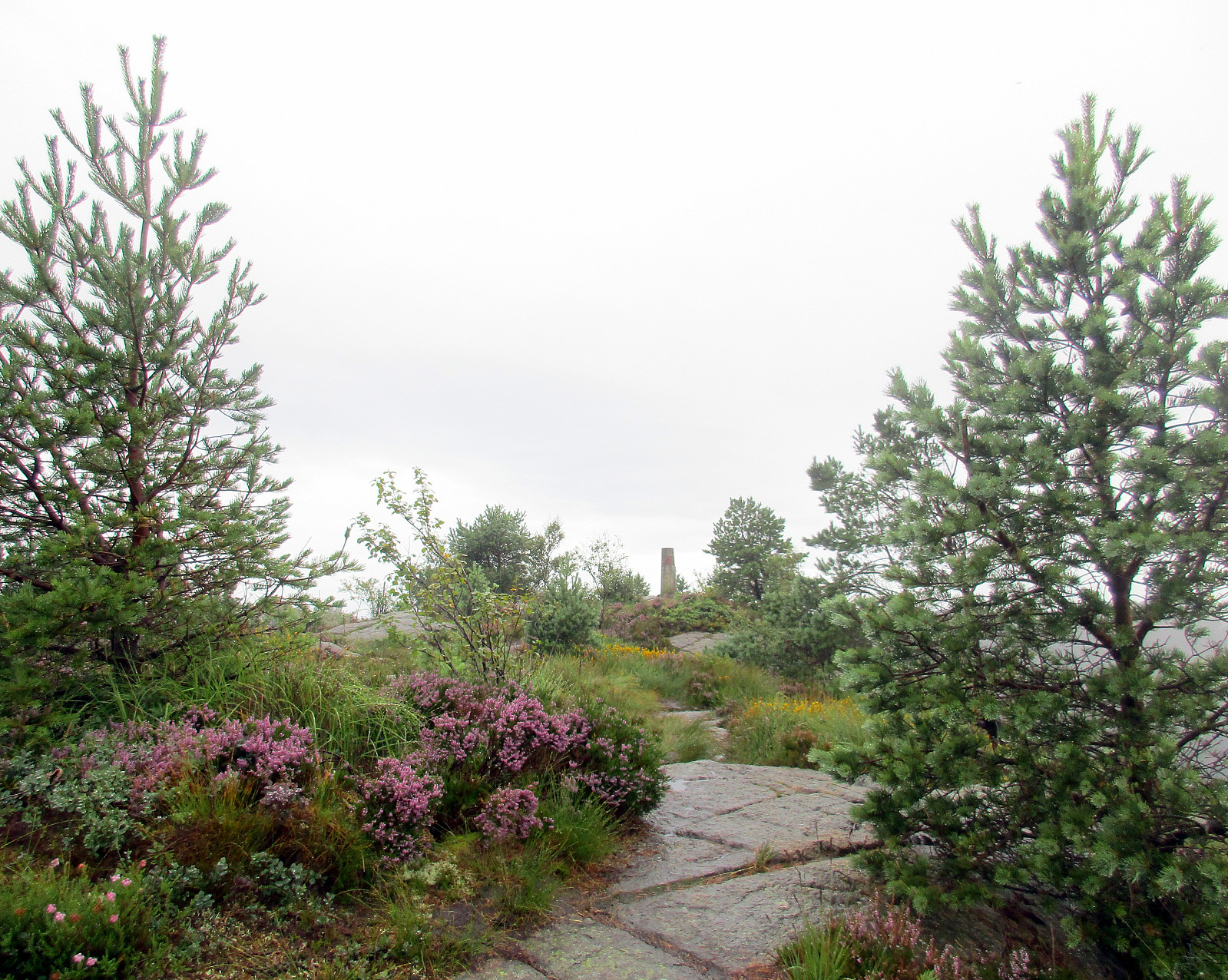
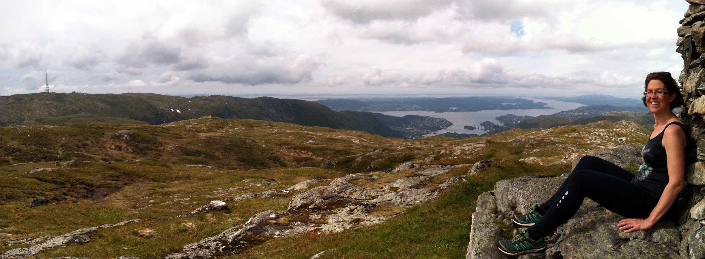
 After work, I needed some fresh air. After only few minutes of decision making, I got on my bicycle and started a quick round south of Fyllingsdalen. My first goal was Feråsen -- an easy-to-overlook small hill between Søreide, Steinsvik and Sandsli. I approached Feråsen from the east and ended up in a small street called Feråslia. I left my bicycle there and continued without. I found a simple trail that looked as if it would surround Feråsen. After having followed it somewhat half around Feråsen, I decided to simply ascend to the top -- with or without a path. While steep on this side, this worked easily and quickly, but I ended up on the neighboring small hill, right next to Feråsen. I changed over -- just to find out that the highest point is mostly part of a (private) garden. >>>
Fusafjellet
- Datum:
- 30.08.2015
- Tourcharakter:
- Bergtour
- Tourlänge:
- 6:30h
- Entfernung:
- 17,4km
 We took the ferry from Hattvik to Venjaneset and continued -- only a little less than 3km -- to Fusa. We parked the car right next to the street, where it crosses Sagelva and where a sign points towards the old postal path (gamle postveien) -- not at the least as also recommended by the page about Storehorga and Langenuen on WestCoastPeaks.com . We first went up a simple street called Øpstad (on the eastern side of Sagelva), which connects directly to a useful forest road, leading up the valley. At about 125mosl, we came to a road fork, continuing on the left, further up. At about 300mosl, another trail fork opens up for different alternatives -- we turned left, again, following the most direct route up to Fusafjellet (from there). Ascending a little further from there, we left the tree line below us and started to enjoy the many nice views that >>>
Raudlifjellet
- Datum:
- 22.08.2015
- Tourcharakter:
- Bergtour
- Tourlänge:
- 1:30h
- Entfernung:
- 4,6km
 A few hundred meters south of the gas station in Søfteland (along the E39), a narrow bridge leads over to Tømmernes. Behind there, right before crossing the little stream, which comes down there to enter Røkenesvatnet, we parked the car and walked into Botnabekken. We first tried to find a forest road on the northern side of the stream, but this was mostly forest terrain -- very wet, actually! About 100 height meters up in Tømmernesdalen, we crossed the stream, again, and continued -- steeply! -- towards the east (and up Raudlifjellet). This ascent was mostly without any path (at least not any visible path) -- still, this worked pretty nicely and we quickly arrived on a nice long ridge that would bring us to the top. Up on Raudlifjellet, we connected to the path that we had walked before (in 2014) and returned on it back to >>>
Storafjellet and the western end of Fanafjellet
- Datum:
- 16.08.2015
- Tourcharakter:
- Bergtour
- Tourlänge:
- 3:00h
- Entfernung:
- 8,3km
 After having read Petter Bjørstad's page about Storafjellet , I was well prepared to get started. The day was very wet, but it was not cold -- so I enjoyed myself! :-) I found the path as described and ascended quickly to Storafjellet (funny name -- means "the big mountain" -- for a quite insignificant hill!). I continued further, descending towards Krokeide, coming down to a road called Svartefjorden. I did not follow this street, however, but descended all the way down to Eidet, where connected to the main road (Krokeidevegen) -- very near to the ferry pier! From there, I went back up (the main road) until I turned right into Austrevågen (quite on top of the small saddle over which the main road leads). I first did not find my way down to the bay Austrevågen, but after a short forth and back, I found it nonetheless >>>
Barmaneset on Algrøyna
- Datum:
- 14.08.2015
- Tourcharakter:
- Wanderung
- Tourlänge:
- 2:30h
- Entfernung:
- 7,0km
 We parked on Nordre Øyavegen, right before getting close to the few houses on northern Algrøyna. From there, we first followed the road further (and down and upwards, again), before continuing on Kongvikvegen (to the west). After maybe 200m, a barn is on the left side with some signs that hiking tracks are leaving the road from there (down between the road and the barn through a narrow passage). Once this entry point is found, the rest of the tour is quite straight forward (or more in a round, actually). We walked out Barmaneset to the west, approaching Rognkallen and Langtrotten at the end of this peninsula (and Kungvika on our right). Once we came close to Krabbakeila, right between Rognkallen and Langtrotten, where the ocean waters get wild, even on a very calm day, we first approached >>>
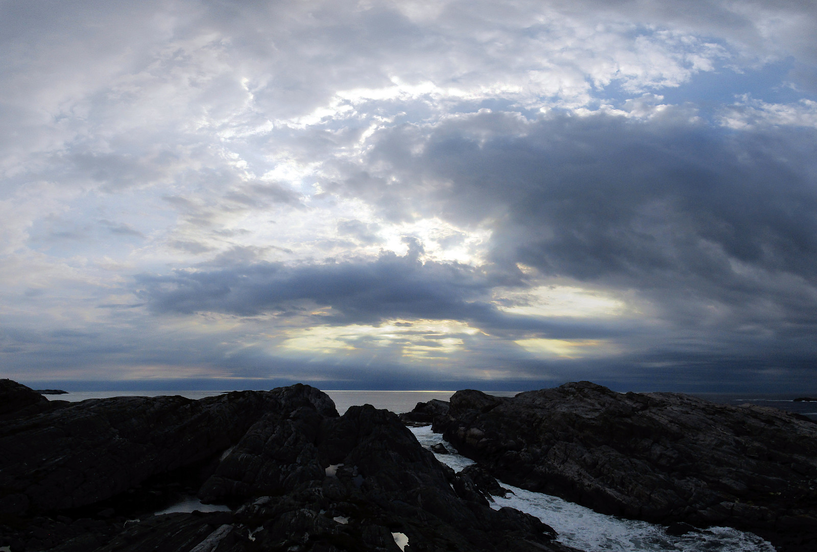
Veten on Korsneset
- Datum:
- 08.08.2015
- Tourcharakter:
- Bergtour
- Tourlänge:
- 1:45h
- Entfernung:
- 4,8km
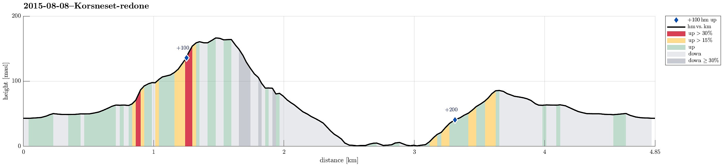 We parked on the parking place at Korsnesvegen (where the forest road norwards into Hagadalen departs). From there, we first followed the forest road northwards (for about 800m), before we found a well-marked path on the left. We followed this path, first westwards, before we then ascended to Veten in a larger turn (first northwards, then northeast). Right before reaching the top, it pays off to go a few steps to the left, westwards -- from there, one enjoyes a great view over Korsfjorden! From the top of Veten, the view over Fanafjorden is really great! We continued on the path that we had taken upwards, then downwards and back to the forest road (this part of this path is less clear, but still relatively easy to find). Back on the forest road, we continued northwards on it, down to >>>
Sveåsen from Kismul
- Datum:
- 05.08.2015
- Tourcharakter:
- Bergtour
- Tourlänge:
- 2:00h
- Entfernung:
- 7,5km
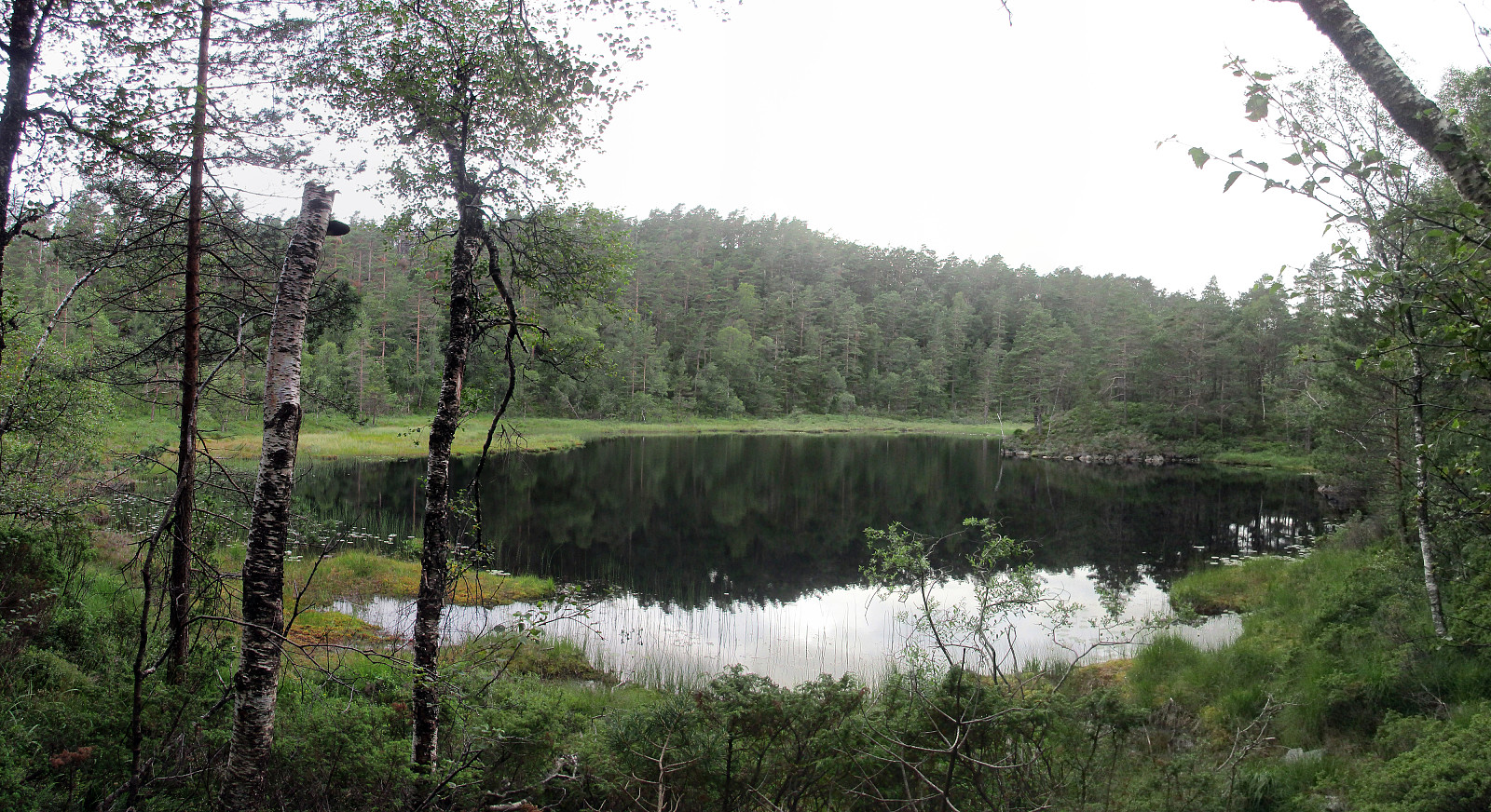 We parked at Kismul, right next to the small street, which leads around Kalandsvatnet, and right next to a partially legible note that informed (more than informs) that earlier the train would also stop there at Kismul (this explains, also, why there is a quite nice cycling path, in extended stretches parallel to the street), and walked up Kismulvegen first. Shortly after passing the last (of very few) houses, a forest road branches to the right and gently upwards. Following this road, one gets up to Svartevatnet with a very easy and relaxed walk. The vegetation next to the path is very varied and it is very enjoyable to walk this forest road! After first walking all the (not very long) way straight ahead towards Svartevatnet (at the lake, we clearly had the impression that the water level >>>
Sveningen from Midseterfjellet
- Datum:
- 02.08.2015
- Tourcharakter:
- Bergtour
- Tourlänge:
- 6:15h
- Entfernung:
- 20,1km
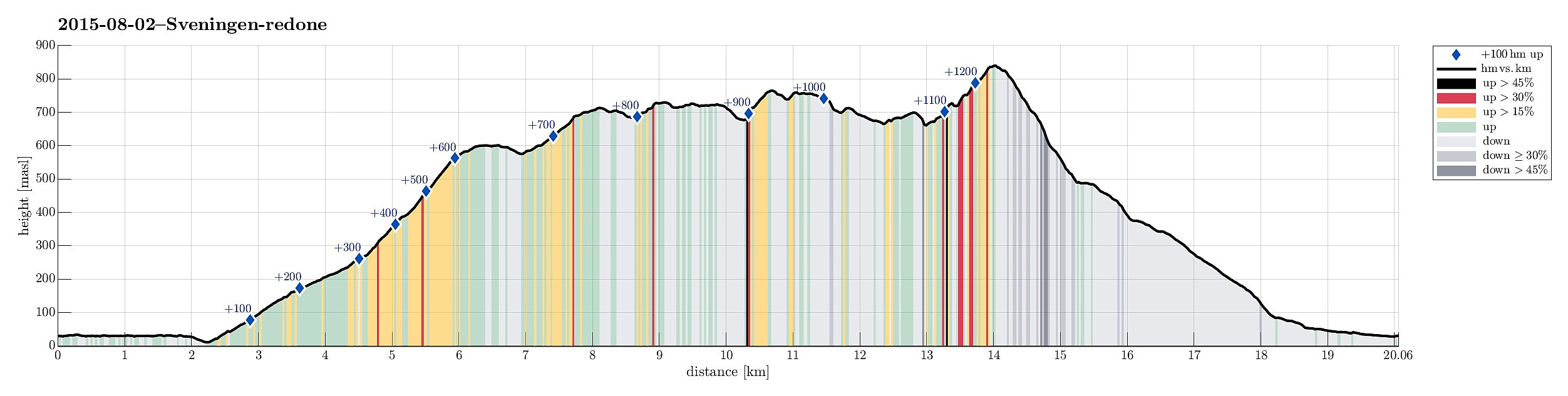 We parked our car at the end of Øvredalsvatnet (in Øvredalen) and walked back (southwards) along the lake to get to our starting point for the hike over the ridge (in Løyningdalen, right south of where Øvredalesvatnet "ends"). We then walked up the narrow road, which leads up to Midsætret, where a small number of houses assemble. From there, we first followed (for a short stretch, only) a forrest road, which leads mostly westwards, before then taking the hiking path that leads up to Midseterfjellet. First, we hiked in the forrest, but as soon as we left the trees behind, nice views opened, first mostly in western direction. The approximately 15 degrees Celsius were comfortable hiking weather -- in the beginning, however, it rained freshly melted snow, which brought the thought >>>
From Flaktveit to Fløyen
- Datum:
- 28.06.2015
- Tourcharakter:
- Bergtour
- Tourlänge:
- 3:30h
- Entfernung:
- 14,1km
 We took bus #4 to Flaktveit and left shortly before the last bus stop. First, we headed in the wrong direction (towards Ulsberglia), probably confused by the many swings, which the bus took, before approaching it final bus stop -- quite embarrassing! :-) But soon we found out, realigning our hike (now in southern direction!), heading towards Hjortland, first. Right after Søre Hjortland and shortly before Grønstølen, we found the path that leads up to the ridge high above Vinddalen. Once up there, one enjoys magnificent views, both towards west via Vinddalen and towards east! From there, heading mostly south, one gets up via Ørnafjellet to a longer ridge that leads to Vikinghytten -- a really nice part of this hike! From Vikinghytten, we headed towards Rundemannen, mostly in western >>>
Hetlebakksåta and Birkelandsnipa
- Datum:
- 27.06.2015
- Tourcharakter:
- Bergtour
- Tourlänge:
- 2:19h
- Entfernung:
- 10,1km
 I parked in Breistein, near the place, where the ferry leaves to Osterøy. Right from there, I found a simple path through the forest up to a paved forest path, which lead me first in northwestern direction. After a turn to the left, I found the path towards Hetlebakksåta -- easily visible -- leaving to the left. I followed this (nice!) path upwards, first via Nuken, then Fjellbruna, towards Fjellsteinen, where a beautiful small lake is formed by a dam. Easily and quickly, I continued upwards to Hetlebakksåta, from where I enjoyed nice views in all directions (mostly towards south, west, and north, though). From there, I descended, first in southern direction, then turning right and continuing in northwestern direction, towards Hetlebakka. I followed a narrow street to the other side, >>>
