Archive - Date
Archive - Activity
-
Bike trip (137)
- Bike trip - mixed (51)
- Bike trip - road (9)
-
Other trip (1)
- Kayaking (1)
-
Other winter trip (4)
- Snowshoe trip (4)
- Ski trip (4)
- Trip by foot (740)
Archive - Geography
Peakbook-Friends


Collected lists
-
Bergen ≥ 50m pf. og ≥ 100 m.o.h.
(87/89)
 97%
97% -
Most dominating tops of the Bergen peninsula
(68/75)
90%
-
Utvalgte topper og turmål i Bergen
(316/350)
90%
-
Alle topper i Bergen
(357/398)
89%
-
Opptur Bergen
(100/113)
88%
-
De syv fjell rundt Bergen
(6/7)
85%
-
Sund ≥ 50m pf.
(14/18)
77%
-
Os ≥ 50m pf.
(25/34)
73%
-
Søyler (fastmerker) i Bergen
(68/100)
68%
-
Fjell ≥ 50m pf.
(21/32)
65%

Trollefjellet
- Date:
- 29.07.2022
- Characteristic:
- Hike
- Duration:
- 6:00h
- Distance:
- 11.6km
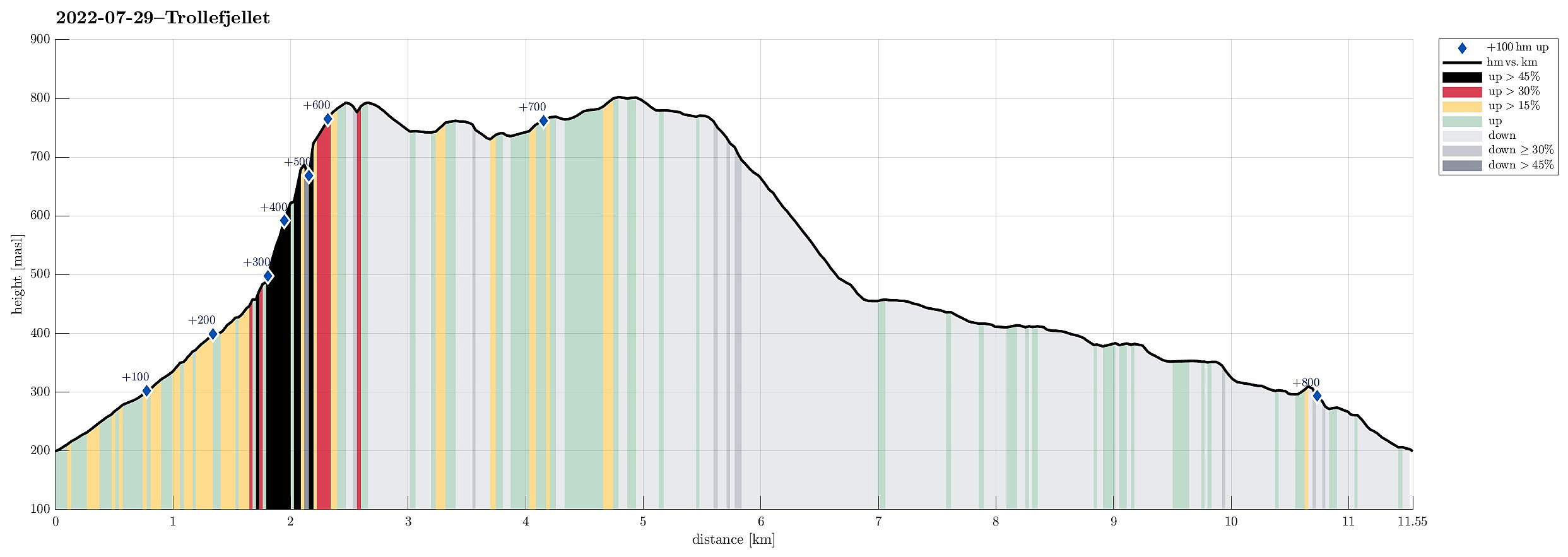 With all the many and wonderful mountains all around, we decided to not drive all too much and rather make a hike close to where we were staying. The impressive cliff of Trollefjellet immediately came to mind and after a short look at the map, it appeared possible to ascend to Trollefjellet via its western (steep!) ridge. After briefly consulting with one from Indrehus, we not only learned that he had made this ascent already before, but also got permission to drive up a little along the forest road in the south of Storeelva. This brought us up to about 200mosl (and quite a bit nearer to the cliff!) and we parked where the forrest road turns right, away from Storeelva and up Nevredalen. From there, we then followed the forrest road further up. This brought us almost perfectly to the saddle >>>
Hornelen (and Storenipa and Svartevassegga) from Berleneset
- Date:
- 28.07.2022
- Characteristic:
- Hike
- Duration:
- 8:00h
- Distance:
- 16.4km
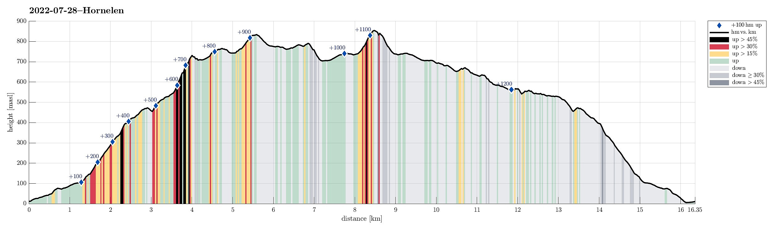 One motivation to drive all the way from Bergen to Bremanger was the prospect of hiking Hornelen, i.e., a mountain that we had heard/read repeatedly about. From the place, where we stayed over night, in the southwest of Svelgen, it's not a really long drive to get to Bremangerlandet. Especially Skatestraumtunnelen helps to get over without any waiting times. The day before, on our hike on Batalden , we had learned that ascending Hornelen from Berleneset should be nice. Accordingly, we did not follow the main trail (from Hornskor), but followed road 616 a little further to the west, before turning left and right into Berleporten, i.e., a tunnel that leads to the other, southern side of the mountains, where Berlepollen cuts deep into Bremangerlandet. More or less right after leaving the tunnel, we then turned >>>
