Archiv - Nach Datum
Archiv - Nach Aktivität
-
Andere Tour (1)
- Kayaking (1)
-
Andere Wintertour (4)
- Schneeschuhtour (4)
-
Fahrradtour (137)
- Fahrradtour Straße (9)
- Fahrradtour gemischt (51)
-
Fußtour (740)
- Bergtour (363)
- Jogging (18)
- Spaziergang (89)
- Wanderung (270)
-
Skitour (4)
- Tourenskilauf (4)
Archiv - Nach Geografie
Peakbookfreunde


Gesammelte Listen
-
Bergen ≥ 50m pf. og ≥ 100 m.o.h.
(87/89)
 97%
97% -
Most dominating tops of the Bergen peninsula
(68/75)
90%
-
Utvalgte topper og turmål i Bergen
(316/350)
90%
-
Alle topper i Bergen
(357/398)
89%
-
Opptur Bergen
(100/113)
88%
-
De syv fjell rundt Bergen
(6/7)
85%
-
Sund ≥ 50m pf.
(14/18)
77%
-
Os ≥ 50m pf.
(25/34)
73%
-
Søyler (fastmerker) i Bergen
(68/100)
68%
-
Fjell ≥ 50m pf.
(21/32)
65%

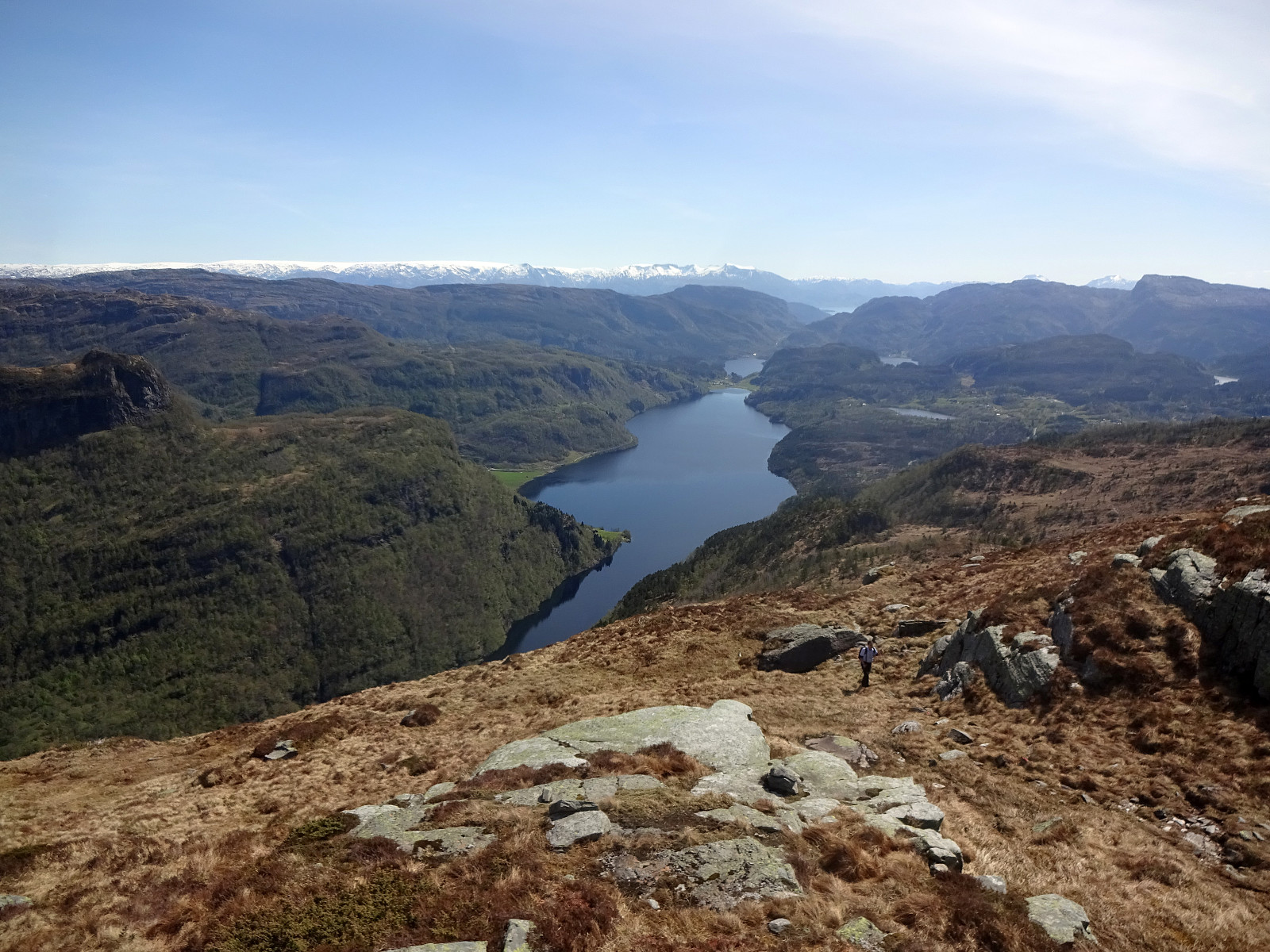
Lysehornet from Kismulvegen
- Datum:
- 07.09.2025
- Tourcharakter:
- Bergtour
- Tourlänge:
- 4:00h
- Entfernung:
- 6,9km
 We had the idea to hike Lysehornet from the northeast (from Kismulvegen) and thus drove via Fana to Kalandsvatnet. Near house #47 along Kismulvegen, we parked -- not without an interaction with a man, who made it explicit that he'd wish us to park in Bygarasjen instead. We then started our hike into southwestern direction, first following a side-part of Kismulvegen up and towards Lindedalen. At large, the plan was to get to Lysehornet without a trail, while then taking a trail back down. After passing the upper houses (and quite a bit of rusting garbage of small to large sizes), we eventually made into the forest of Lindedalen. The first high point to reach was Hovåsen and the ascent from the northeast was a bit steep (but well doable). From Hovåsen, the plan was to hike around the >>>
Gjønakvitingen from Gjøn (via Selfjellet)
- Datum:
- 17.08.2025
- Tourcharakter:
- Wanderung
- Tourlänge:
- 8:00h
- Entfernung:
- 13,5km
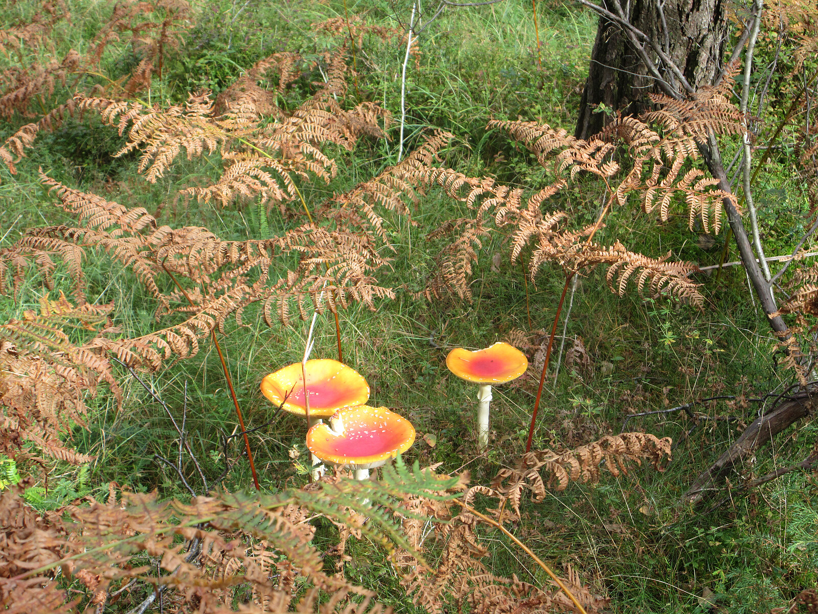
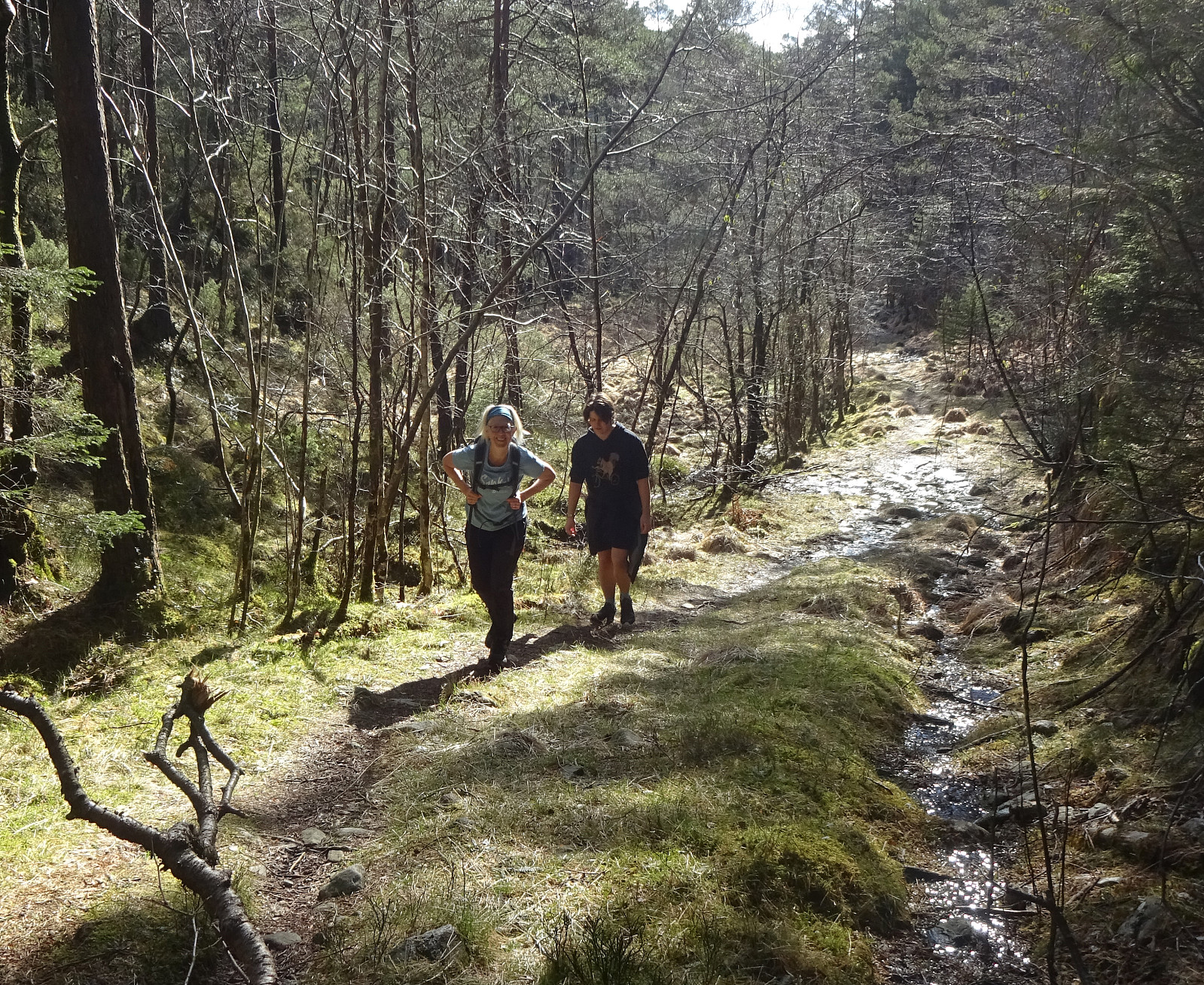
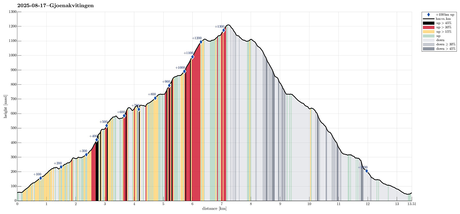 The weather was promising and so we thought this would be a good day to hike up to Gjønakvitingen from Gjøn. From Bergen, we drove towards the East, first along E16, then road #49, before taking road #48 to Eikelandsosen. From there, it was not too far, continuing into eastern direction, before we changed to a narrow road at Holdhus. This way, we drove around the south end of Gjønavatnet in order to get to Gjønavegen, which brought us to Gjøn. At about noon-time, we then started our hike (with enough time on such a nice, long summer Sunday). The one, small "twist", which we had cooked up, when studying the map at home, was to include Selfjellet (via an ascent on the western side of Skarvaelva), before eventually taking the "main trail" down (south of Sauaskorfjellet). >>>
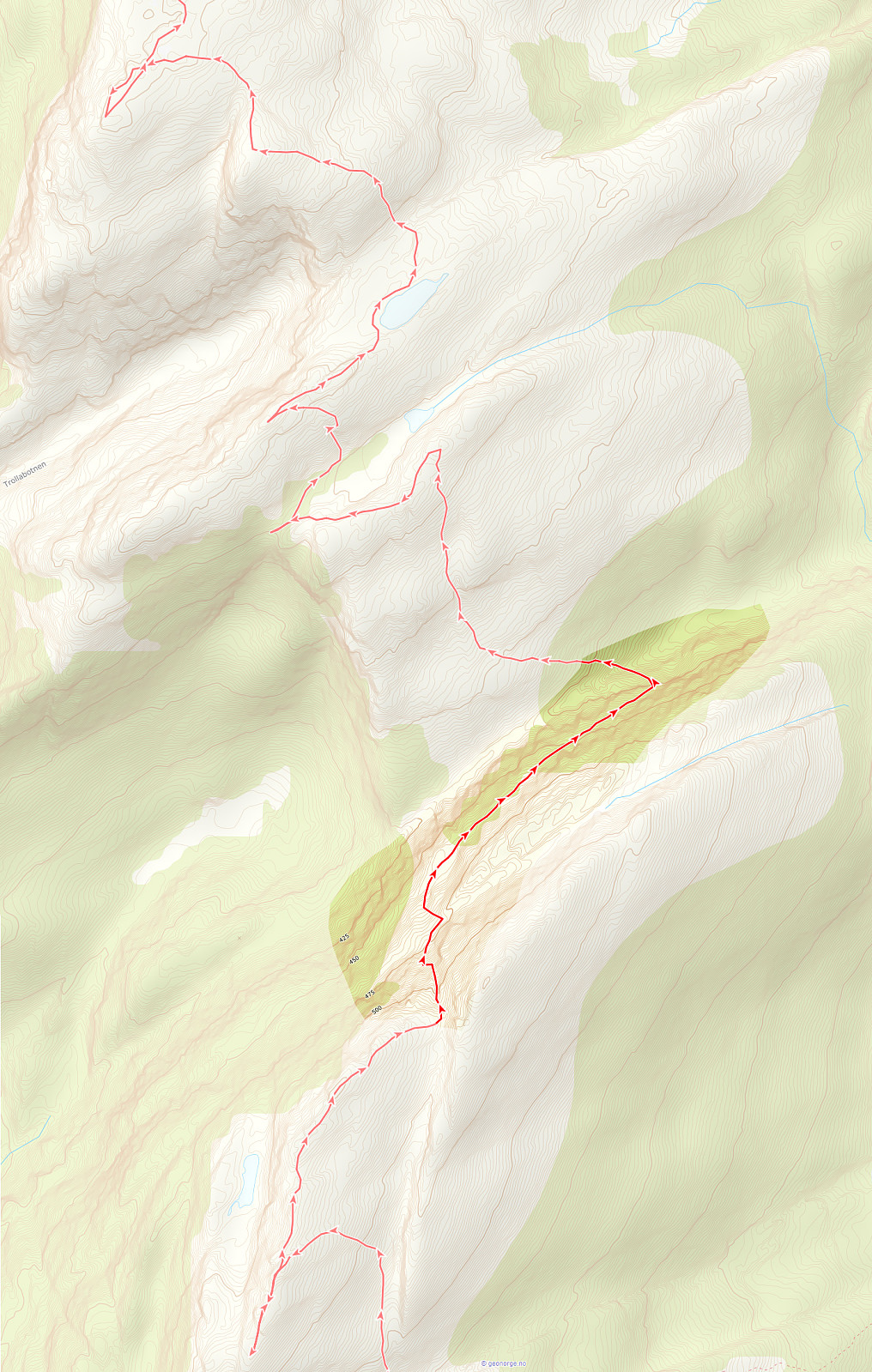
Heihillerhornet, Kjerringafjellet, and Ottanosi
- Datum:
- 26.04.2025
- Tourcharakter:
- Wanderung
- Tourlänge:
- 5:30h
- Entfernung:
- 10,7km
 We expected nice weather and thus planned for a nice hike! :-) We took the ferry from Hatvik near Os in the south of Bergen to Venjaneset in Fusa. From there, we first drove to Eikelandsosen and then to Holdhus, where we left road 48 to get up to the parking place at Heihillervegen (one pays some road fee for driving up there: NOK 75 plus about the same amount "on top" for "lagring og oppslag" as well as for "fakturagebyr"). Our first goal was to hike up to Heihillerhornet and so we "retreated" from the parking place a short stretch along the road to the place, where the trail starts (there's a sign, also). After first finding the trail head, we still managed to get off the trail within only meters from the road! :-) Instead of heading further eastwards, >>>
Round around Vinddalsvatnet
- Datum:
- 30.03.2025
- Tourcharakter:
- Bergtour
- Tourlänge:
- 3:00h
- Entfernung:
- 7,7km
 We started in Søfteland, heading for Gamlevegen. Our first goal was to have a look a this old stone bridge (gamle Torve bro), which -- apparently -- once was part of the old Postal route to Stavanger. This bridge seems to be in a pretty bad condition, hold together by some improvised support structure, these days. We then continued further southwards (following, if not mistaken, the former Postal route). After passing by Gåsakilen (on its western side), we left the "main route" to include Galtåsen "on the way". Since we approached it from the North, this ascent was a bit steep at times (but fully doable). From Galtåsen, we then continued in southwestern direction, eventually "ending up" on a nice forest road. But instead of stepping out and onto Byvegen, >>>
Short visit to Lyseklosteret
- Datum:
- 28.07.2024
- Tourcharakter:
- Spaziergang
- Tourlänge:
- 0:30h
- Entfernung:
- 0,2km
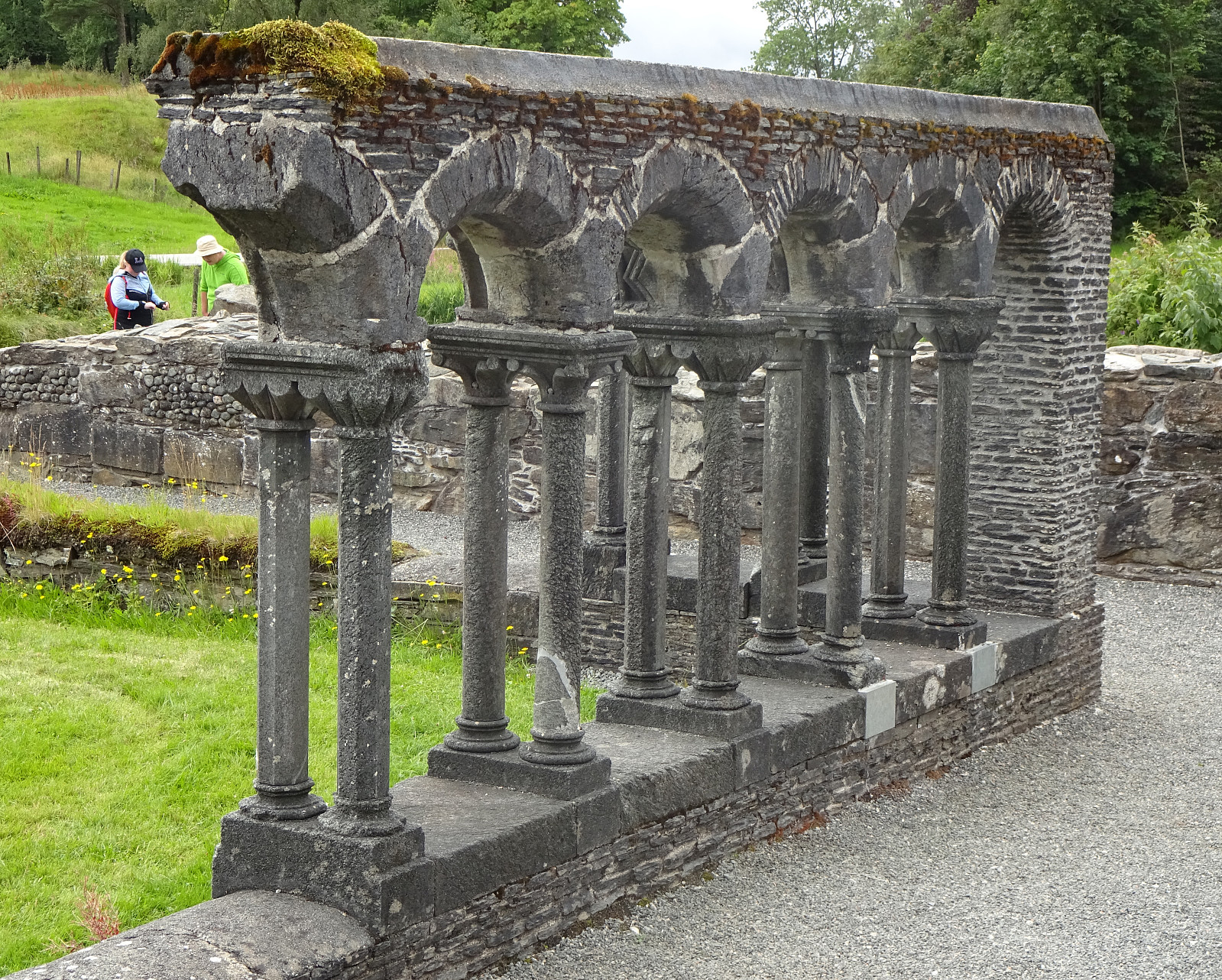 After our exploration of Lysøya , we decided to also pay Lyseklosteret a short visit. All in all, this was no more than parking right next to the ruins, walking around them for a while, and then returning to the car -- always nice to look at Lyseklosteret, but not much physical activity! :-)
Selected photos are available as Google photo album .
See also the related FB-page Hiking around Bergen, Norway .
After our exploration of Lysøya , we decided to also pay Lyseklosteret a short visit. All in all, this was no more than parking right next to the ruins, walking around them for a while, and then returning to the car -- always nice to look at Lyseklosteret, but not much physical activity! :-)
Selected photos are available as Google photo album .
See also the related FB-page Hiking around Bergen, Norway .
Exploring (parts of) Lysøya
- Datum:
- 28.07.2024
- Tourcharakter:
- Bergtour
- Tourlänge:
- 2:30h
- Entfernung:
- 4,2km
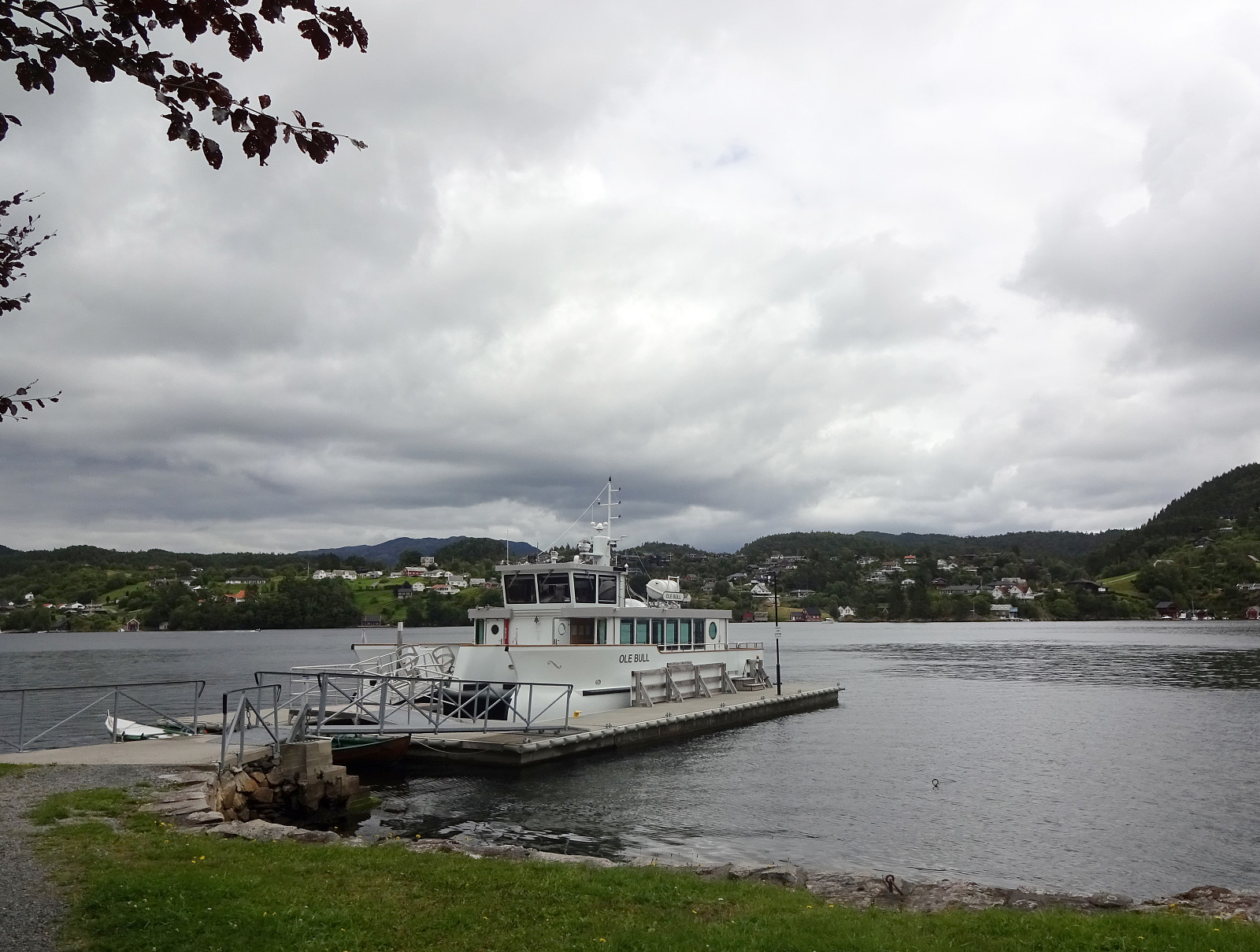 Even though we knew that Ole Bulls villa would be closed, we still thought that making an excursion to Lysøya could be nice. The ferry took us over to Lysøya from Buena and we started our walk with taking a look at Ole Bulls villa (from the outside, only). From there, we then continued southwards (and upwards) to take a look at a small vista-point ("Udsigten"), before then continuing northwards (and via the heights of Lysøya). This then brought us to the little watch tower ("Tårnet") from which one indeed can enjoy some nice views (over the tree-tops). Thereafter, we walked further northwards in order to take a look at Furulunden (also the highest point on Lysøya). Next on our "ToDo list" was Lysøygrotta, just a little underneath Furulunden (in its west). >>>
Søtefjellet from Hausdalen
- Datum:
- 20.07.2024
- Tourcharakter:
- Wanderung
- Tourlänge:
- 6:30h
- Entfernung:
- 10,4km
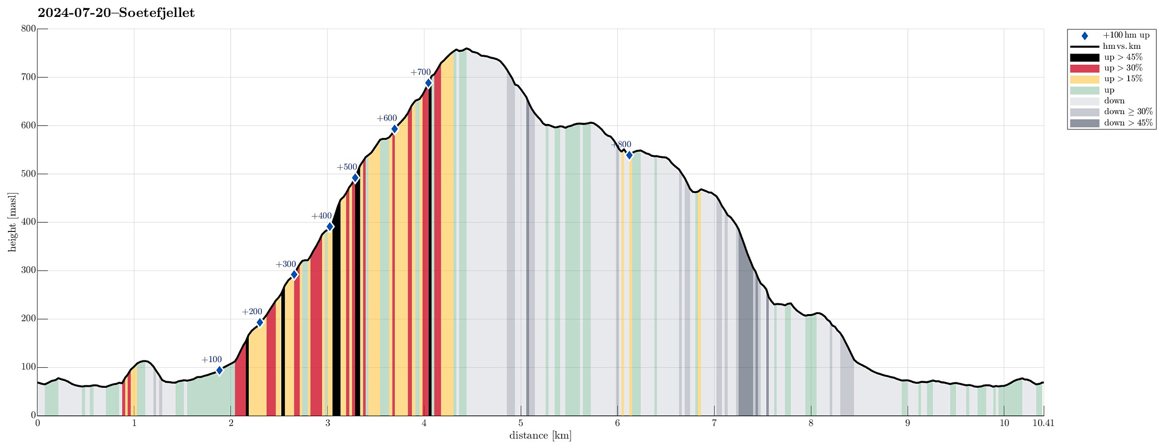 We wished to use the nice weather on this warm Saturday afternoon and headed for Hausdalen in the southeast of Bergen. Driving Hausdalen in for a little less than 7km, we parked in the southwest of Tømmervika (Samdalsvatnet), where a forest road forks off Hausdalsvegen into the direction of Straumsrinden. Following this forest road, we passed by Samdalsvatnet in its southwest, heading for the southwestern ridge of Søtefjellet, starting at Hisbotn. Just because others have described their ascent to the small hill in the north of Ulvvatnet (and even though they did not recommend to visit it -- or maybe because of their according comments :-)), this hill was included as a prelude to the ascent to Søtefjellet. Back on the forest road, and "around some corners in the northeast of Ulvvatnet, >>>
Burlifjellet and Skorafjellet
- Datum:
- 19.05.2024
- Tourcharakter:
- Wanderung
- Tourlänge:
- 5:00h
- Entfernung:
- 11,1km
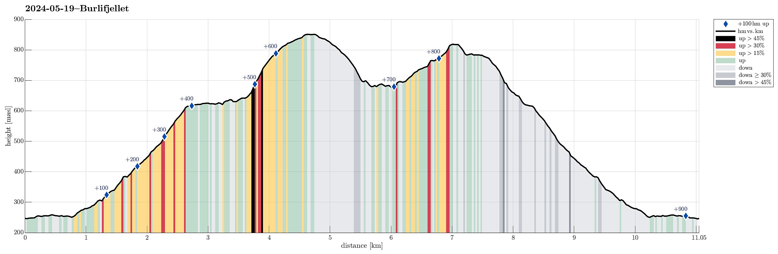 Driving north from Fusa, into the direction of Samnanger, we passed through Eikelandsosen, first, continuing further northwards along road 48. At Sævell, right after passing by Sævellavatnet, we turned right onto Sævellvegen. Near Høgehaugen, we paid a bit of road-toll in order to continue along Sævellvegen. Driving carefully (Sævellvegen is not paved further inwards), we arrived at Kjøpmannavadet shortly after. There, right next to the bridge, we parked at the side of the road. Crossing over the bridge southwards, we started our hike along a forest road that leads to Breivatnet just a little down the road. There, one crosses over Breielva right next to a small cabin right at Breivatnet. A marked trail then leads up to Helane and from there further towards the lower end of Lisetredalen. >>>
Kletten from Strandvik
- Datum:
- 18.05.2024
- Tourcharakter:
- Spaziergang
- Tourlänge:
- 0:30h
- Entfernung:
- 2,2km
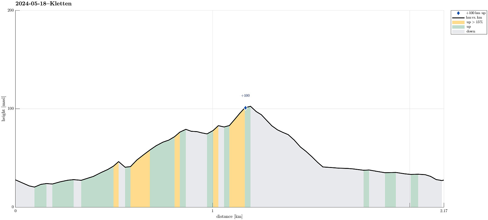 The evening was nice and with plenty of daylight still to use it was just fine with a short round up to Kletten before calling it a day. :-) The plan was to approach Kletten from the east (from Strandvik) and doing so was (almost) straight-forward. Only once, at the very end of Strandvikvegen at house 529, a bit of back-tracking was needed to reconnect with the trail (that is starting a bit further north). Then, instead of going up to Kletten at once, I first surrounded Kletten via Klettaltanen in its south, before eventually ascending to Kletten (then from its west). After crossing over Kletten, I then descended northwards to Strandvikvegen, which I then followed back to Strandvik. Quite nice that one can see Melderskin and Englafjellet from Kletten! :-)
Selected photos are available >>>
The evening was nice and with plenty of daylight still to use it was just fine with a short round up to Kletten before calling it a day. :-) The plan was to approach Kletten from the east (from Strandvik) and doing so was (almost) straight-forward. Only once, at the very end of Strandvikvegen at house 529, a bit of back-tracking was needed to reconnect with the trail (that is starting a bit further north). Then, instead of going up to Kletten at once, I first surrounded Kletten via Klettaltanen in its south, before eventually ascending to Kletten (then from its west). After crossing over Kletten, I then descended northwards to Strandvikvegen, which I then followed back to Strandvik. Quite nice that one can see Melderskin and Englafjellet from Kletten! :-)
Selected photos are available >>>
Fusafjellet from Strandvik
- Datum:
- 18.05.2024
- Tourcharakter:
- Wanderung
- Tourlänge:
- 6:00h
- Entfernung:
- 16,5km
 Given a very nice (and warm!) day, we aimed at hiking Fusafjellet from the south, starting in Strandvik. We first headed into the valley between Fusafjellet in the northeast and Bogafjellet in the west, where Vikaelva comes down. At about 80 masl, in the northeast of Nyland, the valley opens up a little and we left the main gravel road, stepping "directly north", aiming at the little saddle in the east of the small hill that "sits" there in the middle of the valley. The plan was to continue further upwards (into the direction of Langnuen) from there, but before we did that we first explored this little hills for a few minutes, enjoying some nice views southwards from it. We then followed a forest road that ascends the relatively steep southwestern side of Langnuen. >>>
