Archiv - Nach Datum
Archiv - Nach Aktivität
-
Andere Tour (1)
- Kayaking (1)
-
Andere Wintertour (4)
- Schneeschuhtour (4)
-
Fahrradtour (137)
- Fahrradtour Straße (9)
- Fahrradtour gemischt (51)
-
Fußtour (740)
- Bergtour (363)
- Jogging (18)
- Spaziergang (89)
- Wanderung (270)
-
Skitour (4)
- Tourenskilauf (4)
Archiv - Nach Geografie
Peakbookfreunde


Gesammelte Listen
-
Bergen ≥ 50m pf. og ≥ 100 m.o.h.
(87/89)
 97%
97% -
Most dominating tops of the Bergen peninsula
(68/75)
90%
-
Utvalgte topper og turmål i Bergen
(316/350)
90%
-
Alle topper i Bergen
(357/398)
89%
-
Opptur Bergen
(100/113)
88%
-
De syv fjell rundt Bergen
(6/7)
85%
-
Sund ≥ 50m pf.
(14/18)
77%
-
Os ≥ 50m pf.
(25/34)
73%
-
Søyler (fastmerker) i Bergen
(68/100)
68%
-
Fjell ≥ 50m pf.
(21/32)
65%

Blauspitze near Kals am Grossglockner
- Datum:
- 12.07.2016
- Tourcharakter:
- Bergtour
- Tourlänge:
- 8:00h
- Entfernung:
- 17,0km
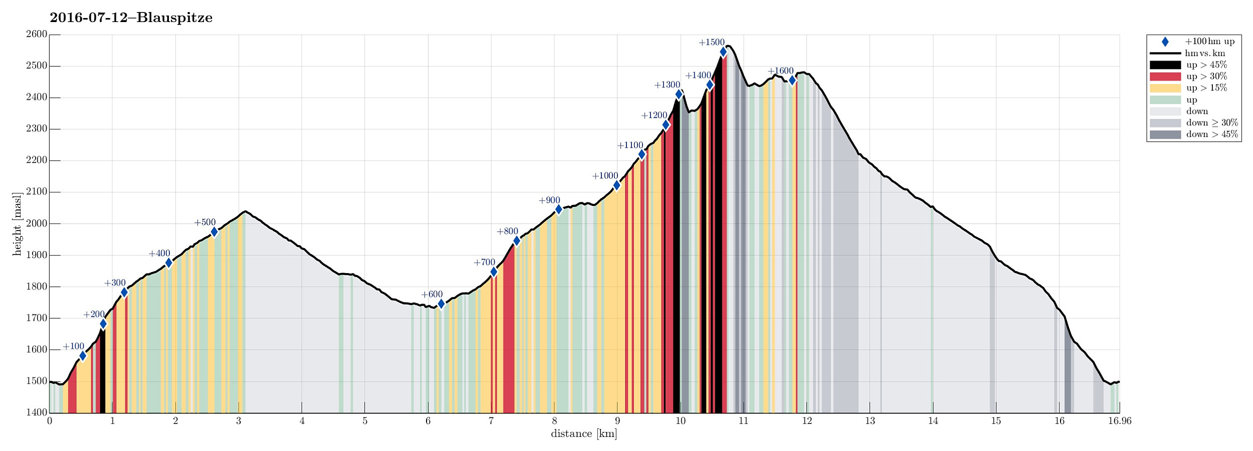 We started from Spöttling-Taurer in the upper end of Kals am Grossglockner, crossed over the Kalserbach there to the western side of the valley, and ascended from there along the Mitterbach-valley towards Kereralm. From there, we continued upwards towards the Hohes Tor. At about 2000m sea-level, we ended up in a thunderstorm and started to feel somewhat uneasy, exposing us too much to the bad weather. We therefore turned around and descended, again, following a forrest road southwards from Kereralm (at about 1800m sea-level). We connected to the place, where a lift comes up from Grossdorf, connecting to Ganotzalm, further up. We continued on the forrest road, which leads up to the hut Glocknerblick on about 1950m sea-level. There, we had a nice rest and filled up some energy (unfortunately, >>>
