Archiv - Nach Datum
Archiv - Nach Aktivität
-
Andere Tour (1)
- Kayaking (1)
-
Andere Wintertour (4)
- Schneeschuhtour (4)
-
Fahrradtour (137)
- Fahrradtour Straße (9)
- Fahrradtour gemischt (51)
-
Fußtour (740)
- Bergtour (363)
- Jogging (18)
- Spaziergang (89)
- Wanderung (270)
-
Skitour (4)
- Tourenskilauf (4)
Archiv - Nach Geografie
Peakbookfreunde


Gesammelte Listen
-
Bergen ≥ 50m pf. og ≥ 100 m.o.h.
(87/89)
 97%
97% -
Most dominating tops of the Bergen peninsula
(68/75)
90%
-
Utvalgte topper og turmål i Bergen
(316/350)
90%
-
Alle topper i Bergen
(357/398)
89%
-
Opptur Bergen
(100/113)
88%
-
De syv fjell rundt Bergen
(6/7)
85%
-
Sund ≥ 50m pf.
(14/18)
77%
-
Os ≥ 50m pf.
(25/34)
73%
-
Søyler (fastmerker) i Bergen
(68/100)
68%
-
Fjell ≥ 50m pf.
(21/32)
65%

Slættaratindur
- Datum:
- 02.05.2015
- Tourcharakter:
- Bergtour
- Tourlänge:
- 3:30h
- Entfernung:
- 3,3km
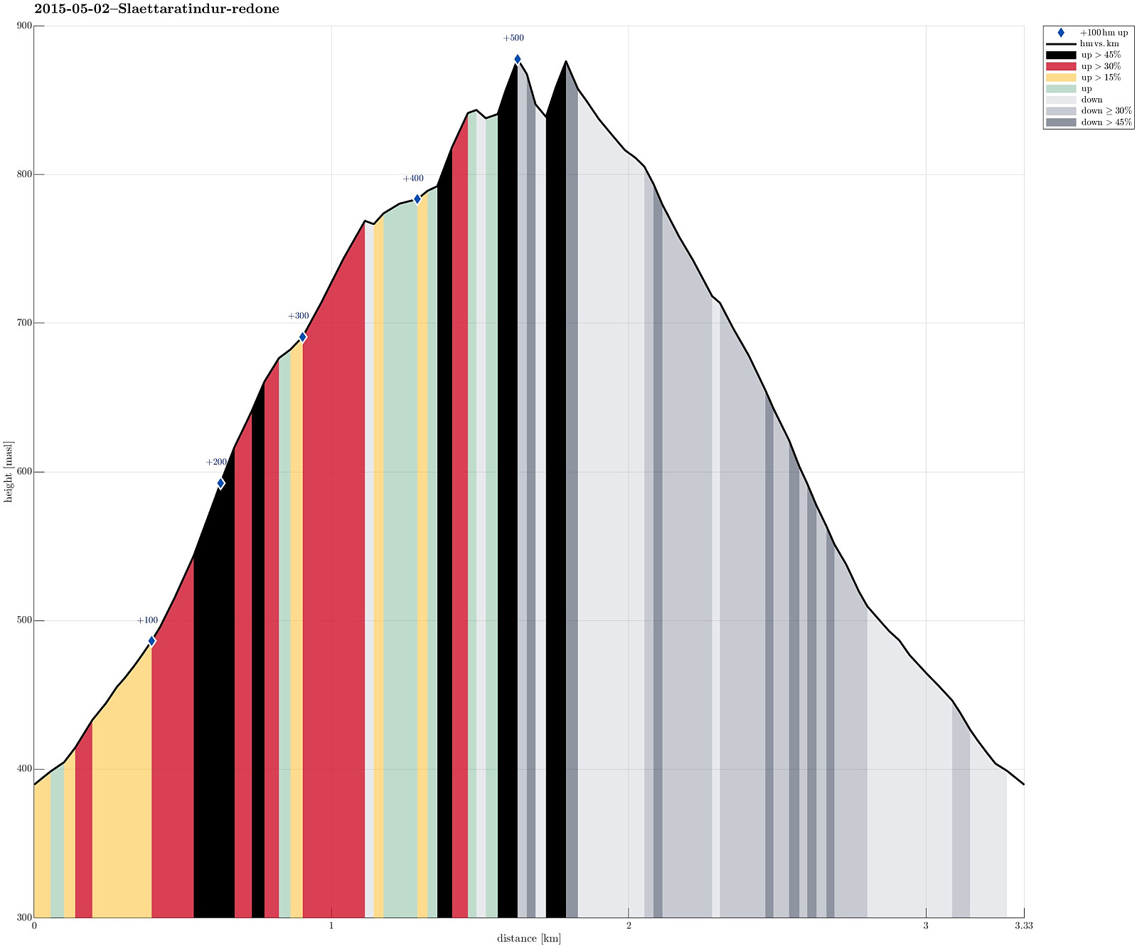 We drove up to Eiðisskarð (pass between Slættaratindur in the north and Vaðhorn in the south) and parked near the highest point on that pass (at about 380m above sealevel). From there, we basically headed straight northwards, (more or less) straight up the quite steep south-slope of Slættaratindur. Doing so, we quickly reached a high ridge, which extends eastwards from Slættaratindur. The ascend was OK (with regular hiking boots) even though it quickly became unavoidable to pass over patches of (steep) snow -- there it was necessary to walk carefully and set each foot consciously. We then followed the ridge towards Slættaratindur. We tried two or three ascends from the eastside, but the proved to be very difficult (climbing, very steep, icy and snowy, etc.) and we decided to descend >>>
Tindur
- Datum:
- 02.05.2015
- Tourcharakter:
- Bergtour
- Tourlänge:
- 3:30h
- Entfernung:
- 7,8km
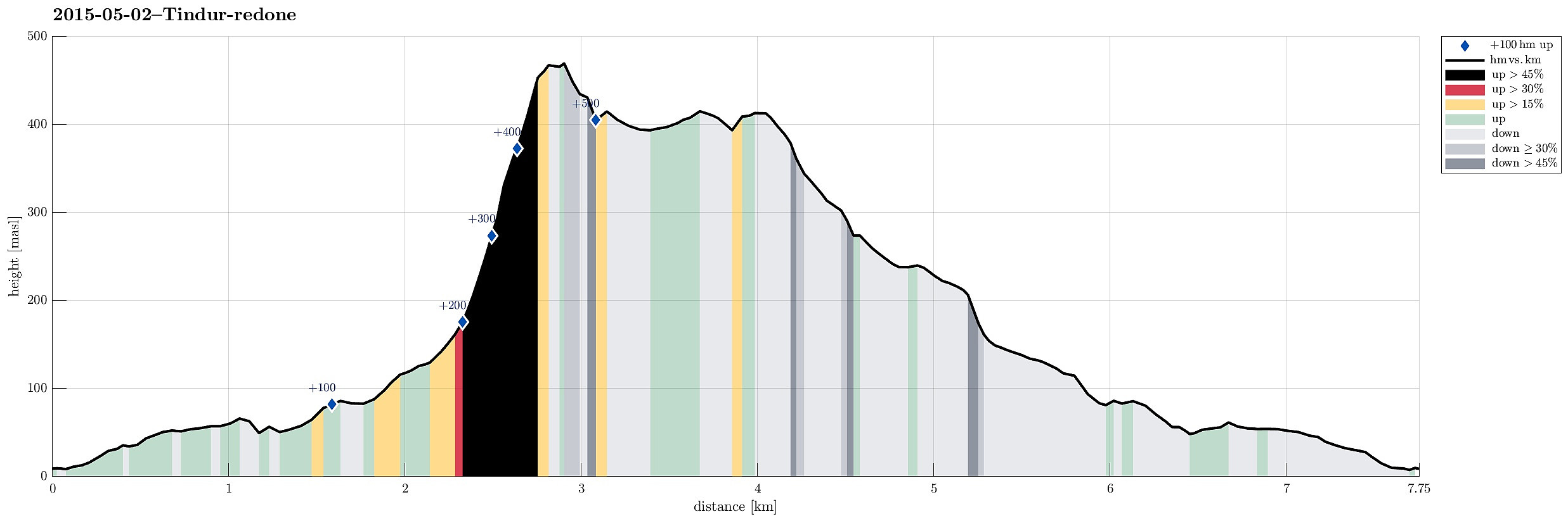 We drove to Elduvík and parked near the cemetery. From there we followed a narrow path (along the northern slope of Skoratindur), along Funningsfjørdur. Between Skoratindur and Tindur, this path leads upwards and over a (not very high!) pass, towards Fuglafjørður. From this pass (below 160m above sealevel) we ascended Tindur, first via its (very!) steep western slope. Before we could reach the top, the slope became so steep that we avoided the last bit by detouring a bit towards the southwestern ascend (which proved to be much easier). From the top one has fantastic views in all directions, wow! :-) Once on the top, we decided to continue towards the eastern-most tip of Tindur, connected by an easy to walk ridge. More wonderful views can be enjoyed from both the ridge and its end >>>
Villingadalsfjall
- Datum:
- 01.05.2015
- Tourcharakter:
- Bergtour
- Tourlänge:
- 5:00h
- Entfernung:
- 4,9km
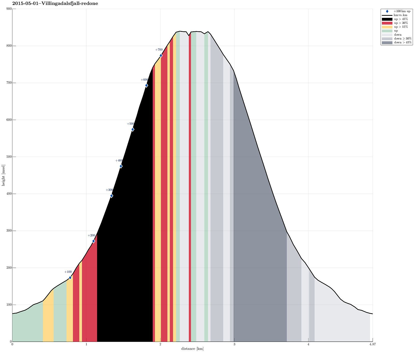 We parked in the northern end of Viðareiði (almost at the end of the upper road, near the place, where the street is a bit wider). From there we went to the end of the road, then along a small stone wall, already ascending towards Villingadalsfjall. Then, we basically followed a series of blue sticks, which someone placed in short distances from each other to indicate the best path up. Ascending to the top proved to be (very) steep in selected places and we had to concentrate -- not at the least due the snow (quite a bit of snow, still). The top itself flattens out and there are magnificent views in all directions! What a great tour! After a short break on the top (even though the weather was very good, the conditions still did not invite to stay on the top for very long), we descended >>>
