Archive - Date
Archive - Activity
-
Bike trip (137)
- Bike trip - mixed (51)
- Bike trip - road (9)
-
Other trip (1)
- Kayaking (1)
-
Other winter trip (4)
- Snowshoe trip (4)
- Ski trip (4)
- Trip by foot (740)
Archive - Geography
Peakbook-Friends


Collected lists
-
Bergen ≥ 50m pf. og ≥ 100 m.o.h.
(87/89)
 97%
97% -
Most dominating tops of the Bergen peninsula
(68/75)
90%
-
Utvalgte topper og turmål i Bergen
(316/350)
90%
-
Alle topper i Bergen
(357/398)
89%
-
Opptur Bergen
(100/113)
88%
-
De syv fjell rundt Bergen
(6/7)
85%
-
Sund ≥ 50m pf.
(14/18)
77%
-
Os ≥ 50m pf.
(25/34)
73%
-
Søyler (fastmerker) i Bergen
(68/100)
68%
-
Fjell ≥ 50m pf.
(21/32)
65%

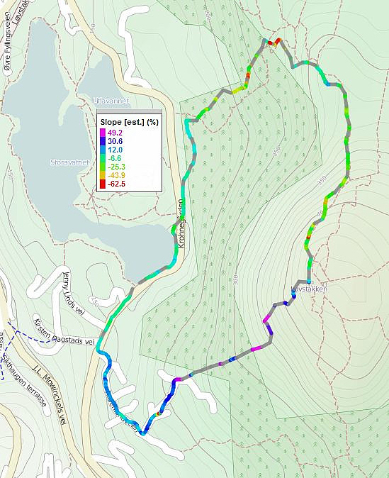
Løvstakken
- Date:
- 30.12.2011
- Characteristic:
- Hillwalk
- Duration:
- 1:30h
- Distance:
- 10.8km
 Walk via Gullsteinen to Løvstakken and retour.
Web page WestCoastPeaks.com provides useful information about Løvstakken .
Walk via Gullsteinen to Løvstakken and retour.
Web page WestCoastPeaks.com provides useful information about Løvstakken .
Hausdalshorgi
- Date:
- 08.10.2011
- Characteristic:
- Hillwalk
- Duration:
- 4:00h
- Distance:
- 9.8km
 Very nice hike via Hausdalshorgi to Austefjellet and then back via Dyrdalsvatnet!
Selected photos are available as G+ photo album .
Very nice hike via Hausdalshorgi to Austefjellet and then back via Dyrdalsvatnet!
Selected photos are available as G+ photo album .
Slettegga
- Date:
- 02.10.2011
- Characteristic:
- Hillwalk
- Duration:
- 3:00h
- Distance:
- 8.2km
 Nice trip up to Slettegga (and down again).
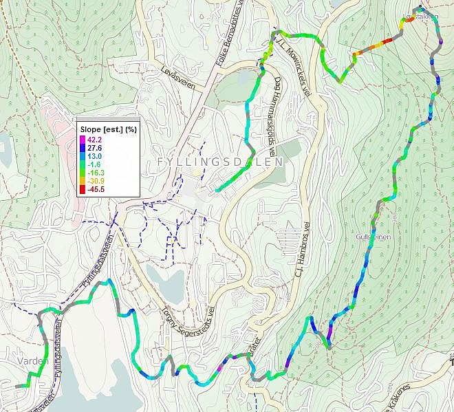
Sveningen
- Date:
- 10.10.2010
- Characteristic:
- Hillwalk
- Duration:
- 4:00h
- Distance:
- 11.5km
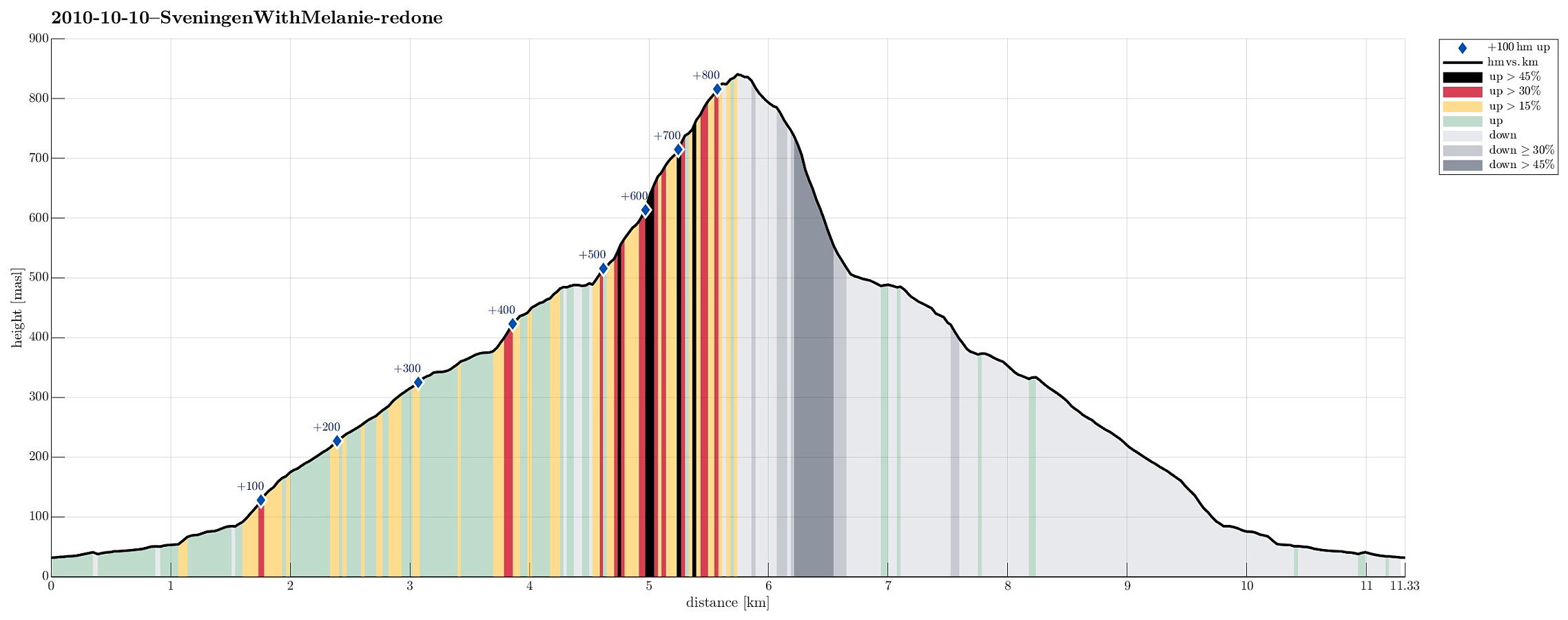 Nice autumn hike up to and down from Sveningen!
Selected photos are available as Google photo album .
Web page WestCoastPeaks.com provides useful information about Sveningen, Søtefjellet, Sauskolten, Rindafjellet, and Midtsæterfjellet
and also Petter Bjørstad has a useful page about Sveningen .
Nice autumn hike up to and down from Sveningen!
Selected photos are available as Google photo album .
Web page WestCoastPeaks.com provides useful information about Sveningen, Søtefjellet, Sauskolten, Rindafjellet, and Midtsæterfjellet
and also Petter Bjørstad has a useful page about Sveningen .
Svartaberget
- Date:
- 08.10.2010
- Characteristic:
- Hillwalk
- Duration:
- 0:45h
- Distance:
- 2.1km
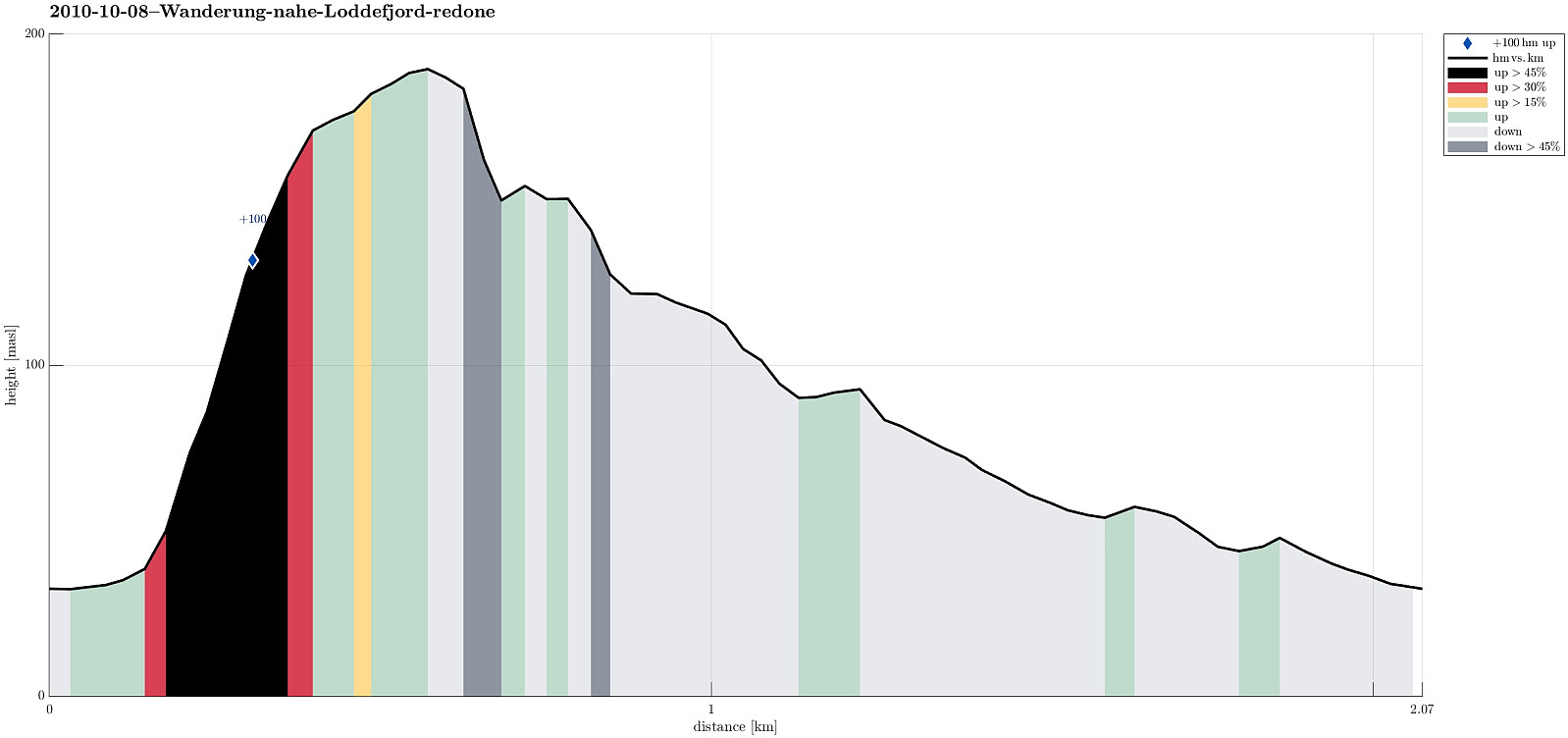 Short hike over Svartaberget (relatively late, also).
Løvstakken
- Date:
- 11.04.2010
- Characteristic:
- Hillwalk
- Duration:
- 1:00h
- Distance:
- 3.6km
 Up and down Løvstakken from Svartatjørna.
Web page WestCoastPeaks.com provides useful information about Løvstakken .
Up and down Løvstakken from Svartatjørna.
Web page WestCoastPeaks.com provides useful information about Løvstakken .
Fanafjellet
- Date:
- 30.05.2009
- Characteristic:
- Hillwalk
- Duration:
- 2:30h
- Distance:
- 6.6km
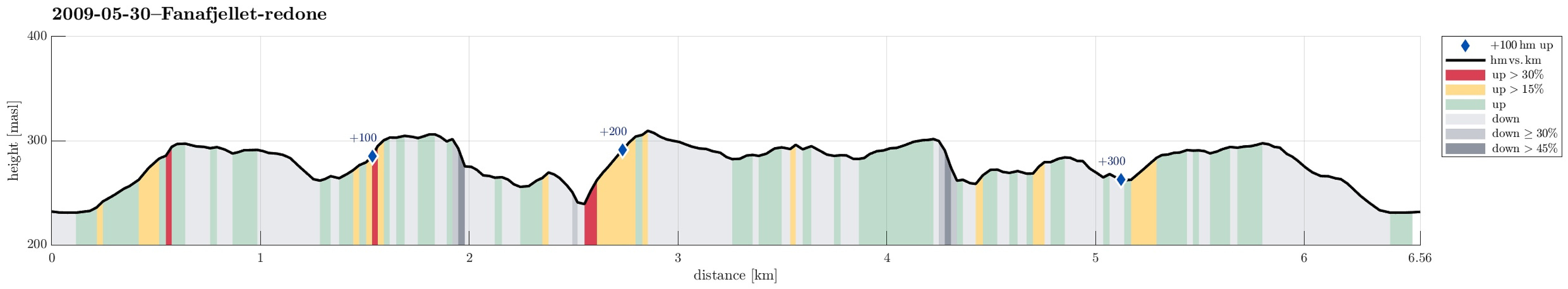 Nice family walk to Fanafjellet.
Bruviknipa
- Date:
- 21.05.2009
- Characteristic:
- Hillwalk
- Duration:
- 4:00h
- Distance:
- 8.5km
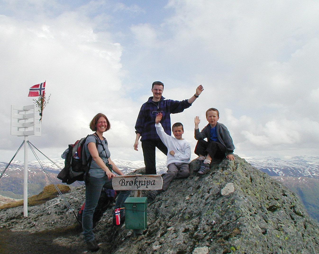 Very nice hike up and down Brøknipa.
Via Kvitebjørnen to Rundemanen
- Date:
- 01.05.2009
- Characteristic:
- Hillwalk
- Duration:
- 4:00h
- Distance:
- 9.2km
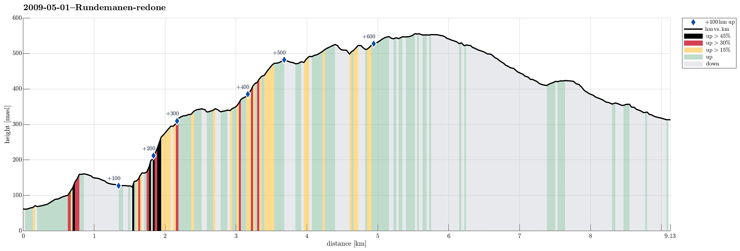 Very nice spring hike (via Kvitebjørnen) up Rundemanen
Veten i Åsane
- Date:
- 26.04.2009
- Characteristic:
- Hillwalk
- Duration:
- 3:00h
- Distance:
- 5.3km
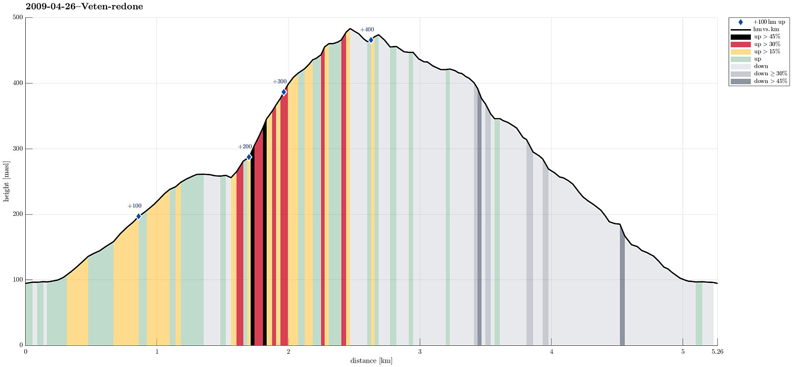 Very nice spring hike up and down Veten i Åsane.
