Arkiv - dato
Arkiv - aktivitet
-
Annen tur (1)
- Kajakkpadling (1)
-
Annen vintertur (4)
- Trugetur (4)
- Fottur (736)
-
Skitur (4)
- Fjellskitur (4)
-
Sykkeltur (123)
- Blandet sykling (41)
- Gatesykling (5)
Arkiv - Etter geografi
"Peakbookvenner"


Lister jeg samler etter
-
Bergen ≥ 50m pf. og ≥ 100 m.o.h.
(87/89)
 97%
97% -
Most dominating tops of the Bergen peninsula
(68/75)
90%
-
Utvalgte topper og turmål i Bergen
(313/347)
90%
-
Alle topper i Bergen
(356/398)
89%
-
Opptur Bergen
(100/113)
88%
-
De syv fjell rundt Bergen
(6/7)
85%
-
Sund ≥ 50m pf.
(14/18)
77%
-
Os ≥ 50m pf.
(25/34)
73%
-
Søyler (fastmerker) i Bergen
(68/100)
68%
-
Fjell ≥ 50m pf.
(21/32)
65%

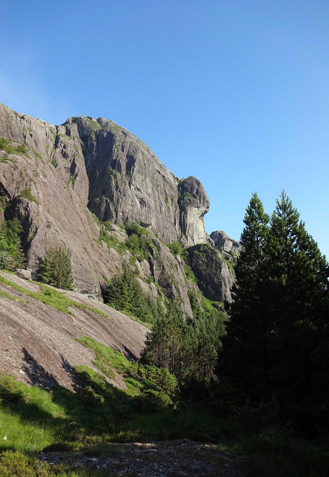
Skåldalsnipa from Moldalia
- Dato:
- 22.08.2021
- Turtype:
- Fottur
- Turlengde:
- 3:00t
- Distanse:
- 8,8km
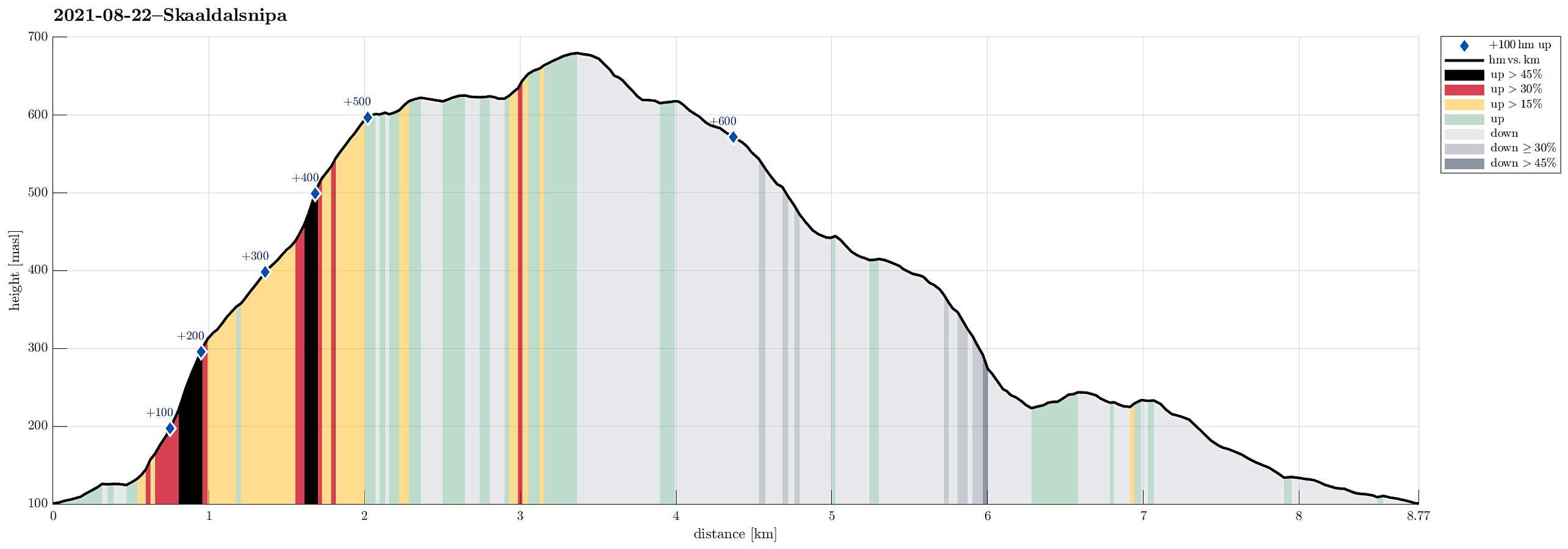 With a lovely late summer day ahead of us, we aimed at exploring a route leading up to / down from Skåldalsnipa that we had not yet hiked, i.e., the "diagonal" that runs (more or less) exactly north-south, connecting Hestabotn (below 450mosl in the north) and Skåldalsnipa (at about 600mosl in the south). To do so, we parked right next to Skåldalselva, where road Moldalia forks off from road Moldamyrane, and started our hike with an ascent towards the ridge that extends southwards from Skåldalsnipa. Starting along a forest road that extends towards the southeast from Moldalia (first kind of parallel to the long pipe installation on the steep western mountain slope of Skåldalsnipa), we located the trail head (after a short, wrong detour) at about 135mosl. From there, a good >>>
Pollatinden from Råkeneset
- Dato:
- 14.07.2021
- Turtype:
- Fottur
- Turlengde:
- 8:30t
- Distanse:
- 15,0km
 The "big" hiking plan of these few days in Solund was to hike Pollatinden -- but to do this from Råkeneset, where we stayed overnight before and after. The matter of fact that Pollatinden, as well as quite a few of the other landmarks around it, exposes significant cliffs towards the west/northwest (and Råkeneset is exactly in the northwest of Pollatinden), turned this hiking plan into a non-neglegible challenge. When studying the map, it appeared that we could follow one of two routes of "attack": either from the north (via Råkefjellet and then up between Sandvikfjellet and Pollatinden) or from the south (via Storefjellet), while the "standard" approach to Pollatinden (as marked trail) is from the southeast, i.e., exactly from the other side of the mountain, >>>
Sperrefjellet and Nordsjøløypen on Ytre Sula
- Dato:
- 13.07.2021
- Turtype:
- Fottur
- Turlengde:
- 4:30t
- Distanse:
- 10,3km
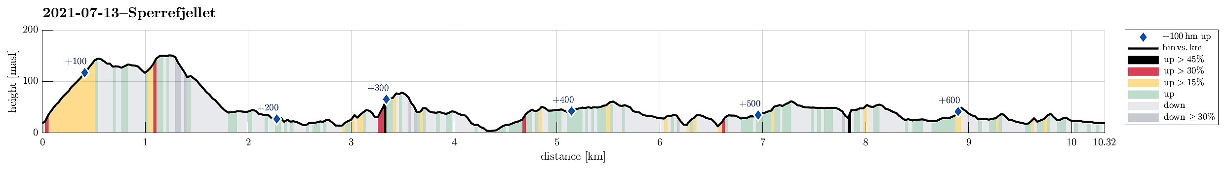 Staying in Solund for a few days, we also wished to explore Ytre Sula a little. We thus drove westwards from Hardbakke, using road 606. At the very end of this road, at Gjerdneset, we then took the ferry that brought us out to Ytre Sula (to Halldorsneset), crossing Ytre Steinsundet. After weighing several ideas against each other, we ended up with an attempt on Sperrefjellet (not far from Halldorsneset). About half a kilometer from Halldorsneset, we turned left at the T-junction, continuing (for only a short stretch) into the direction of Hjønnevåg. As soon as Sperrevatnet appeared on our left (in the south), we parked on the right, where also a sign marks the trail head for the beginning of this hike. The first section of this hike was then up to Ytre Heia (a little steep, but well-marked >>>
Storeggene, Rabben, Blåfjellet, and Arnipa
- Dato:
- 12.07.2021
- Turtype:
- Fottur
- Turlengde:
- 6:30t
- Distanse:
- 13,9km
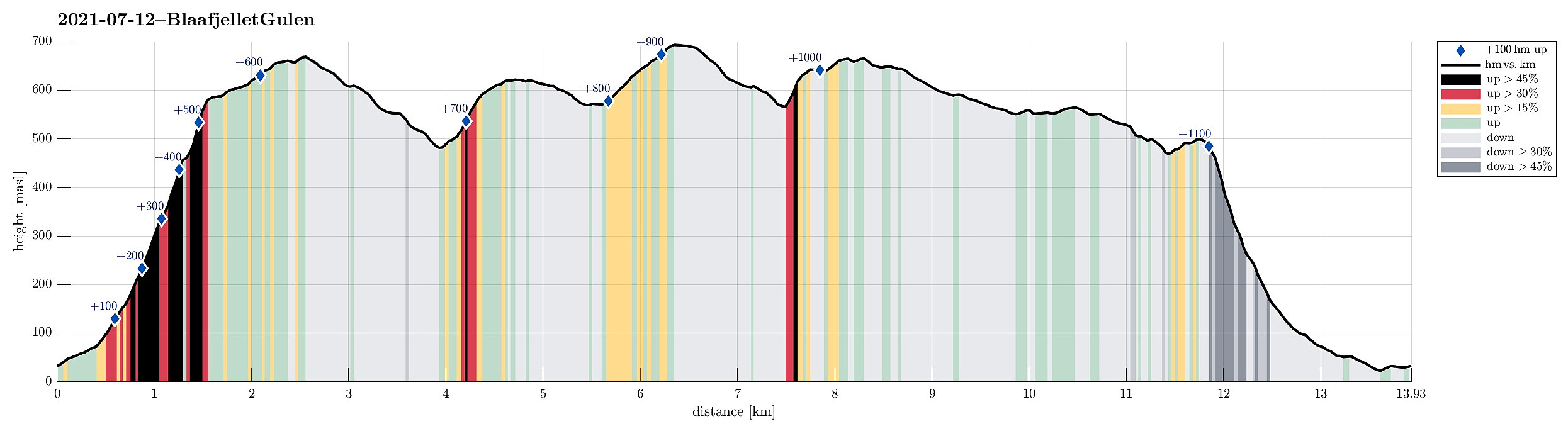 On our way from Bergen to Solund, we wanted to include one hike in Gulen. When checking the map for opportunities, reading also another trip report here on Peakbook , we got tempted to go a nice round in the east of Nordgulen. In order to get to the starting point (at Nordgulen), we drove northwards from Bergen, leaving road E39 at about Knarvik to continue to Mongstad from where we then took a ferry over to Sløvågen. From there, we continued along road 57 (into the direction of Rutledalen), driving first along Eidsfjorden and then further along Nordgulfjorden. Only several hundreds of meters from the northern end of Nordgulvågen, we left road 57 towards the east in order to park somewhere in the area of Tveit. After asking one of the locals, we conveniently parked right next to a playgroud in the northeast of Tveit.
Already >>>
On our way from Bergen to Solund, we wanted to include one hike in Gulen. When checking the map for opportunities, reading also another trip report here on Peakbook , we got tempted to go a nice round in the east of Nordgulen. In order to get to the starting point (at Nordgulen), we drove northwards from Bergen, leaving road E39 at about Knarvik to continue to Mongstad from where we then took a ferry over to Sløvågen. From there, we continued along road 57 (into the direction of Rutledalen), driving first along Eidsfjorden and then further along Nordgulfjorden. Only several hundreds of meters from the northern end of Nordgulvågen, we left road 57 towards the east in order to park somewhere in the area of Tveit. After asking one of the locals, we conveniently parked right next to a playgroud in the northeast of Tveit.
Already >>>
Nice round around Fedje
- Dato:
- 19.06.2021
- Turtype:
- Fottur
- Turlengde:
- 4:00t
- Distanse:
- 11,0km
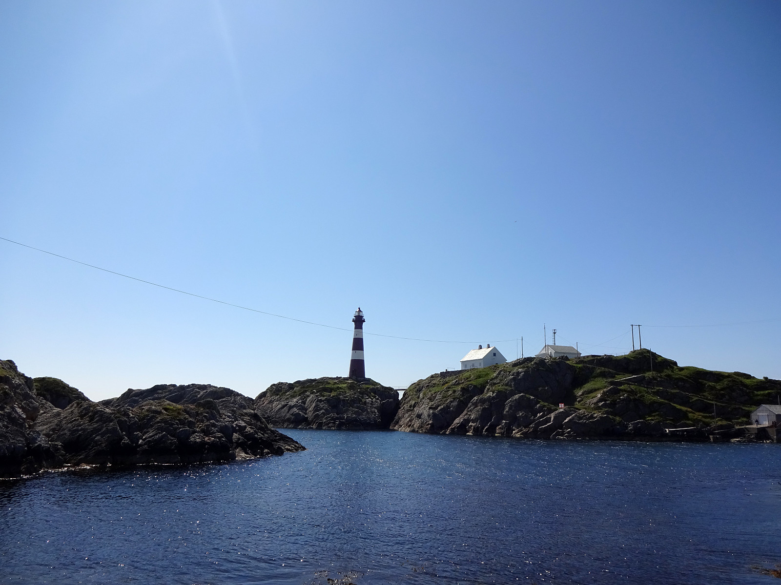 We took the ferry to Fedje and started our hike around the island from there. Our plan was to round Fedje in clockwise direction. Accordingly, we headed southwestwards, first, to pass by Husavatnet on its western side. Continuing in southwestern direction, we got around the wetter inner areas of Fedje near the west coast of the island. After walking by Vassviketjørna, we made a short detour to Vassvika to enjoy a short lunch break. From there, we continued further southwards until we were very close to Hellisøy with its impressive lighthouse. We then switched over to the eastern side of the island by following Fyrsundvegen. After a few steps on Stormarkvegen, we turned onto Mortevikvegen, which brought us to the head of the trail along the eastern coast of Fedje. Following this trail >>>
Søtefjellet from Hausdalen via Åsen
- Dato:
- 06.06.2021
- Turtype:
- Fottur
- Turlengde:
- 5:30t
- Distanse:
- 11,3km
 With the promise of a nice afternoon ahead of us and knowing the days are long during the Norwegian summer, we headed for Hausdalen and a hike that we had thought about for quite a while (it had to wait for the right day!). The main idea was to start in Samdalen (a long way into Hausdalen) and then hike to Åsen first (a kind of smallish hill that nonetheless peaks out from its exposed position at the junction of Hausdalen and Brekkjedalen). From there, the idea was to attempt an ascent to Søtefjellet, from where we knew that it was straight-forward to hike down along the long ridge that leads in southwestern direction towards Ulvvatnet. After driving into Hausdalen from the very south of Kalandsvatnet (along E39 in the south of Bergen), we found a suitable place right next to the road, >>>
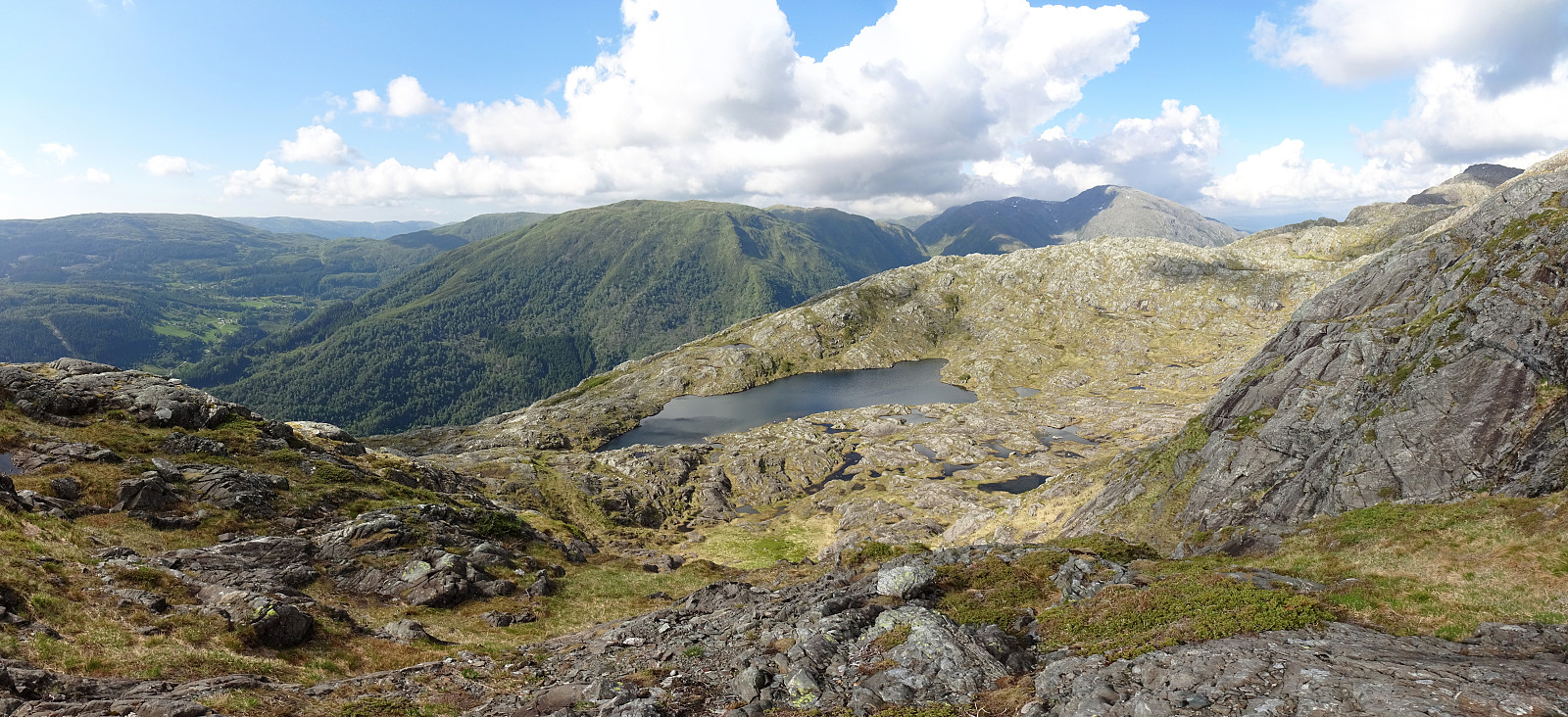
Austefjellet via Kurlarinden
- Dato:
- 22.05.2021
- Turtype:
- Fottur
- Turlengde:
- 3:30t
- Distanse:
- 7,5km
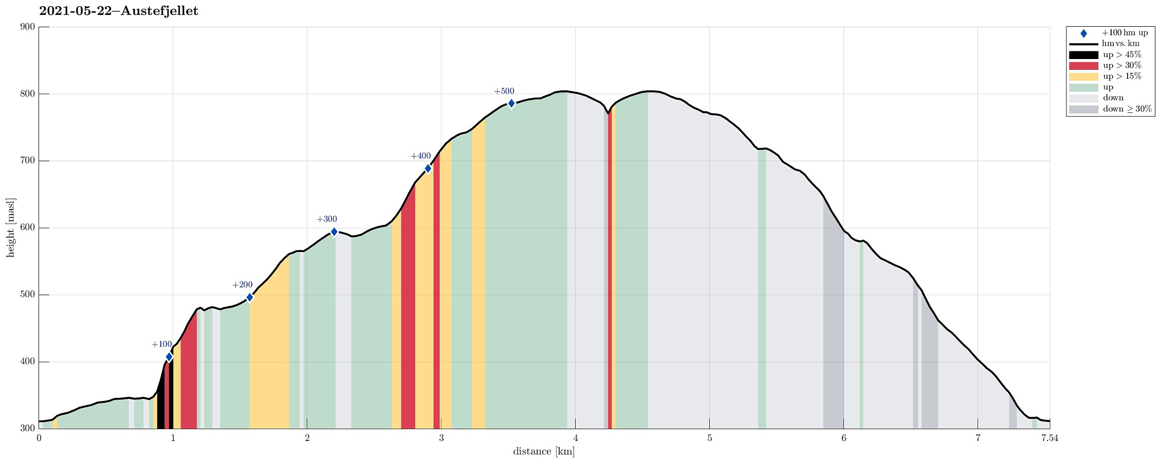 With the goal to do some nice, medium-sized hike, we aimed at Austefjellet, starting from Osavatnet. We thus drove into the direction of Arna (from Bergen), leaving the main road shortly before coming close to Haukelandsvatnet. Driving first towards Unneland, we then continued along Gullfjellsvegen to get up to the parking place in the north of Osavatnet. Walking first along Gullfjellsvegen further eastwards, we came to the place in the west of Taushaugen, where the roads split (with the "main road", Gullfjellsvegen, making a turn to the left, while a minor road continues straight-ahead, into the direction of Kurlatjørna). Following this minor road, we soon after had passed by Kurlatjørna (on our right, south of us), coming to the end of this road (it's continuing behind a closed >>>
Visiting Myrdal Våpenlager and Skavdalsfjellet
- Dato:
- 15.05.2021
- Turtype:
- Fottur
- Turlengde:
- 4:00t
- Distanse:
- 7,9km
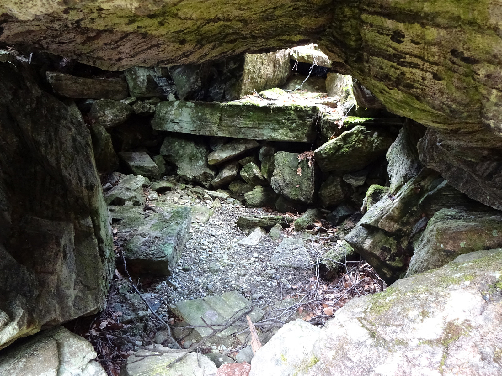 With the weather being forecasted as "grayish", the plan was to do something below the higher tops. Ever since we had visited Bautasteinen in the north of Krokvatnet near the top of Livarden , which made us read up on Johannes Dyngeland and related history, we had a little plan "on the shelf" to "one day" go and search for this place in Langedalen, where they apparently had hidden weapons while resisting the NS-occupation of Norway. We started in Nedre Dyngeland, where it is not really easy to find an appropriate parking spot. After passing by Grøvlet in the north of Dyngelandsvatnet, we approached the saddle in the north of Fjellet (marked with Fjellsenden on the map) on something that could be called a minor trail. Once on the saddle, we decided to also include a short detour via Fjellet, stepping up to its "top" >>>
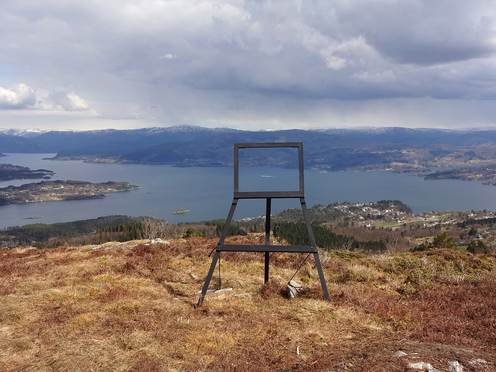
Storekvitefjellet, Lauvåsen, Naknekampen, and Høgeåsen
- Dato:
- 08.05.2021
- Turtype:
- Fottur
- Turlengde:
- 3:30t
- Distanse:
- 9,3km
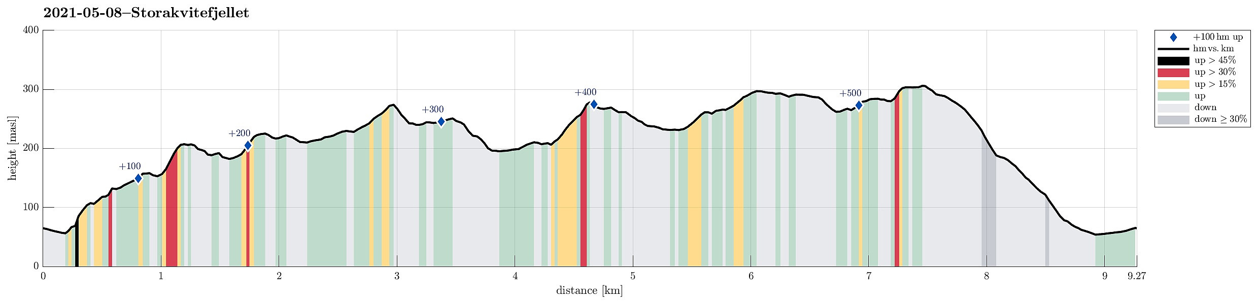 After starting our day with some scepticism regarding the expected weather, we then decided to still head for a nearby hike. Double-checking the weather prediction map suggested that the south of Bergen may see somewhat better wheater. We thus aimed at a hike there, not too far from Bergen, and since we had not been on Storekvitefjellet, we decided to give it a try. :-) After first driving to Fana, we then crossed Fanafjellet von Fanafjellsvegen until we came close to Nordvika on the southern side of Fanafjellet. There we parked next to the road and started our hike towards Stonghaugen, first. The southwestern side of Stonghaugen is a bit steep, but not really any problem to get up to. Already a bit up there, we enjoyed our first nice views back to Nordvika. From Stonghaugen, it then >>>
Gladihaug and Krossane from Votno
- Dato:
- 01.05.2021
- Turtype:
- Fottur
- Turlengde:
- 4:00t
- Distanse:
- 13,5km
 For a while, we had contemplated to hike Gladihaug one day. This morning, we decided to finally do it! :-) We took the car to the north of Bergen, driving along E39 towards Knarvik. Once there, we turned left in Knarvik and continued along road 57 (into the direction of Mongstad in the north of Knarvik). After driving through Espelandstunnelen and Herlandstunnelen on Lindåsvegen, we parked right next to the road (where one also could drive off to Seim only a bit further in the north). We then started our hike towards Gladihaug by walking into Votno, approaching the significant ridge of Hellefjellet from its north. As soon as we found ourselves on this ridge (in the south of Votno), we also had found a simple trail that was easy to follow. At about 250mosl, this trail even got "upgraded" >>>
