Archive - Date
Archive - Activity
-
Bike trip (120)
- Bike trip - mixed (38)
- Bike trip - road (5)
-
Other trip (1)
- Kayaking (1)
-
Other winter trip (4)
- Snowshoe trip (4)
- Ski trip (4)
- Trip by foot (732)
Archive - Geography
Peakbook-Friends
Lyderhorn from Kjøkkelvikveien
- Date:
- 05.10.2025
- Characteristic:
- Hike
- Duration:
- 2:00h
- Distance:
- 4.7km
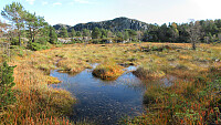
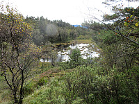
 We parked close to the Kjøkkelvikveien-Nedbergeveien junction and first walked a bit along Kjøkkelvikveien to find a good place for starting our ascent towards Stemmebakkane and Høgenuten. Opposite to Fæsterveien, we then found a narrow access road, leading up to the house with number 105. After the second hairpin curve up the rather steep mountain side, we then followed a simple trail into the forest (and further upwards). Even though there's no trail to be seen on Norgeskart for this part, one still can find simple hiking trails "all the way up" to Stemmebakkane and Høgenuten. From up there, one also then can enjoy some nice views. A bit south of Høgenuten, one then joins the main trail to Lyderhorn. After making it "all the way up" to Lyderhorn (not so much >>>
Hochstaff & Reisalpe from Ebenwaldhöhe
- Date:
- 27.09.2025
- Characteristic:
- Hike
- Duration:
- 4:00h
- Distance:
- 9.7km
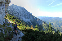
 Expecting some nice weather on this Saturday, we aimed at a nice hike not too far from Vienna. After comparing a few opportunities, we ended up with driving to Ebenwaldhöhe in the west of Kleinzell and hiking from there to Reisalpe, also including an ascent to Hochstaff "on the way". For some 400 meters, we first followed a simple road, mostly in southern direction, across Ebenwaldhöhe, before then deviating from the main track (which leads around Hochstaff on its northwestern side) to include an ascent to Hochstaff, also. This route is not exactly well marked and one better knows where to go; despite of this detail, however, it's still all on proper trails to get up to Hochstaff from Ebenwaldhöhe (the ascent to Hochstaff is quite steep, but still nicely within "regular >>>
Ötscher via Rauher Kamm from Lackenhof
- Date:
- 21.09.2025
- Characteristic:
- Hike
- Duration:
- 6:00h
- Distance:
- 15.9km
 After spending the night involuntarily at an airport hotel in Amsterdam, we got to Vienna early on this Sunday, expecting a nice day. We thus rushed to get into the mountains, driving to Lackenhof in the southwest of Vienna. Our plan was to make a nice hiking round up and down Ötscher, using its northeastern ridge (Rauher Kamm) as the ascent route, while then descending via the Ötscherschutzhaus in the southwest of the mountain. Once in Lackenhof, we aimed at the large parking lot in Weitental to leave the car behind -- just to find that it was completely full with cars (while the combination of Sunday with nice weather and our relatively late arrival could have let us anticipate this situation, we had not). Luckily, one parking place got freed up only minutes after our arrival, letting >>>
Lundåsane from Hausdalen
- Date:
- 14.09.2025
- Characteristic:
- Hike
- Duration:
- 3:00h
- Distance:
- 5.9km
 We wished to explore the Hausdalen-side of Lundåsane and thus drove to Hausdalen, where we parked a bit south of Håland. From there, we first walked up a gravel road that extends parallel to Hålandsbekken. About half way up, I decided that I wished to explore Storerinden, in the east of Slokadalen, also. Stepping up to this hill was straight-forward, while not on a trail, though. From Storerinden, while not really a prominent "peak", I still got a nice view towards Hausdalshorgi (it's always nice to see Hausdalshorgi!). I then continued across the ridge to re-connect with the gravel road near the T-junction, where one leg of the gravel road extends a bit further up to Plasset. Instead of following the gravel road any further, though, I used a trail (maybe more a former trail) >>>
Gjønakvitingen from Gjøn (via Selfjellet)
- Date:
- 17.08.2025
- Characteristic:
- Hike
- Duration:
- 8:00h
- Distance:
- 13.5km
 The weather was promising and so we thought this would be a good day to hike up to Gjønakvitingen from Gjøn. From Bergen, we drove towards the East, first along E16, then road #49, before taking road #48 to Eikelandsosen. From there, it was not too far, continuing into eastern direction, before we changed to a narrow road at Holdhus. This way, we drove around the south end of Gjønavatnet in order to get to Gjønavegen, which brought us to Gjøn. At about noon-time, we then started our hike (with enough time on such a nice, long summer Sunday). The one, small "twist", which we had cooked up, when studying the map at home, was to include Selfjellet (via an ascent on the western side of Skarvaelva), before eventually taking the "main trail" down (south of Sauaskorfjellet). >>>
Byrkjefjellet, Iendefjellet, and Skeisheia
- Date:
- 02.08.2025
- Characteristic:
- Hike
- Duration:
- 7:00h
- Distance:
- 16.5km
 We expected "one last nice day before the rain" and thus aimed at one more nice hike! :-) Without much hesitation, we agreed to make a hike to Iendefjellet, north of Kvamskogen. We took the car from Bergen to Kvamskogen and parked at the southern end of Tryglakleiv, right next to the "main road" across Kvamskogen (road #49). We then started to hike up road Tryglakleiv, aiming at the heights in the southwest of Tryglakleivtjørnane. All of this is easy to find and from "up there" (a bit below 600 masl), the real ascent towards Byrkjefjellet starts (then mostly in northern direction). Following a proper trail, we completed the (partially steep) ascent relatively quickly. It was, however, very hot and we recognized and respected the roughly 600 height meters >>>
Livarden from Haukelandsvatnet
- Date:
- 27.07.2025
- Characteristic:
- Hike
- Duration:
- 4:00h
- Distance:
- 7.9km
 We wished to use (part of) the nice Sunday for a nice hike and chose Livarden, not far from Bergen. Instead of the usual hike (from Totland), we decided to approach it "direttissima" from Haukelandsvatnet. We parked in the southeast of Nygardsvika (langs Unnelandsvegen) and started in easterly direction -- to pass by (and below) Kalvehalsen. For a bit, we followed a (faint) trail, which leads up to a small building south (and above) Kalvehalsen. Instead of following this trail for any longer part, however, we quickly aimed at Stallafossen (there wasn't much to see or hear of this waterfall, though -- probably due to the rather dry perdiod during the past days). The goal was to ascend to a ridge in the south of Stallafossen (the first "big" one on the westside of the >>>
Mt. Miyanoura on Yakushima
- Date:
- 01.07.2025
- Characteristic:
- Hike
- Duration:
- 7:30h
- Distance:
- 13.6km
 To include a nice hike had been part of our original plans for our visit to Yakushima. Depending on the circumstances, we also had looked at an ascent to Mt. Miyanoura, the hightest top of Yakushima, but wanted to wait until we would be in a better position to understand the weather, our form, etc. After one nice day of chilling on Yakushima, everything looked good and we made an early start to give us enough time for the there-and-back hike (officially 2*8km according to all signs). To make the actual ascent to Mt. Miyanoura possible for us on this day, we first drove up to the Yodogawa Mountain Trail Entrance at some 1370masl. This drive, already, to the high up end of a narrow mountain road, was a nice experience -- with numerous turns and a close-up impression of the surrounding jungle. >>>
Nakadake (Kuju mountains) from Makinoto Pass
- Date:
- 28.06.2025
- Characteristic:
- Hike
- Duration:
- 5:00h
- Distance:
- 12.2km
 It was one of our goals for our visit to Kyushu to make a nice hike near Mt. Aso and this hike in the Kuju mountains, north of the massive caldera of volcano Aso, seemed very nice from its description. To get started, we drove to the Makinoto Pass in the West of Mt. Nakadake, but found that all parking spots had been taken, already. A bit further down the road, however, we found a place, where we could leave the car. After first walking back to the pass, we then followed the main trail in easterly direction. Gaining height steadily, we came to a place, where it was to Mt. Ogigahana to the right, and to "all other tops" to the left. Just shortly after choosing the latter option, we then followed a side-trail (without any signs) to get up to Mt. Hossho (not choosing the "main >>>
Hiking down from Mt. Hiei
- Date:
- 22.06.2025
- Characteristic:
- Hike
- Duration:
- 4:00h
- Distance:
- 7.5km
 We wished to visit Mt. Hiei in the NE of central Kyoto, but were not ready to hike up to it, given the high summer temperatures. We thus chose to take, first, the Eizan Cable Car and, then, the Eizan Ropeway, up to a place near the top of Mt. Hiei. Walking eastwards from there, we first made it to the actual top of Mt. Hiei, before descending along a hiking trail to the graveyard behind the Enryakuji Temple. Walking through this graveyard in the forest, early in the morning, was a special moment. After visiting the Enryakuji Temple (several of the buildings), we then hiked down the mountain along a hiking trail towards the East (in parallel to the cable car that comes up from Sakamoto). It was impressive to see that quite a few others hiked in the opposite direction, i.e., up the mountain >>>


