Arkiv - dato
Arkiv - aktivitet
-
Annen tur (1)
- Kajakkpadling (1)
-
Annen vintertur (4)
- Trugetur (4)
- Fottur (740)
-
Skitur (4)
- Fjellskitur (4)
-
Sykkeltur (137)
- Blandet sykling (51)
- Gatesykling (9)
Arkiv - Etter geografi
"Peakbookvenner"


Lister jeg samler etter
-
Bergen ≥ 50m pf. og ≥ 100 m.o.h.
(87/89)
 97%
97% -
Most dominating tops of the Bergen peninsula
(68/75)
90%
-
Utvalgte topper og turmål i Bergen
(316/350)
90%
-
Alle topper i Bergen
(357/398)
89%
-
Opptur Bergen
(100/113)
88%
-
De syv fjell rundt Bergen
(6/7)
85%
-
Sund ≥ 50m pf.
(14/18)
77%
-
Os ≥ 50m pf.
(25/34)
73%
-
Søyler (fastmerker) i Bergen
(68/100)
68%
-
Fjell ≥ 50m pf.
(21/32)
65%

Stendafjellet from the north
- Dato:
- 29.10.2022
- Turtype:
- Fottur
- Turlengde:
- 1:00t
- Distanse:
- 2,2km
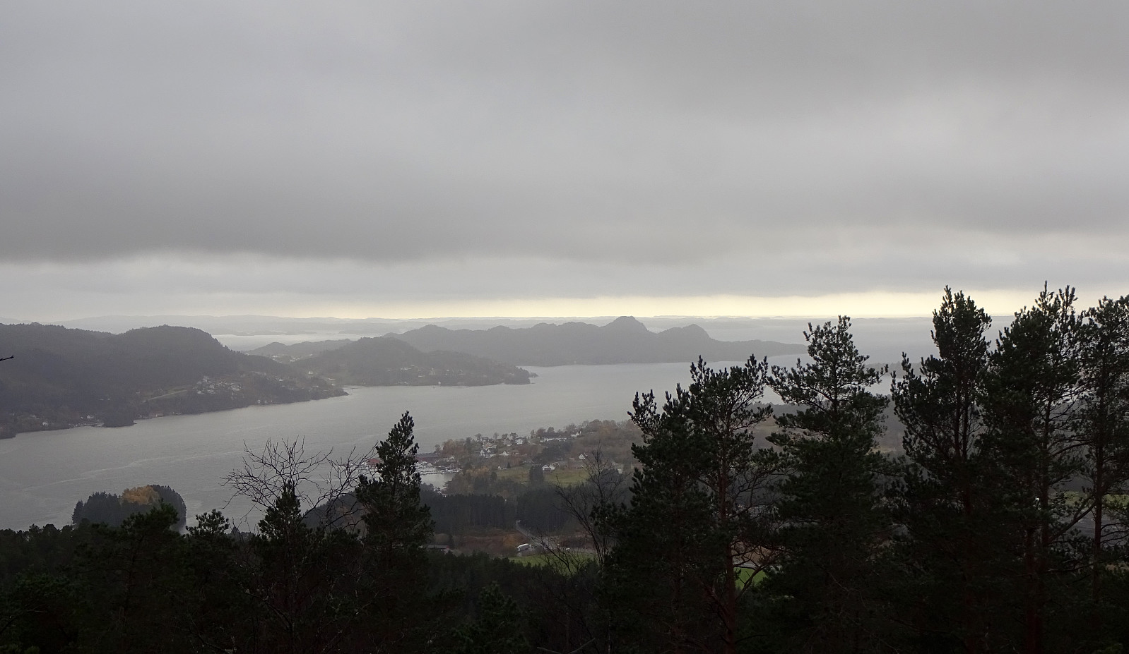 Even though it all looked (and was!) a rainy day, we still wished to get some fresh air. Since we had something else to do nearby, we decided to just quickly include a short detour up and down Stendafjellet (from the north). Driving up Øvre Krohnåsen, we found a spot to park near the playing ground at the upper end of this road. From there, we started our short hike towards the "top" of Stendafjellet, choosing a route through the forest (without a trail). All this was straight-forward and without any difficulties (at about 200masl, there's a little cliff, which is easy to get around, though). On Stendafjellet, we visited the lookout point, looking down to Fanafjorden from there, before then returning (along a similar, but still a bit different route). All in all, this was >>>
Round around Dyrdalsvatnet from Øvstebø
- Dato:
- 15.10.2022
- Turtype:
- Fottur
- Turlengde:
- 4:30t
- Distanse:
- 10,1km
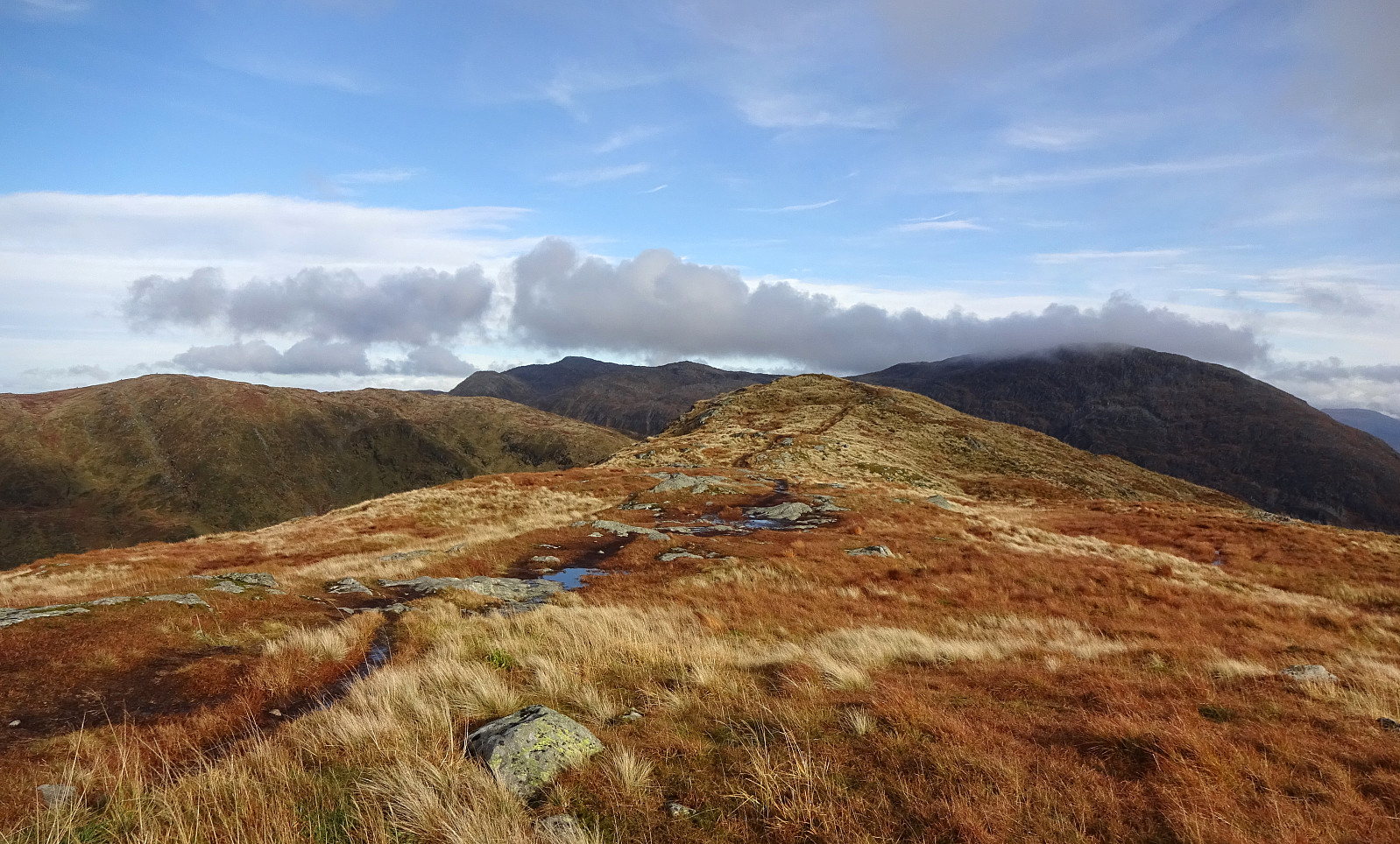 We expected a rather nice autumn day and decided to hike up to Hausdalshorgi, one of our favorite mountains near Bergen. A good way to approach Hausdalshorgi is from Øvstebø, a short way further northeast from Bontveit. The usual route leads first up to Dyrdalsvatnet (parallel to Dyrdalselva, on its northwestern side) and from there further up to Hausdalshorgi, conveniently using a little bridge over Dyrdalselva (when it's not swept away by some floods as a few years back). This time, we wished to explore an alternative approach to Hausdalshorgi, crossing Dyrdalselva already at Øvstebø, then ascending through the forest up to Bjørnaberget, and then further up along a small ridge that extends in northwestern direction from Bjørnaberget. Even though the stretch up to Bjørnaberget is >>>
