Archiv - Nach Datum
Archiv - Nach Aktivität
-
Andere Tour (1)
- Kayaking (1)
-
Andere Wintertour (4)
- Schneeschuhtour (4)
-
Fahrradtour (137)
- Fahrradtour Straße (9)
- Fahrradtour gemischt (51)
-
Fußtour (740)
- Bergtour (363)
- Jogging (18)
- Spaziergang (89)
- Wanderung (270)
-
Skitour (4)
- Tourenskilauf (4)
Archiv - Nach Geografie
Peakbookfreunde


Gesammelte Listen
-
Bergen ≥ 50m pf. og ≥ 100 m.o.h.
(87/89)
 97%
97% -
Most dominating tops of the Bergen peninsula
(68/75)
90%
-
Utvalgte topper og turmål i Bergen
(316/350)
90%
-
Alle topper i Bergen
(357/398)
89%
-
Opptur Bergen
(100/113)
88%
-
De syv fjell rundt Bergen
(6/7)
85%
-
Sund ≥ 50m pf.
(14/18)
77%
-
Os ≥ 50m pf.
(25/34)
73%
-
Søyler (fastmerker) i Bergen
(68/100)
68%
-
Fjell ≥ 50m pf.
(21/32)
65%

Søtefjellet from Hausdalen via Åsen
- Datum:
- 25.06.2022
- Tourcharakter:
- Wanderung
- Tourlänge:
- 4:00h
- Entfernung:
- 10,4km
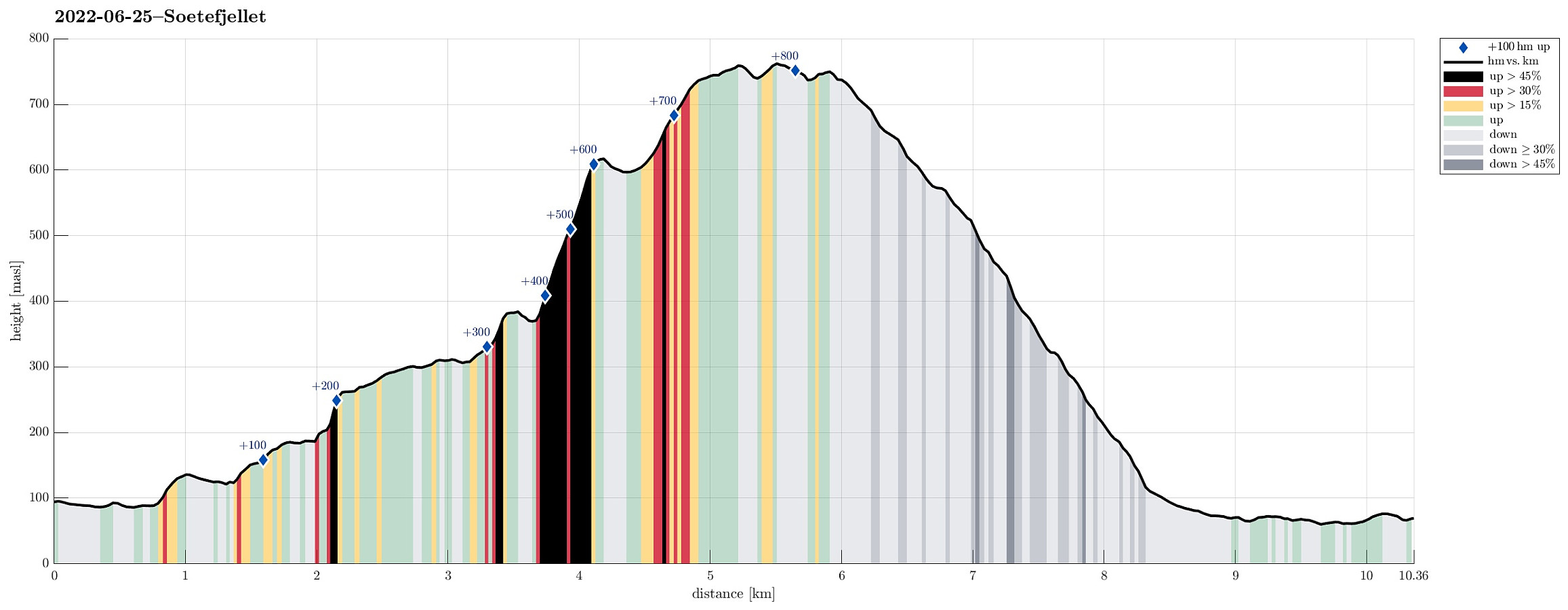 We exploited the situation of having two cars to cut short a few kilometers on the road through Samdalen. After passing by Kalandsvatnet along E39 in the south of Bergen, we turned left at Kalandseidet to continue further into Hausdalen. Right before coming to Tømmervika of Samdalsvatnet, we left one car where a forest road comes down to Hausdalsvegen. With the other car, we then continued all the way in to the end of Hausdalsvegen, where we parked at the parking spot. Given our plan to ascend Søtefjellet via Åsen, we had planned to cross Hausdalselva using a simple bridge at Hausdalen, just a few meters back along the "main road". Getting there, however, we found a sign that informed us that crossing over there was only possible with the consent of the land owner. Luckily, >>>
Høgafjellet (and Hikletten) from Lonadalen
- Datum:
- 05.06.2022
- Tourcharakter:
- Wanderung
- Tourlänge:
- 5:30h
- Entfernung:
- 17,7km
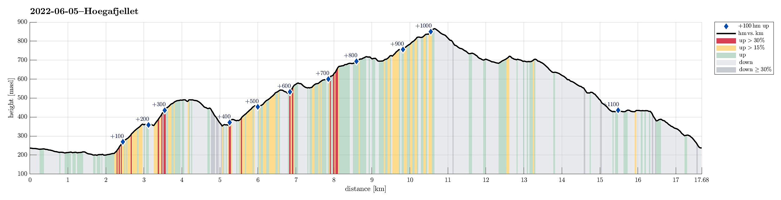 Very nice round including Høgafjellet on Osterøy, starting from its south, i.e., Lonadalen. Using Osterøybrua to conveniently cross over to Osterøy, we turn right before entering the tunnel, driving to Bruvik from there. Leaving the fjord there, we ascended to the saddle in the north of Bruvik (and in the east of Brøknipa) to connect to the interior of Osterøy along road 5418. Before getting all the way down to the large lakes in the middle of Osterøy, we turned right, entering a gravel road that would bring us to Lonadalen, passing by Sagatjørna, Midtvatnet, and Blomdalsvatnet. Near the saddle in Lonadalen, where also the trail from Høgafjellet comes down, we parked and started our hike in northeastern direction, following Lonadalen a bit further, first. At Midttun, we passed >>>
