Arkiv - dato
Arkiv - aktivitet
-
Annen tur (1)
- Kajakkpadling (1)
-
Annen vintertur (4)
- Trugetur (4)
- Fottur (740)
-
Skitur (4)
- Fjellskitur (4)
-
Sykkeltur (137)
- Blandet sykling (51)
- Gatesykling (9)
Arkiv - Etter geografi
"Peakbookvenner"


Lister jeg samler etter
-
Bergen ≥ 50m pf. og ≥ 100 m.o.h.
(87/89)
 97%
97% -
Most dominating tops of the Bergen peninsula
(68/75)
90%
-
Utvalgte topper og turmål i Bergen
(316/352)
89%
-
Alle topper i Bergen
(357/400)
89%
-
Opptur Bergen
(100/113)
88%
-
De syv fjell rundt Bergen
(6/7)
85%
-
Sund ≥ 50m pf.
(14/18)
77%
-
Os ≥ 50m pf.
(25/34)
73%
-
Søyler (fastmerker) i Bergen
(68/100)
68%
-
Fjell ≥ 50m pf.
(21/32)
65%

Double-round to Alvøen
- Dato:
- 28.11.2021
- Turtype:
- Blandet sykling
- Turlengde:
- 3:00t
- Distanse:
- 28,8km
 Even though I had a lot of work to do, still, I could not resist the nice weather and needed to get out, at least a little! Getting onto my eBike, I decided to visit Alvøen (once again) and check out a few of the smaller hills there. To get there, I decided to pass by Tennebekk, first. I thus biked first north in Fyllingsdalen and at Spelhaugen I got onto the gravel road that leads up to Tennebekk. On the other side, I turned south (southwest), again. Passing by Loddefjord, I aimed at Hilleren in the southwest of Haakonsvern. Once past Mathopen, I connected to Skarelien, which brought me up to Hilrafjellet by basically cycling a "full round" around it, first. From Hilrafjellet, I enjoyed some proper views, before I continued to check out Medhaugen next. While I could also >>>
Round around Meland church
- Dato:
- 21.11.2021
- Turtype:
- Fottur
- Turlengde:
- 4:00t
- Distanse:
- 8,6km
 Expecting a nice November Sunday, we aimed at a round around Meland church near Knarvik in the north of Bergen. Driving along E39 from Bergen brought us across Salhusfjorden with the help of Nordhordlandsbrua. As soon as we touched ground on Flatøy, again, we changed to Rosslandsvegen, leading westwards into the direction of Meland and Holsnøy. Near Frekhaug, we turned right (onto the comparably narrow road to Meland). After crossing over from Dale to Meland, we parked near Meland church and started our hike from there. The first sub-goal of the day was Salbukletten in the northwest of Meland. We passed by Erstad, first, and then ascended from there to Salbukletten (into northwestern direction from Erstad). This ascent, even though without trail, was nice and easy! On Salbukletten, >>>
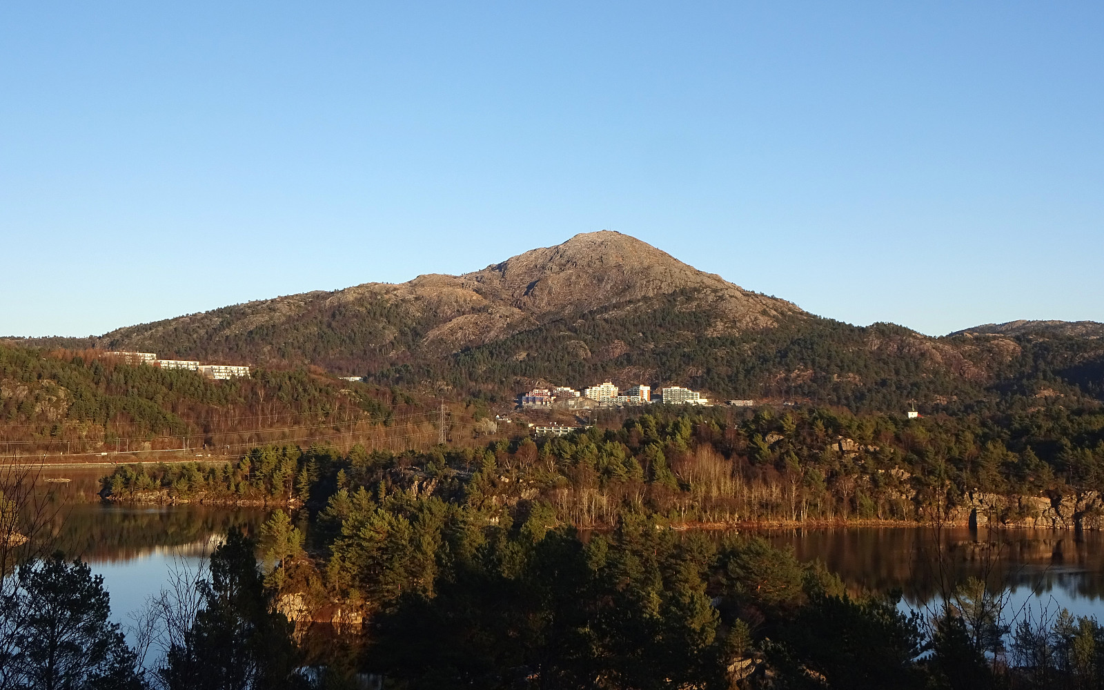
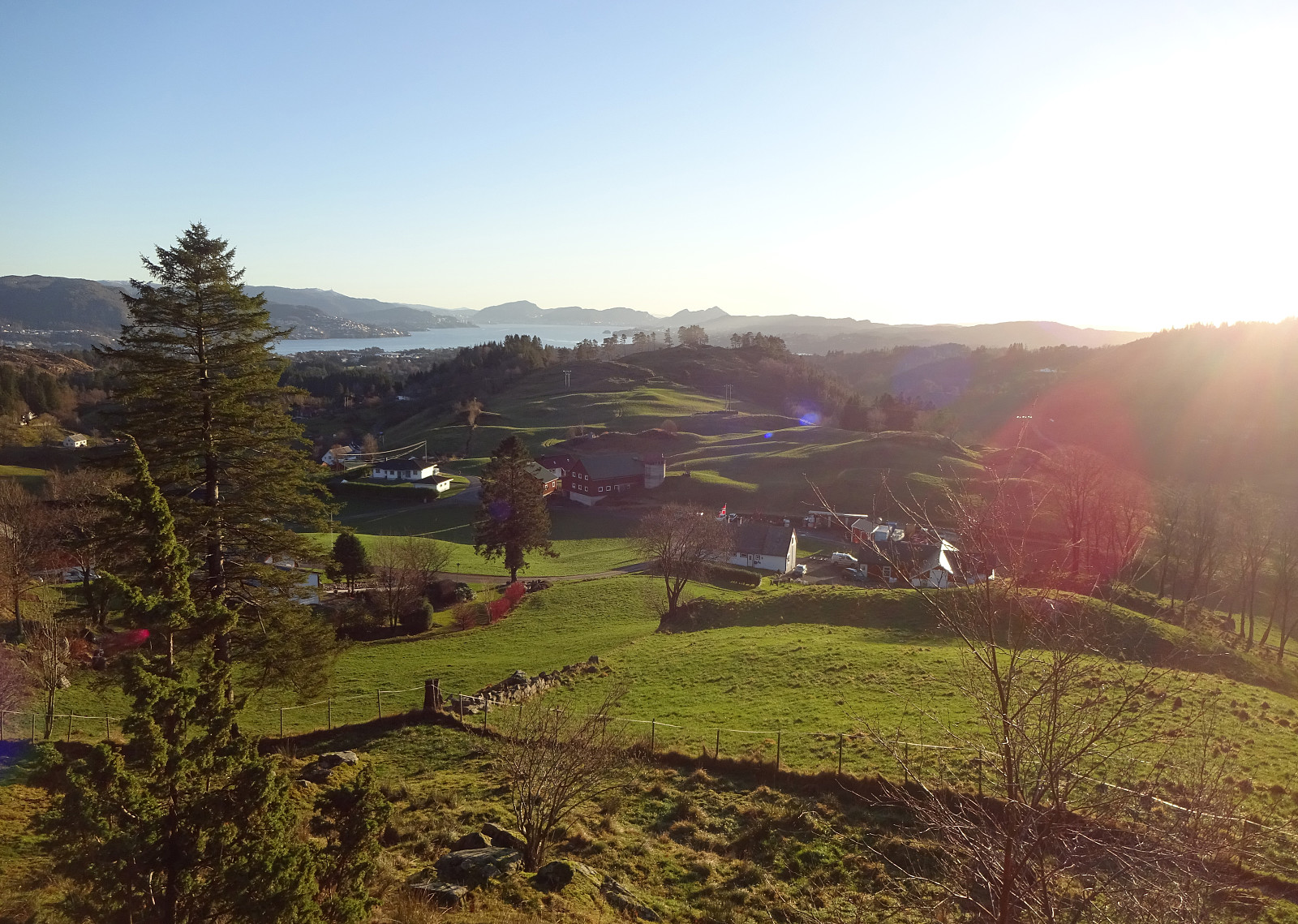
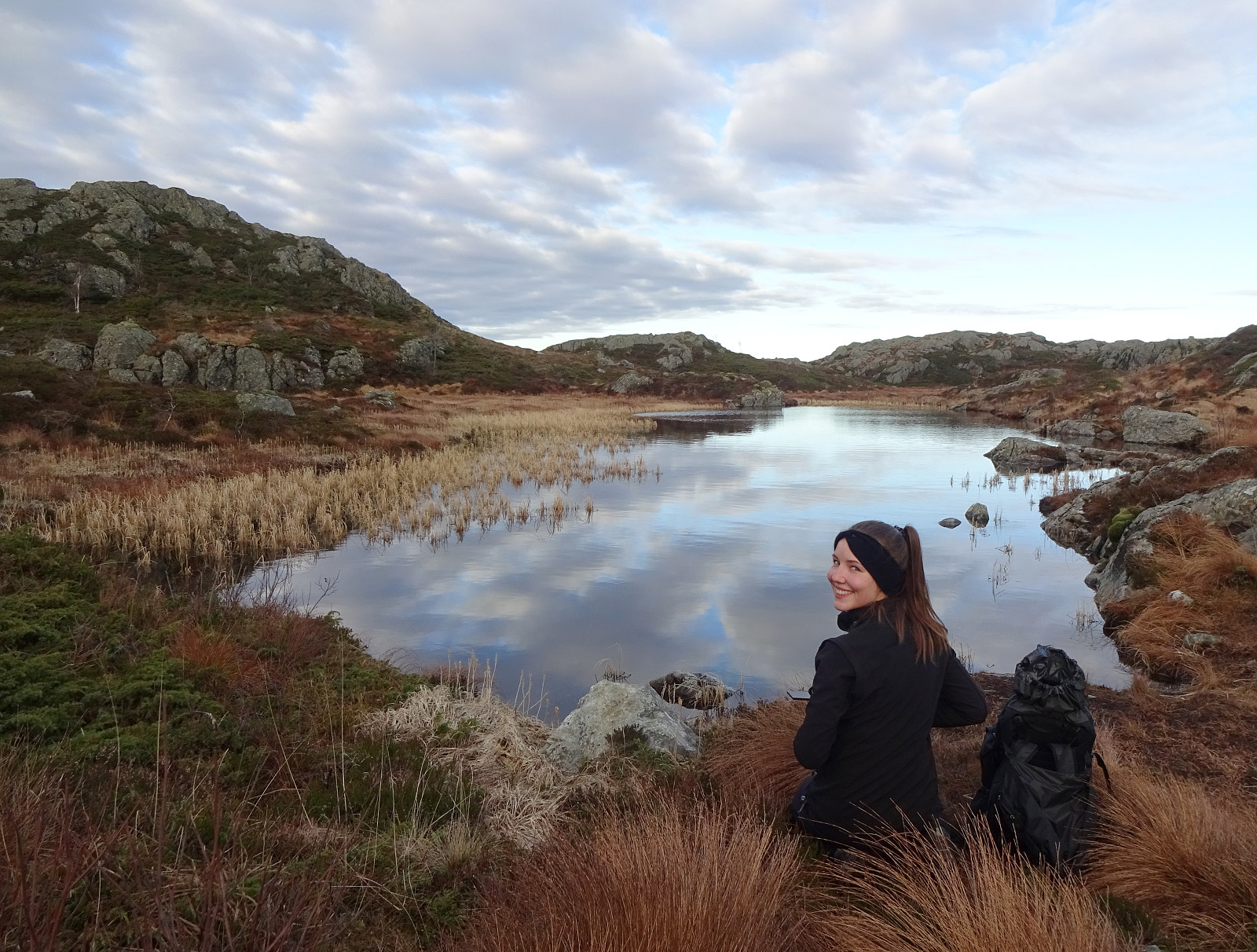
Ørnafjellet (and Lyderhorn) the "wild" way
- Dato:
- 14.11.2021
- Turtype:
- Blandet sykling
- Turlengde:
- 3:00t
- Distanse:
- 17,6km
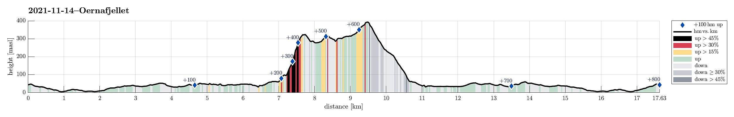 After a very nice "standard" hike to Møsnuken the day before, we wished to use the second nice weekend day for another, maybe a bit more "experimental" hike. For some time already, we had asked ourselves, whether it is possible to ascend Ørnafjellet near Lyderhorn "direttissima" from Banuren. This Sunday, we thought to try this idea. We took our eBikes and biked along Bjørgeveien into the direction of Loddefjord. After rounding Svartaberget and Bjørndalstjørna, we cycled northwards on the eastside of Lyderhorn, passing by Liavatnet. On the northeastern side of Lianakken, we turned left and onto Banuren, leading us up to the houses of Banuren. Between Søre Banuren and Nordre Banuren, where one major trail from Lyderhorn comes down, we left our bikes behind, starting >>>
Møsnuken from Tyssdalen
- Dato:
- 13.11.2021
- Turtype:
- Fottur
- Turlengde:
- 4:30t
- Distanse:
- 9,7km
 As a small group of four, we wished to some nice autumn hiking in quite fine weather. To also enjoy some views across the nice fjord-landscape around Bergen, we decided to make "the standard hike" up to Møsnuken. Taking E39 south from Bergen, we soon passed by Kalandsvatnet and then Syfteland. A little further south, just before the roundabout at Ulven, we turned left and onto Tøsdalsvegen. In the south of Tyssdalsvatnet, we crossed over a small bridge and parked soon after at the parking spot for hikers right next to Tyssdalselva. Starting our hike on the main trail towards Møsnuken, we crossed Tyssdalselva after just a few meters. Then, after just following the main trail for a few further meters, we turned left to do the ascent to Møsnuken via Linken. This (also very >>>
