Arkiv - dato
Arkiv - aktivitet
-
Annen tur (1)
- Kajakkpadling (1)
-
Annen vintertur (4)
- Trugetur (4)
- Fottur (740)
-
Skitur (4)
- Fjellskitur (4)
-
Sykkeltur (137)
- Blandet sykling (51)
- Gatesykling (9)
Arkiv - Etter geografi
"Peakbookvenner"


Lister jeg samler etter
-
Bergen ≥ 50m pf. og ≥ 100 m.o.h.
(87/89)
 97%
97% -
Most dominating tops of the Bergen peninsula
(68/75)
90%
-
Utvalgte topper og turmål i Bergen
(316/352)
89%
-
Alle topper i Bergen
(357/400)
89%
-
Opptur Bergen
(100/113)
88%
-
De syv fjell rundt Bergen
(6/7)
85%
-
Sund ≥ 50m pf.
(14/18)
77%
-
Os ≥ 50m pf.
(25/34)
73%
-
Søyler (fastmerker) i Bergen
(68/100)
68%
-
Fjell ≥ 50m pf.
(21/32)
65%

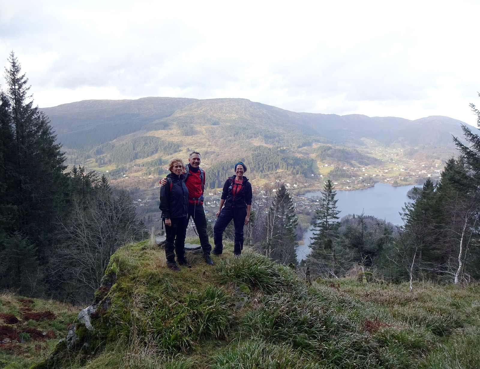
Lyderhorn
- Dato:
- 28.11.2020
- Turtype:
- Fottur
- Turlengde:
- 1:30t
- Distanse:
- 3,6km
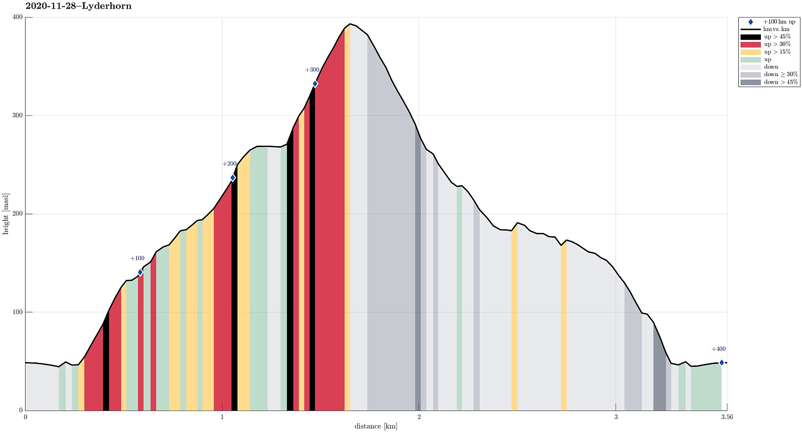 Aiming at using a relatively short morning period for which no rain was predicted, we decided to "just" ascent to Lyderhorn (when needing a good idea for a nice, near hike, Lyderhorn is a natural solution!). One question requiring a bit of extra-thinking, though, regards the choice of the route up (and down). While already driving towards Loddefjord, we discussed several options and landed on a new ascent from the southeast, i.e., where the highways join south of Liavatnet. We parked right next to Lyderhornsveien, north of Bjørndalstjørna, and walked the few meters to the place, where the highway 555 disappears into Lyderhorntunnelen right underneath. While leaving the road where a simple trail comes down from a saddle in the west, we did not follow this trail upwards, but decided >>>
Livarden via Nordvardsrinden
- Dato:
- 15.11.2020
- Turtype:
- Fottur
- Turlengde:
- 4:00t
- Distanse:
- 5,8km
 Lucky we have friends, who agreed to embark with us on a little adventure: ascending to Livarden from Unnelandsvegen! To prepare, we had carefully studied the map and, in particular, the area between Kalvehalsen and Nordvardsrinden. A search for related trip reports of others did not result in anything. Understanding that the terrain is very steep on the north-side of Livarden, we paid extra attention to where we possibly could do it. Eventually, we decided to first approach Stallafossen (to have a look at it), then traverse to a little cabin at about 250mosl, west of Stallafossen, before then ascending along Nordvardsrinden up to Livarden. We parked along Unnelandsvegen, where the trail over Lavrinden comes down (where Klubbaelva spings into Nygardvika), and walked along Unnelandsvegen >>>
Eikhaugen
- Dato:
- 07.11.2020
- Turtype:
- Fjelltur
- Turlengde:
- 3:30t
- Distanse:
- 7,5km
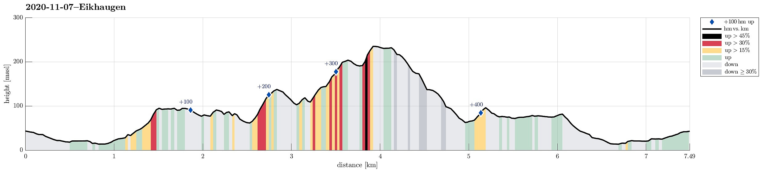 A quite wet day invited to engage with some local exploration. After some short planning, Eikhaugen was identified as the overall goal, this afternoon. Starting from Varden, we headed north, first. At Askeladdveien, we decided to ascend relatively steeply to some minor heights west of Peer Gyntsvei. Crossing over this ridge south--north, we connected to the east-facing hillside in the west of Spelhaugen. At the northern end of Spelhaugen, where the Kindergarden and the parking place for Tennebekk-hikers is, we crossed over to the other, northeastern side of Spelhaugen, ascending relatively steeply up to the (also minor) heights north of Barliveien (Lurane). Rounding the southern end of Eikelifjellet on its southeastern side (northwest of Løvås), we entered a nice valley with a little >>>
