Archiv - Nach Datum
Archiv - Nach Aktivität
-
Andere Tour (1)
- Kayaking (1)
-
Andere Wintertour (4)
- Schneeschuhtour (4)
-
Fahrradtour (137)
- Fahrradtour Straße (9)
- Fahrradtour gemischt (51)
-
Fußtour (740)
- Bergtour (363)
- Jogging (18)
- Spaziergang (89)
- Wanderung (270)
-
Skitour (4)
- Tourenskilauf (4)
Archiv - Nach Geografie
Peakbookfreunde


Gesammelte Listen
-
Bergen ≥ 50m pf. og ≥ 100 m.o.h.
(87/89)
 97%
97% -
Most dominating tops of the Bergen peninsula
(68/75)
90%
-
Utvalgte topper og turmål i Bergen
(316/350)
90%
-
Alle topper i Bergen
(357/398)
89%
-
Opptur Bergen
(100/113)
88%
-
De syv fjell rundt Bergen
(6/7)
85%
-
Sund ≥ 50m pf.
(14/18)
77%
-
Os ≥ 50m pf.
(25/34)
73%
-
Søyler (fastmerker) i Bergen
(68/100)
68%
-
Fjell ≥ 50m pf.
(21/32)
65%

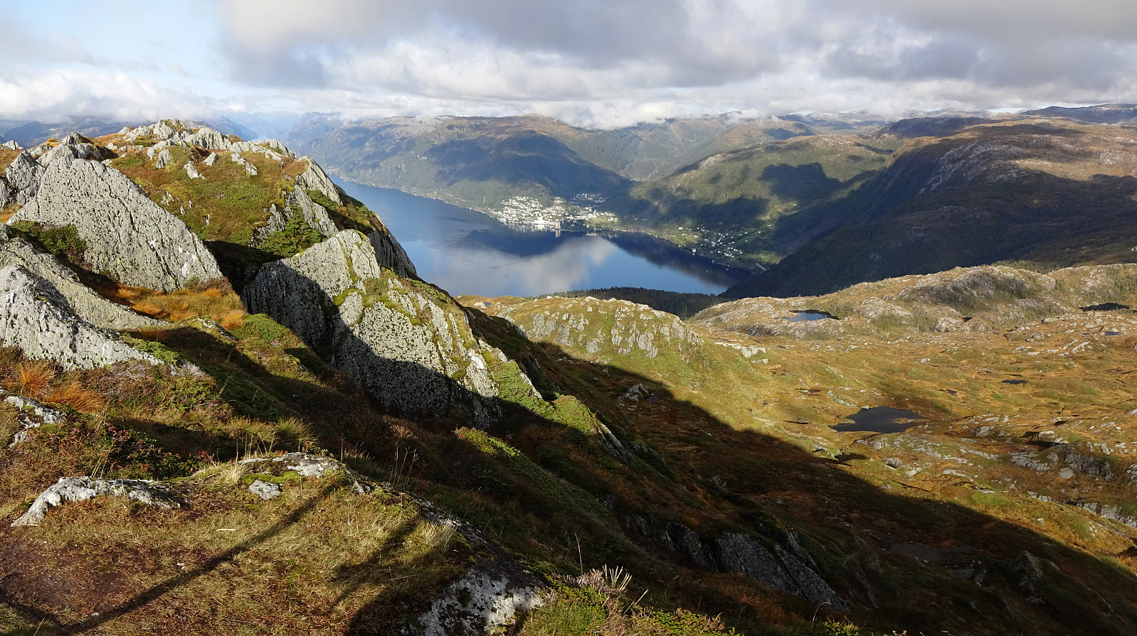
Rundehaugen from Fjæreide
- Datum:
- 27.09.2020
- Tourcharakter:
- Bergtour
- Tourlänge:
- 4:30h
- Entfernung:
- 9,7km
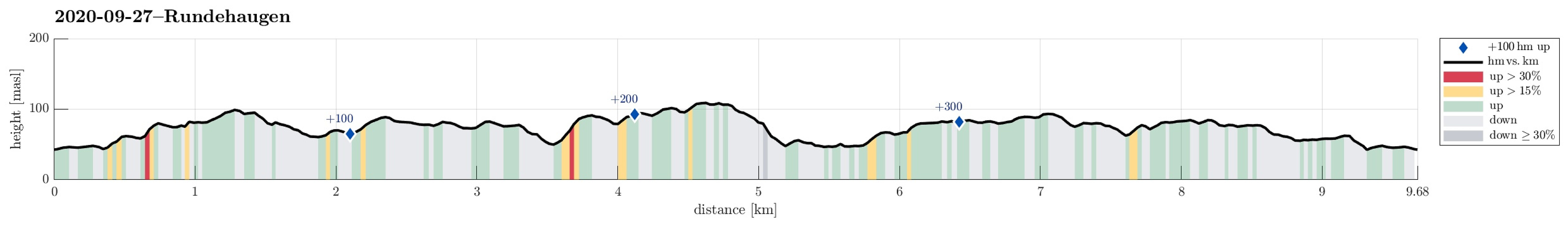 Since we expected the afternoon to be substantially cloudy, we decided to make a hike in the lowlands rather than up on some tops (and in the clouds). Since we had not yet explored this region in detail, we chose to start at Fjæreide (in the west of Knappskog on Sotra) and then aim for Rundehaugen (in the east of Skålvik). After driving along road 555 westwards to Sotra and then northwards (road 561), one comes to Knappskog. There, one can turn left (westwards, again) and follow a narrow road to Fjæreide, where there's ample space for parking next to the road (they may have had, or still have, plans to broaden this road, leaving quite a bit of not yet used space besides the road). At the southern-most point (in Fjæreide) the road crosses over a small valley in a large turn to the right. >>>
Krånipa, Raudnipa, and Hananipa (from Gullbotn)
- Datum:
- 19.09.2020
- Tourcharakter:
- Wanderung
- Tourlänge:
- 7:30h
- Entfernung:
- 17,7km
 After a quite rainy period, we looked forward to a weekend with some nice weather. After weighing several hiking ideas against each other, we settled on a slightly longer hike over three Nipa-mountains in the East of Gullbotn. Driving along E16 from Arna, we turned right and up towards Gullbotn near Trengereid. Once above the saddle, we left the road at Gullbotn and parked right there (quite a number of parking places there). According to our plan (Krånipa first), we first headed in northern direction to get around Øyjordsvatnet. Almost exactly where Teinelva enters Øyjordsvatnet, we used a convenient bridge for pedestrians to get over to the other, eastern side. There, we turned left, again, to head for a small valley that runs south-north in the west of Skåpet. While passing by >>>
