Arkiv - dato
Arkiv - aktivitet
-
Annen tur (1)
- Kajakkpadling (1)
-
Annen vintertur (4)
- Trugetur (4)
- Fottur (740)
-
Skitur (4)
- Fjellskitur (4)
-
Sykkeltur (137)
- Blandet sykling (51)
- Gatesykling (9)
Arkiv - Etter geografi
"Peakbookvenner"


Lister jeg samler etter
-
Bergen ≥ 50m pf. og ≥ 100 m.o.h.
(87/89)
 97%
97% -
Most dominating tops of the Bergen peninsula
(68/75)
90%
-
Utvalgte topper og turmål i Bergen
(316/352)
89%
-
Alle topper i Bergen
(357/400)
89%
-
Opptur Bergen
(100/113)
88%
-
De syv fjell rundt Bergen
(6/7)
85%
-
Sund ≥ 50m pf.
(14/18)
77%
-
Os ≥ 50m pf.
(25/34)
73%
-
Søyler (fastmerker) i Bergen
(68/100)
68%
-
Fjell ≥ 50m pf.
(21/32)
65%

Sælskletten and Sælsfjellet on Tofterøy
- Dato:
- 28.03.2020
- Turtype:
- Fjelltur
- Turlengde:
- 2:00t
- Distanse:
- 6,5km
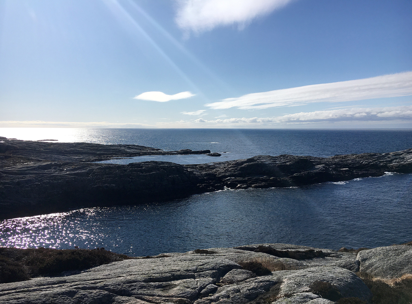
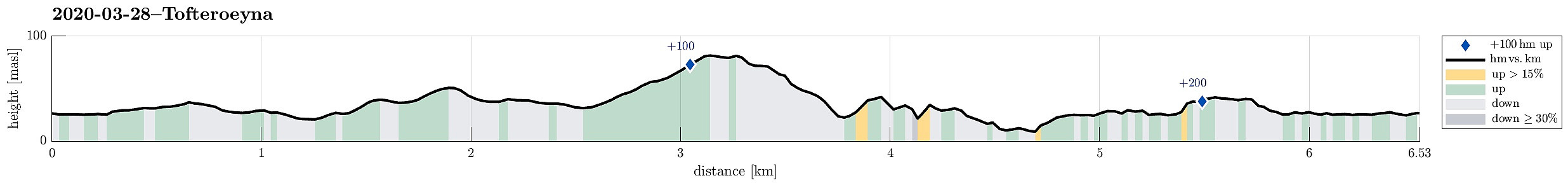 Another Saturday with a promise of cold but nice weather invited us to plan another hike near the North Atlantic, making this the third in a row, after our nice hike to Brotavarden from Telavåg and our excursion to Ternneset from Kausland . This time, our goal was to hike a little round on Tofterøy, far in the southwest of Sotra. After following road 555 southwards, we turned right (onto road 200 towards Tofterøy) and passed over the narrow bridge (Tofterøybrua), after first havig waited for two horses to finish their (partially stressed) passage over the bridge. :-) On Tofterøy, we then followed the road until we came close to Trælevika. There, just north of Storavatnet, we parked and started our hike. The first goal of our hike was Sælskletten in the southeast of where we had parked. In order to find the needed trailhead, we had to walk back along >>>
Ternneset from Kausland
- Dato:
- 21.03.2020
- Turtype:
- Fjelltur
- Turlengde:
- 3:15t
- Distanse:
- 11,8km
 Once again, we aimed at using a nice weekend day for getting some fresh air. Since we will had fond memories of our recent hike to Brotavarden from Telavåg , we decided to once again aim for the outer islands. This time, we planned for a hike from Kausland, just a bit north of Glesvær. The idea was to connect to Goltasundet (from the east) and then hike out towards the North Altantic along it's northern shore. On Sotra, we headed towards Glesvær. Near Kausland, we then left Glesnesvegen to the right (west), before parking only a few hundreds of meters down this little side road. From there, we followed a very clear trail (more like a gravel road in the beginning), leading us westwards. Soon after, we approached Goltatjørna from its north. We first tried to round it on a "tight route", but soon understood >>>
Brotavarden from Telavåg
- Dato:
- 14.03.2020
- Turtype:
- Fjelltur
- Turlengde:
- 3:30t
- Distanse:
- 11,8km
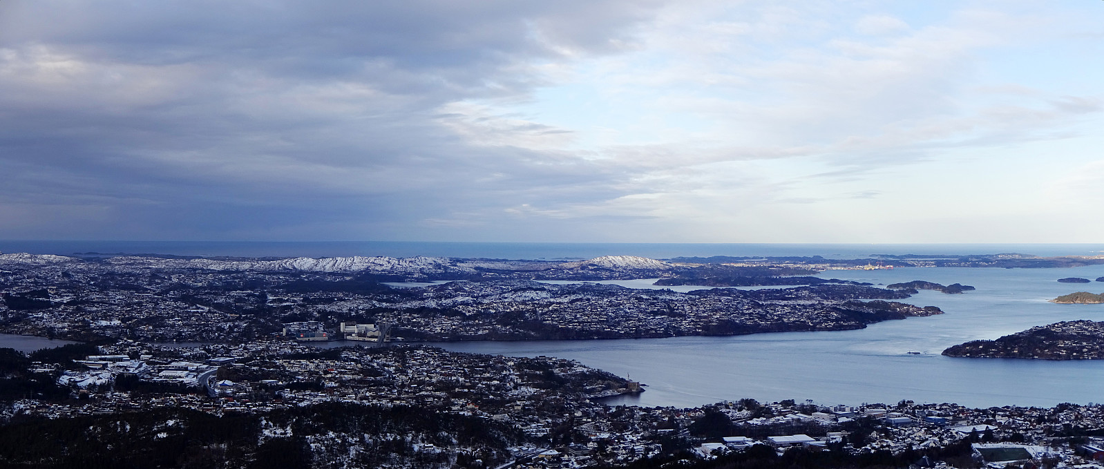
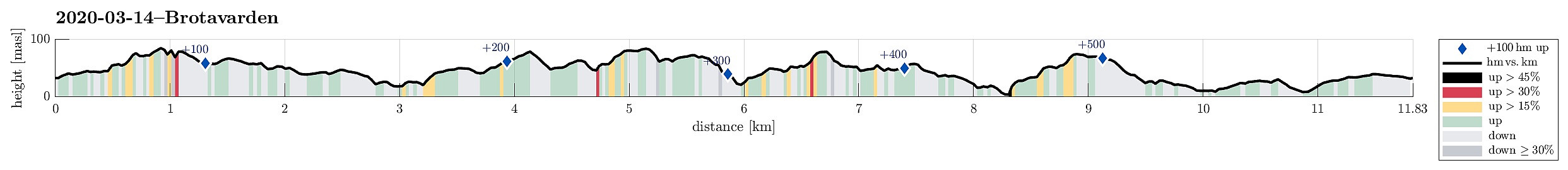 We really needed some fresh air (these times, you know) and since we were not really prepared for lots of snow and so, we decided to give the outer islands another try. After some consideration, Brotavarden was chosen as the hiking goal (with a start-point near Telavåg). We parked a few hundreds of meters before coming to Telavåg, near some soccer fields in the southeast of Telavåg. Just on the other side, we located the trail head and headed at once for our first intermediate goal, Nipa (in the east of Telavåg). Even though it's only a few meters up to the "top" of this cliff, one still has some nice views from there! Since winds were strong and temperatures were rather low, we did not stay there for any longer time, but continued (into the direction Brotavarden) immediately. >>>
Lyderhorn
- Dato:
- 01.03.2020
- Turtype:
- Fjelltur
- Turlengde:
- 1:30t
- Distanse:
- 2,7km
 We needed some fresh air and since time was limited, we chose a nearby goal: Lyderhorn! We parked near Kjøkkelvik school and followed the main trail upwards from there (along a minor ridge which lead into southeastern direction, towards Små-Lyderhorn. From this intermediate point, it's then straight upwards (in northern direction up the steep side of Lyderhorn). Due to low temperatures (and limited time), we continued more or less directly across the top of Lyderhorn, aiming at the other, minor path down to where we started. As already once (at least) before, we missed, however, the point, where this minor path deviates from the main trail (towards north from Lyderhorn) -- the matter of fact that "everything" was covered by snow did not help to see, where this trail left. Something >>>
