Arkiv - dato
Arkiv - aktivitet
-
Annen tur (1)
- Kajakkpadling (1)
-
Annen vintertur (4)
- Trugetur (4)
- Fottur (740)
-
Skitur (4)
- Fjellskitur (4)
-
Sykkeltur (137)
- Blandet sykling (51)
- Gatesykling (9)
Arkiv - Etter geografi
"Peakbookvenner"


Lister jeg samler etter
-
Bergen ≥ 50m pf. og ≥ 100 m.o.h.
(87/89)
 97%
97% -
Most dominating tops of the Bergen peninsula
(68/75)
90%
-
Utvalgte topper og turmål i Bergen
(316/350)
90%
-
Alle topper i Bergen
(357/398)
89%
-
Opptur Bergen
(100/113)
88%
-
De syv fjell rundt Bergen
(6/7)
85%
-
Sund ≥ 50m pf.
(14/18)
77%
-
Os ≥ 50m pf.
(25/34)
73%
-
Søyler (fastmerker) i Bergen
(68/100)
68%
-
Fjell ≥ 50m pf.
(21/32)
65%

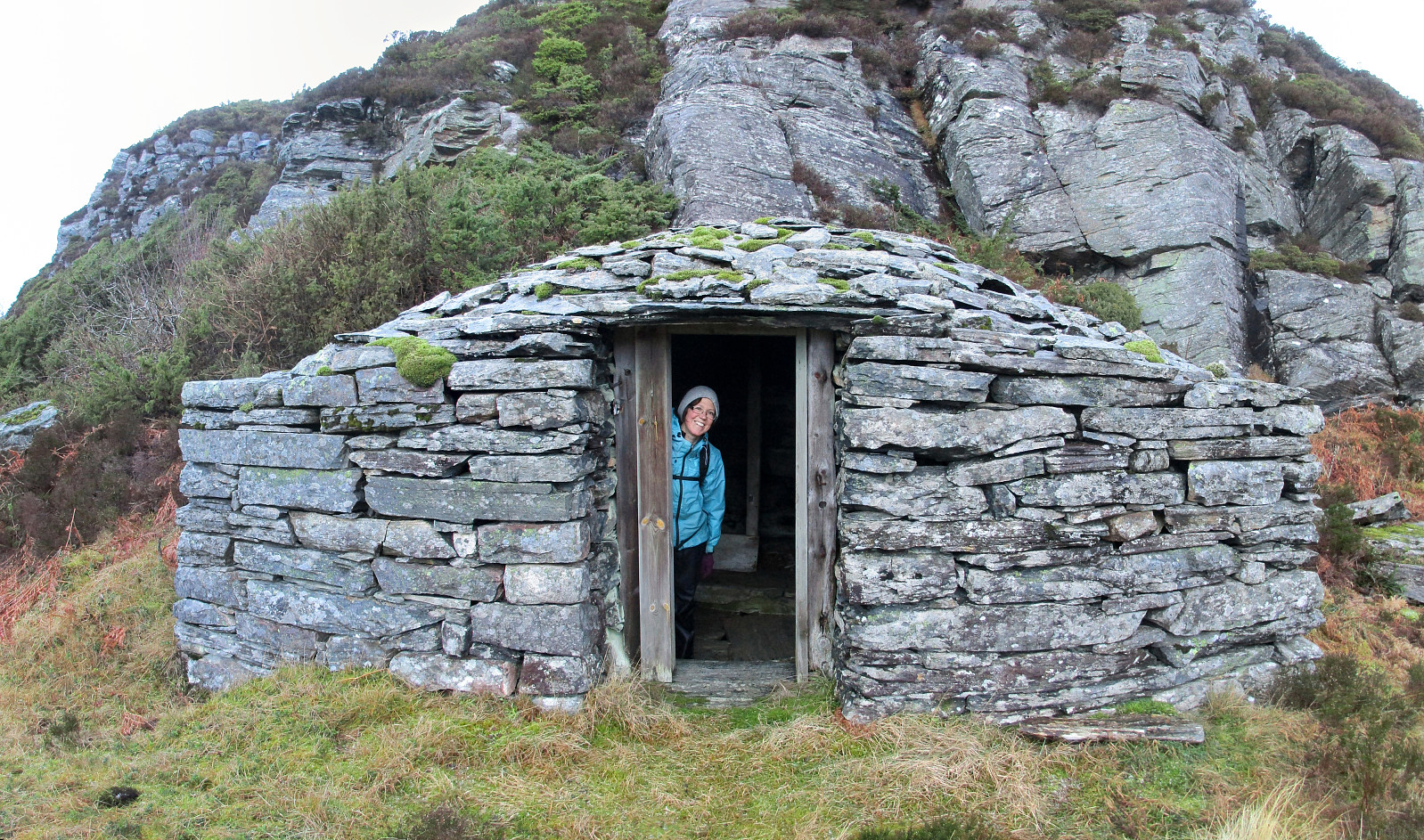
Snow-covered Liatårnet from Li
- Dato:
- 27.01.2019
- Turtype:
- Fjelltur
- Turlengde:
- 2:15t
- Distanse:
- 4,8km
 Considering the snow-covered landscape outside and comparably good weather, it was not too difficult to decide for a nice Sunday hike. We took our car towards the west (Sotra) and there to Li (on the east-side of Liatårnet). Near Haugane, we parked and continued along Liaskjervegen walking until we came to Hola, where we found Hølo (a short road up to the west from F206). Pretty much at the top end of this short road, we then found the path to Liatårnet (and were positively surprised that it was easy to find!). Since someone had gone there already, it was even easy to step up the snow-covered path. Furthermore, we got the impression that rather recently a substantial effort must have been put into this path (with a few signs here and there, a proper stone bridge across a small stream, >>>
Olsokfjellet, Damgårdsfjellet, and Gravdalsfjellet
- Dato:
- 19.01.2019
- Turtype:
- Fjelltur
- Turlengde:
- 2:00t
- Distanse:
- 6,1km
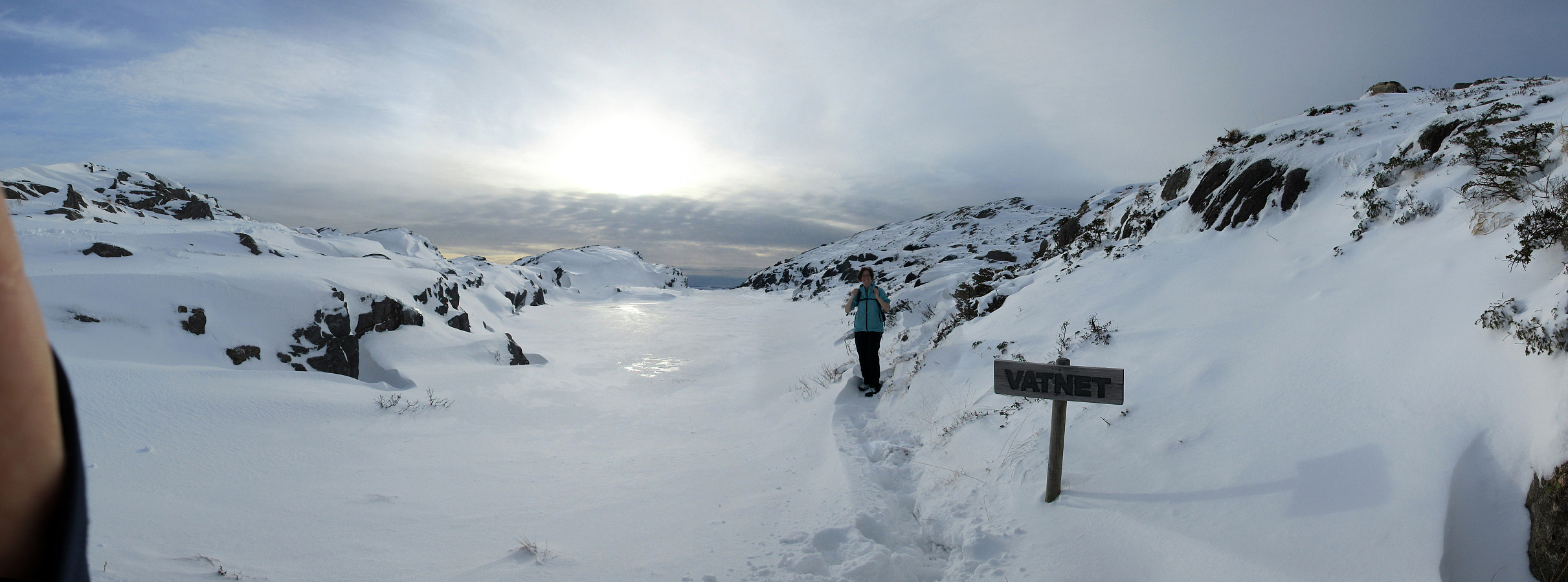
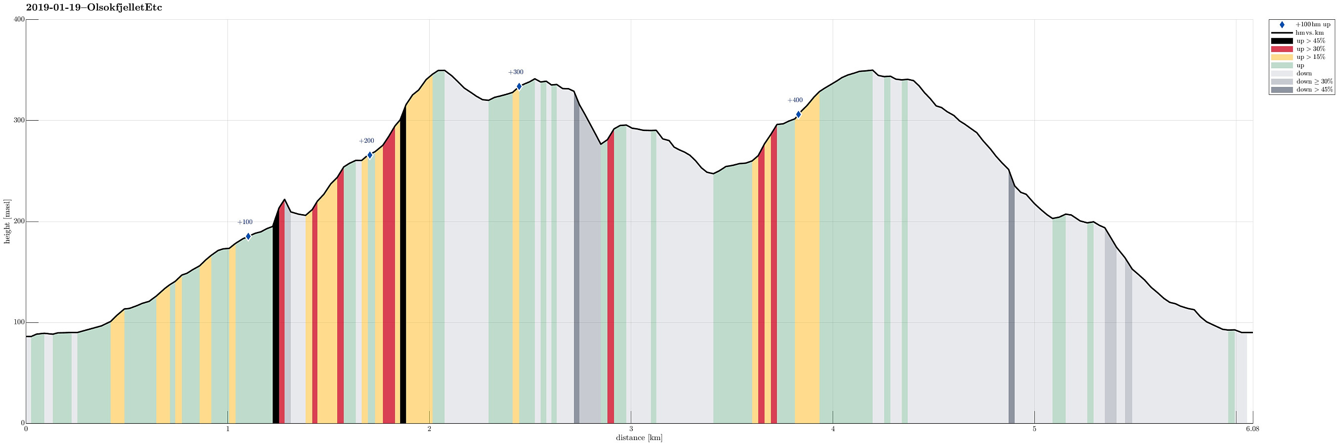 We started near Betanien hospital in upper Fyllingsdalen and walked upwards into Nordnæsdalen. A little north of the sports plain at Nordnæsdalen, we found the path to the right (east), which leads up to Olsokfjellet. Half way up, when leaving the trees behind, we enjoyed a few nice views towards the south and over Fyllingsdalen. From the top of Olsokfjellet, we connected to Damsgårdsfjellet. After crossing Damsgårdsfjellet southeast--northwest, we descended into Skaret (icy!) before continuing into the direction of Gravdalsfjellet from there (mostly westwards, first). Finding all the paths in the snow without any difficulties, we quickly connected to Gravdalsfjellet. At the top of Gravdalsfjellet, we again enjoyed some nice views! :-) Descending in southern direction from there, >>>
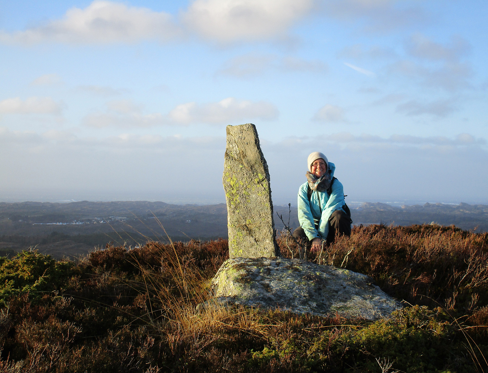
Brakafjellet etc.
- Dato:
- 13.01.2019
- Turtype:
- Fjelltur
- Turlengde:
- 4:00t
- Distanse:
- 10,6km
 We expected a few hours of nice weather and thus left home before lunch to get started.
Also this time , our plan was to hike some not so often visited tops in Sund kommune. We took road 555 to Sotra and then further to the south until we came to a small place called Vorland. There, we parked and started our hike along Gjerdevegen (in eastern direction). Soon behind the last house at Gjerdevegen we crossed over some wet terrain (still in eastern direction), in order to connect to a simple path that then continues in northeastern direction (towards Kleiva). At Kleiva, we departed from the trail and continued in northeaster direction through a little valley. We continued through a trough into the direction of Djupeskarvatnet (all this without a path). At Djupeskarvatnet, we connected to another simple >>>
We expected a few hours of nice weather and thus left home before lunch to get started.
Also this time , our plan was to hike some not so often visited tops in Sund kommune. We took road 555 to Sotra and then further to the south until we came to a small place called Vorland. There, we parked and started our hike along Gjerdevegen (in eastern direction). Soon behind the last house at Gjerdevegen we crossed over some wet terrain (still in eastern direction), in order to connect to a simple path that then continues in northeastern direction (towards Kleiva). At Kleiva, we departed from the trail and continued in northeaster direction through a little valley. We continued through a trough into the direction of Djupeskarvatnet (all this without a path). At Djupeskarvatnet, we connected to another simple >>>
Wet Løvstakken
- Dato:
- 06.01.2019
- Turtype:
- Fjelltur
- Turlengde:
- 1:45t
- Distanse:
- 5,2km
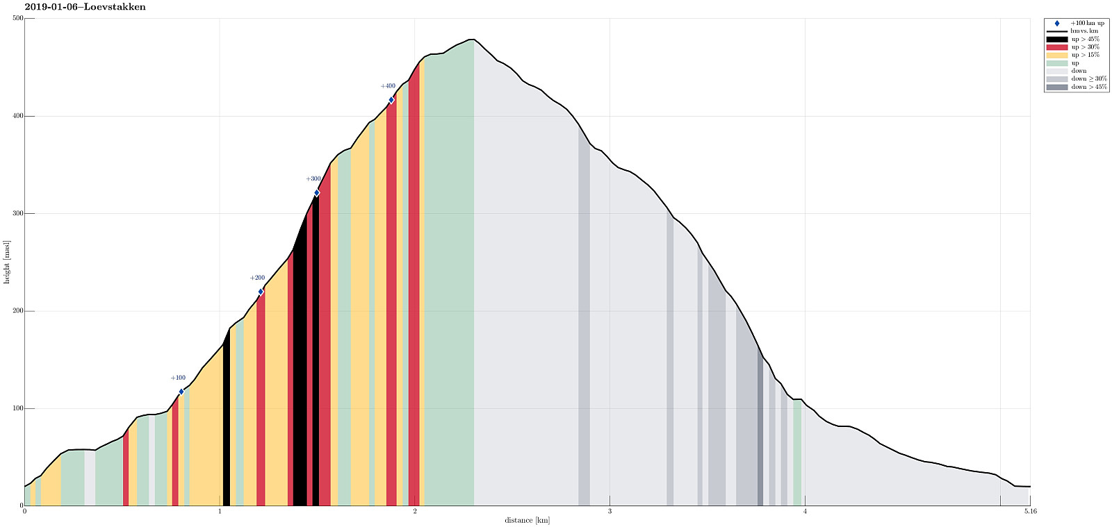 Even though the clouds were hanging really low and even though it was as wet outside as it looked from inside (very!), we still decided to get some fresh air. We chose Løvstakken, but wished to hike it from Krambua and long a trail that we wished to explore. We parked near the BoA sports shop and after a few "wild meters", we were ready to walk up Grønnestølen (along Grønnestølensveien first, then further up parallel to a little stream that comes down in the south of Grønnestølen. Ascending on the right (eastern) side of this stream, we continued further up along a nice (and quite steep) path (though Dalen). At about 250mosl, we briefly lost our path, but managed to reconnect to it soon after. From there, then, it was pretty straight-forward to further ascend to Løvstakken >>>
Tveitafjellet
- Dato:
- 01.01.2019
- Turtype:
- Fjelltur
- Turlengde:
- 1:30t
- Distanse:
- 4,1km
 In order to get some fresh air, we disregarded the unfavorable weather conditions (rather strong storm, intermixed with some precipitation) and headed towards Sotra. The bridge (Sotrabrua) was guarded on both sides, because of the strong winds, but we could still cross over. On Sotra, we continued along road #555 towards Fjell and from there further south, coming by Dala and Hammarsland. At Tveita, we then started to look out for a spot, where we could park, but continued to Eide just a bit further south to actually find a suitable place along the road. Sine we had planned to go up Tveitafjellet first, we first walked a bit back along the road (in northern direction) until we found a good spot to enter Eidesdalen, just southwest of Tveitafjellet. Only a few steps into this valley, however, >>>
