Archiv - Nach Datum
Archiv - Nach Aktivität
-
Andere Tour (1)
- Kayaking (1)
-
Andere Wintertour (4)
- Schneeschuhtour (4)
-
Fahrradtour (120)
- Fahrradtour Straße (5)
- Fahrradtour gemischt (38)
-
Fußtour (728)
- Bergtour (359)
- Jogging (18)
- Spaziergang (87)
- Wanderung (264)
-
Skitour (3)
- Tourenskilauf (3)
Archiv - Nach Geografie
Peakbookfreunde
Wet Løvstakken
- Datum:
- 06.01.2019
- Tourcharakter:
- Bergtour
- Tourlänge:
- 1:45h
- Entfernung:
- 5,2km
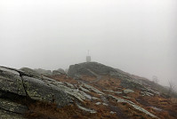
 Even though the clouds were hanging really low and even though it was as wet outside as it looked from inside (very!), we still decided to get some fresh air. We chose Løvstakken, but wished to hike it from Krambua and long a trail that we wished to explore. We parked near the BoA sports shop and after a few "wild meters", we were ready to walk up Grønnestølen (along Grønnestølensveien first, then further up parallel to a little stream that comes down in the south of Grønnestølen. Ascending on the right (eastern) side of this stream, we continued further up along a nice (and quite steep) path (though Dalen). At about 250mosl, we briefly lost our path, but managed to reconnect to it soon after. From there, then, it was pretty straight-forward to further ascend to Løvstakken >>>
Tveitafjellet
- Datum:
- 01.01.2019
- Tourcharakter:
- Bergtour
- Tourlänge:
- 1:30h
- Entfernung:
- 4,1km
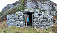
 In order to get some fresh air, we disregarded the unfavorable weather conditions (rather strong storm, intermixed with some precipitation) and headed towards Sotra. The bridge (Sotrabrua) was guarded on both sides, because of the strong winds, but we could still cross over. On Sotra, we continued along road #555 towards Fjell and from there further south, coming by Dala and Hammarsland. At Tveita, we then started to look out for a spot, where we could park, but continued to Eide just a bit further south to actually find a suitable place along the road. Sine we had planned to go up Tveitafjellet first, we first walked a bit back along the road (in northern direction) until we found a good spot to enter Eidesdalen, just southwest of Tveitafjellet. Only a few steps into this valley, however, >>>


