Arkiv - dato
Arkiv - aktivitet
-
Annen tur (1)
- Kajakkpadling (1)
-
Annen vintertur (4)
- Trugetur (4)
- Fottur (740)
-
Skitur (4)
- Fjellskitur (4)
-
Sykkeltur (137)
- Blandet sykling (51)
- Gatesykling (9)
Arkiv - Etter geografi
"Peakbookvenner"


Lister jeg samler etter
-
Bergen ≥ 50m pf. og ≥ 100 m.o.h.
(87/89)
 97%
97% -
Most dominating tops of the Bergen peninsula
(68/75)
90%
-
Utvalgte topper og turmål i Bergen
(316/350)
90%
-
Alle topper i Bergen
(357/398)
89%
-
Opptur Bergen
(100/113)
88%
-
De syv fjell rundt Bergen
(6/7)
85%
-
Sund ≥ 50m pf.
(14/18)
77%
-
Os ≥ 50m pf.
(25/34)
73%
-
Søyler (fastmerker) i Bergen
(68/100)
68%
-
Fjell ≥ 50m pf.
(21/32)
65%

Spiraling out of Rotterdam :-)
- Dato:
- 21.05.2018
- Turtype:
- Sykkeltur
- Turlengde:
- 1:30t
- Distanse:
- 14,8km
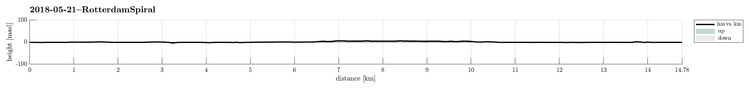 In order do a bit of physical work out, I just took my bike and left the center of Rotterdam without any particular plan. Within short, however, I had the following idea: why not cycling out of Rotterdam in a spiraling pattern?! Obvious idea, of course! :-) So I started cycling/circling around the Cool district of Rotterdam in ever bigger rounds. Eventually, I completed three full turns, seeing a few places in Rotterdam that I had not been to before (nice!). After a short stop at the Walenburg Cafe north of the main train station in Rotterdam, I returned to the center with a smile on my face. :-)
See also the related FB-page Hiking around Bergen, Norway .
Some information about the Walenburg is available here , here , and here .
In order do a bit of physical work out, I just took my bike and left the center of Rotterdam without any particular plan. Within short, however, I had the following idea: why not cycling out of Rotterdam in a spiraling pattern?! Obvious idea, of course! :-) So I started cycling/circling around the Cool district of Rotterdam in ever bigger rounds. Eventually, I completed three full turns, seeing a few places in Rotterdam that I had not been to before (nice!). After a short stop at the Walenburg Cafe north of the main train station in Rotterdam, I returned to the center with a smile on my face. :-)
See also the related FB-page Hiking around Bergen, Norway .
Some information about the Walenburg is available here , here , and here .
Visiting the Japanese garden in Den Haag
- Dato:
- 20.05.2018
- Turtype:
- Sykkeltur
- Turlengde:
- 5:00t
- Distanse:
- 59,3km
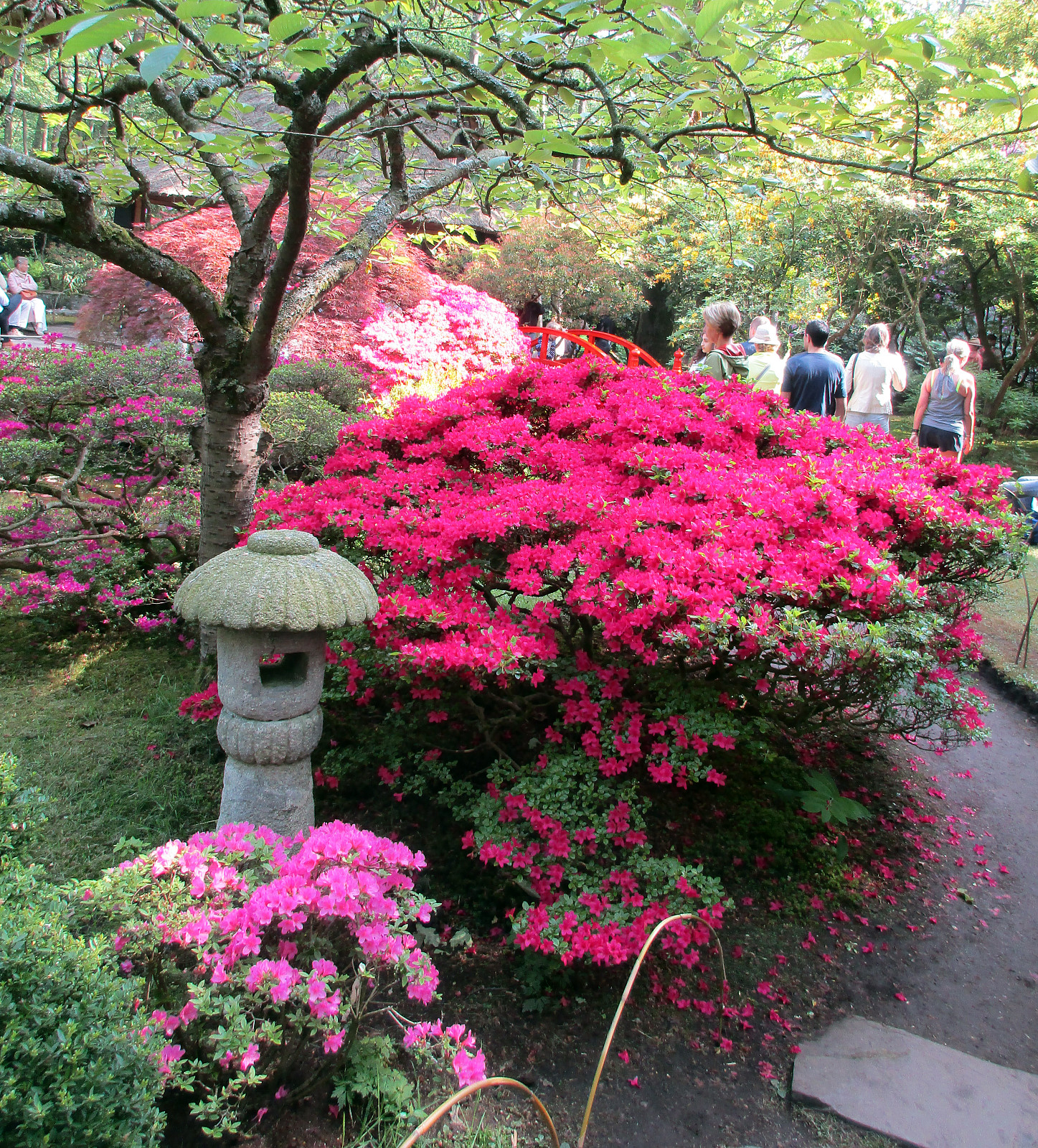 We started from the center of Rotterdam with the goal to see the Janapese Garden in Den Haag, which only is open for a few weeks every year. We started in northern direction, passing by the airport of Rotterdam on its eastern end. From there we cycled across the green region between Rotterdam (in the south), Delft (in the northwest), and Berkel en Rodenrijs (in the east). Coming by numerous canals, we crossed through Delfgauw in the east of Delft from south to north. Soon after, we came by the very nice little lake De Grots Plas, where we stopped to enjoy the view! :-) Thereafter, we continued into the direction of Den Haag, coming through some larger residential areas (not too interesting, after all). After a while, we came to De Vliet, which is a long canal between Delft and Leiden >>>
Exploring Turøyna
- Dato:
- 11.05.2018
- Turtype:
- Fjelltur
- Turlengde:
- 3:00t
- Distanse:
- 3,3km
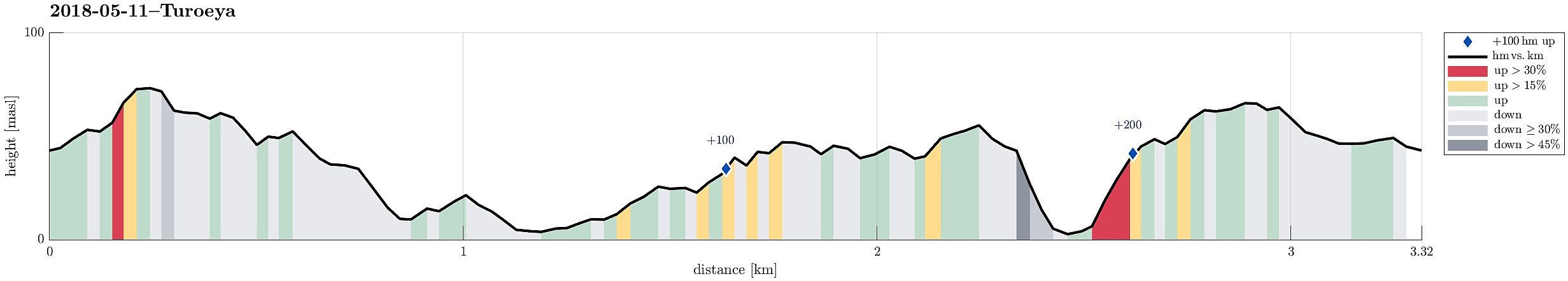 It was time to get out to Turøyna and explore the rather wild nature there! We started from the street to the small settlement on Turøyna and headed towards the large cairn, Turøyvarden, on the largest top of the island. From there, we continued northwards (and without any path) to reach Svartanova via Tuskeluren. From there, to get further northwest to Laksneset, we had to find a way to cross over a rather deep trough. Starting relatively low on Svartanova and searching for a proper place "on half height", walking in southwestern direction, proved to be the right approach and after only a few steps, we were able to cross over. Then it was straight forward to get to Laksneset and enjoy some nice views from there. Continuing our hike around the island, we then followed the >>>
Short hike on Storskora
- Dato:
- 11.05.2018
- Turtype:
- Fottur
- Turlengde:
- 0:30t
- Distanse:
- 2,0km
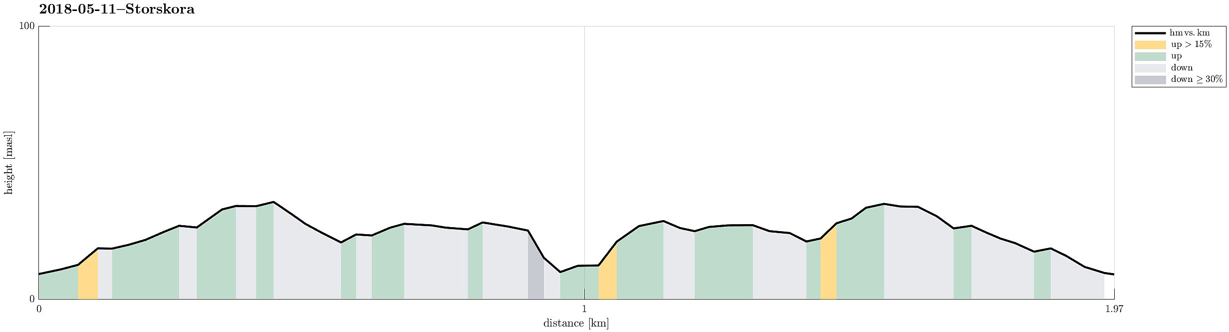 After our hike on Turøyna , we continued with a short hike on Storskora, visiting a little light house at the northwestern end of this little island. Following a nicely marked path from the street, it was straight-forward to reach our target. From there, we basically took the same path back, then.
Selected photos are available as Google photo album .
See also the related FB-page Hiking around Bergen, Norway .
After our hike on Turøyna , we continued with a short hike on Storskora, visiting a little light house at the northwestern end of this little island. Following a nicely marked path from the street, it was straight-forward to reach our target. From there, we basically took the same path back, then.
Selected photos are available as Google photo album .
See also the related FB-page Hiking around Bergen, Norway .
Short hike along the northwestern side of Sælenvatnet
- Dato:
- 06.05.2018
- Turtype:
- Fottur
- Turlengde:
- 0:30t
- Distanse:
- 2,3km
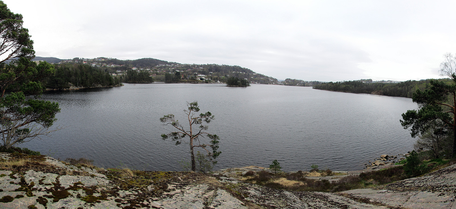 Starting from Varden, this was "only" a short hike along the northwestern side of Sælenvatnet.
Selected photos are available as Google photo album .
See also the related FB-page Hiking around Bergen, Norway .
Starting from Varden, this was "only" a short hike along the northwestern side of Sælenvatnet.
Selected photos are available as Google photo album .
See also the related FB-page Hiking around Bergen, Norway .
Short hike into Kanadaskogen
- Dato:
- 05.05.2018
- Turtype:
- Fjelltur
- Turlengde:
- 1:00t
- Distanse:
- 4,8km
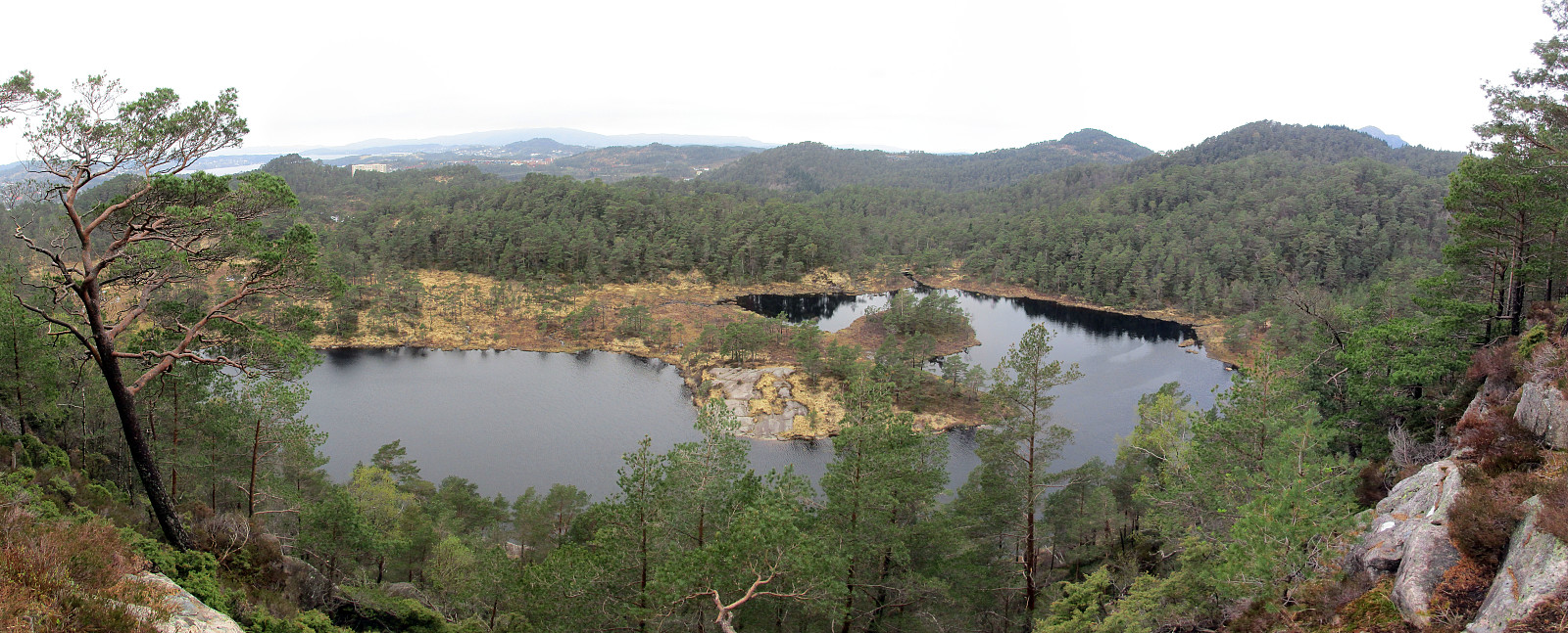 Starting from Varden in the south of Fyllingsdalen, this was "just" a short and quick hike into Kanadaskogen and around Stora Krokatjørna.
See also the related FB-page Hiking around Bergen, Norway .
Starting from Varden in the south of Fyllingsdalen, this was "just" a short and quick hike into Kanadaskogen and around Stora Krokatjørna.
See also the related FB-page Hiking around Bergen, Norway .
