Archive - Date
Archive - Activity
-
Bike trip (137)
- Bike trip - mixed (51)
- Bike trip - road (9)
-
Other trip (1)
- Kayaking (1)
-
Other winter trip (4)
- Snowshoe trip (4)
- Ski trip (4)
- Trip by foot (740)
Archive - Geography
Peakbook-Friends


Collected lists
-
Bergen ≥ 50m pf. og ≥ 100 m.o.h.
(87/89)
 97%
97% -
Most dominating tops of the Bergen peninsula
(68/75)
90%
-
Utvalgte topper og turmål i Bergen
(316/352)
89%
-
Alle topper i Bergen
(357/400)
89%
-
Opptur Bergen
(100/113)
88%
-
De syv fjell rundt Bergen
(6/7)
85%
-
Sund ≥ 50m pf.
(14/18)
77%
-
Os ≥ 50m pf.
(25/34)
73%
-
Søyler (fastmerker) i Bergen
(68/100)
68%
-
Fjell ≥ 50m pf.
(21/32)
65%

Løvstakken from Fjøsanger
- Date:
- 26.12.2017
- Characteristic:
- Hillwalk
- Duration:
- 2:30h
- Distance:
- 5.9km
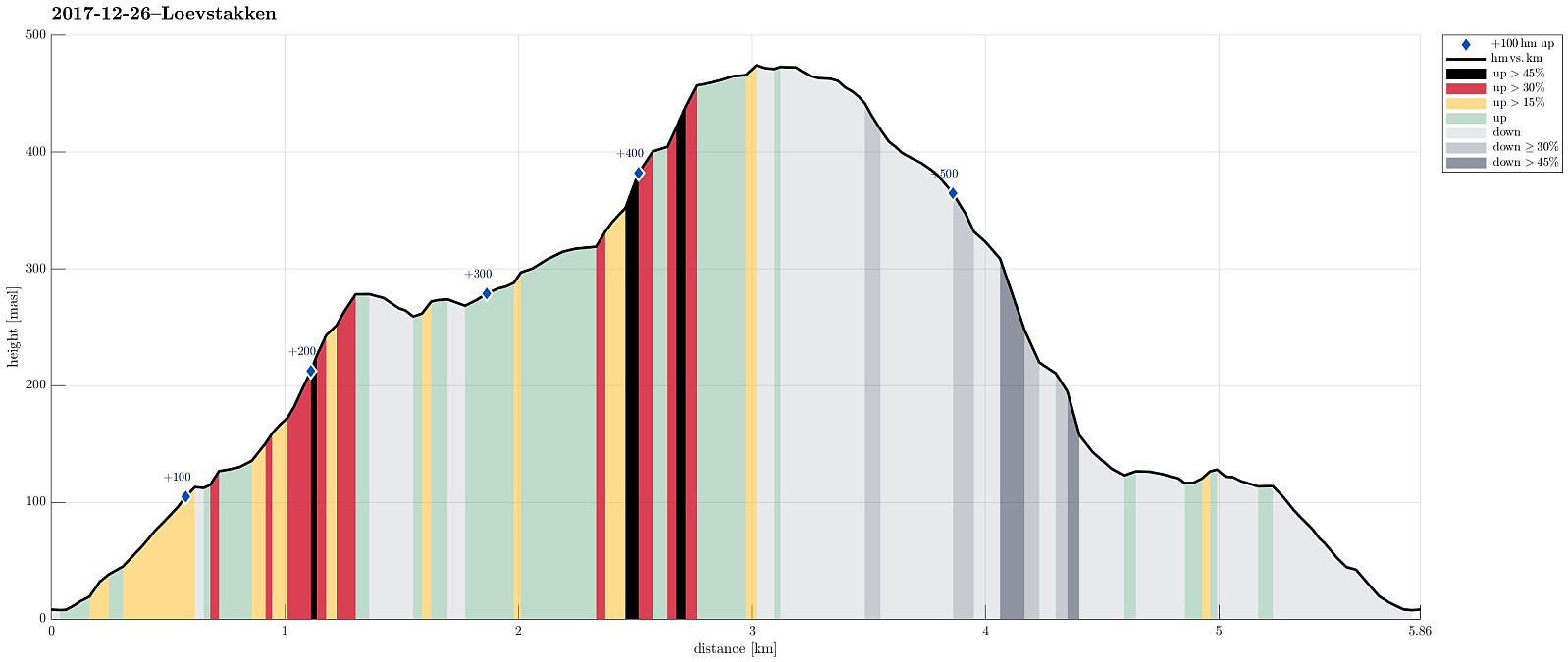 We parked near the supermarket at Fjøsanger and walked first a bit up towards the farm Fjøsanger. Before getting there, we connected to a gravel path that runs mostly parallel to the mountain and walked along this one until the forest starts to open up on the left side. At the very edge of the forest, another path then continues steeply upwards and we used this to get "to the next level" (the still relatively new path which maybe later will be connected with the new Løvstien all around Løvstakken's eastern side). We then walked this path to its current end (there is a little hut for having a break). From there, we then continued through the forest, again, getting up to Mindebakken (a little hill, northeast of Gullsteinen). Since Mindebakken is comparably steep on its western >>>
Sauafjellet
- Date:
- 16.12.2017
- Characteristic:
- Hillwalk
- Duration:
- 2:00h
- Distance:
- 4.5km
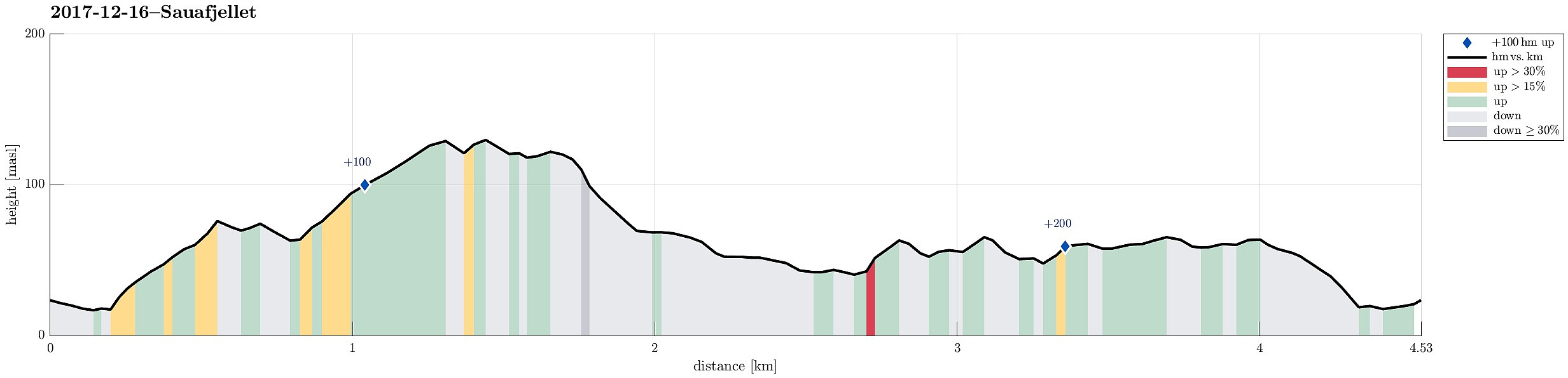 We took the car to Sotra and there to Fjæreide (near Knappskog). We parked near the place where seemingly also the bus turns around (more or less in the middle between Fjæreidpollen in the NE and Fjæreidvatnet in the SW). We then walked first for a few meters down the road which leads down to the water (Fjæreidpollen/Smalneset), before then turning left (following a sign from Kyststien). Within short we were in the snow and soon after we departed from the path towards Spjeldsfjellet (our plan was to get up Sauafjellet first). After quickly ascending to Fagrevollen, we connected to a ridge, which leads up to Sauafjellet in western direction. At Sauafjellet, we enjoyed some great views towards the Atlantic! We then decided to head towards Spjeldsfjellet, even though it was clear that >>>
