Archive - Date
Archive - Activity
-
Bike trip (137)
- Bike trip - mixed (51)
- Bike trip - road (9)
-
Other trip (1)
- Kayaking (1)
-
Other winter trip (4)
- Snowshoe trip (4)
- Ski trip (4)
- Trip by foot (740)
Archive - Geography
Peakbook-Friends


Collected lists
-
Bergen ≥ 50m pf. og ≥ 100 m.o.h.
(87/89)
 97%
97% -
Most dominating tops of the Bergen peninsula
(68/75)
90%
-
Utvalgte topper og turmål i Bergen
(316/350)
90%
-
Alle topper i Bergen
(357/398)
89%
-
Opptur Bergen
(100/113)
88%
-
De syv fjell rundt Bergen
(6/7)
85%
-
Sund ≥ 50m pf.
(14/18)
77%
-
Os ≥ 50m pf.
(25/34)
73%
-
Søyler (fastmerker) i Bergen
(68/100)
68%
-
Fjell ≥ 50m pf.
(21/32)
65%

Crossing Høgafjellet from south to north
- Date:
- 27.11.2016
- Characteristic:
- Hillwalk
- Duration:
- 2:30h
- Distance:
- 5.6km
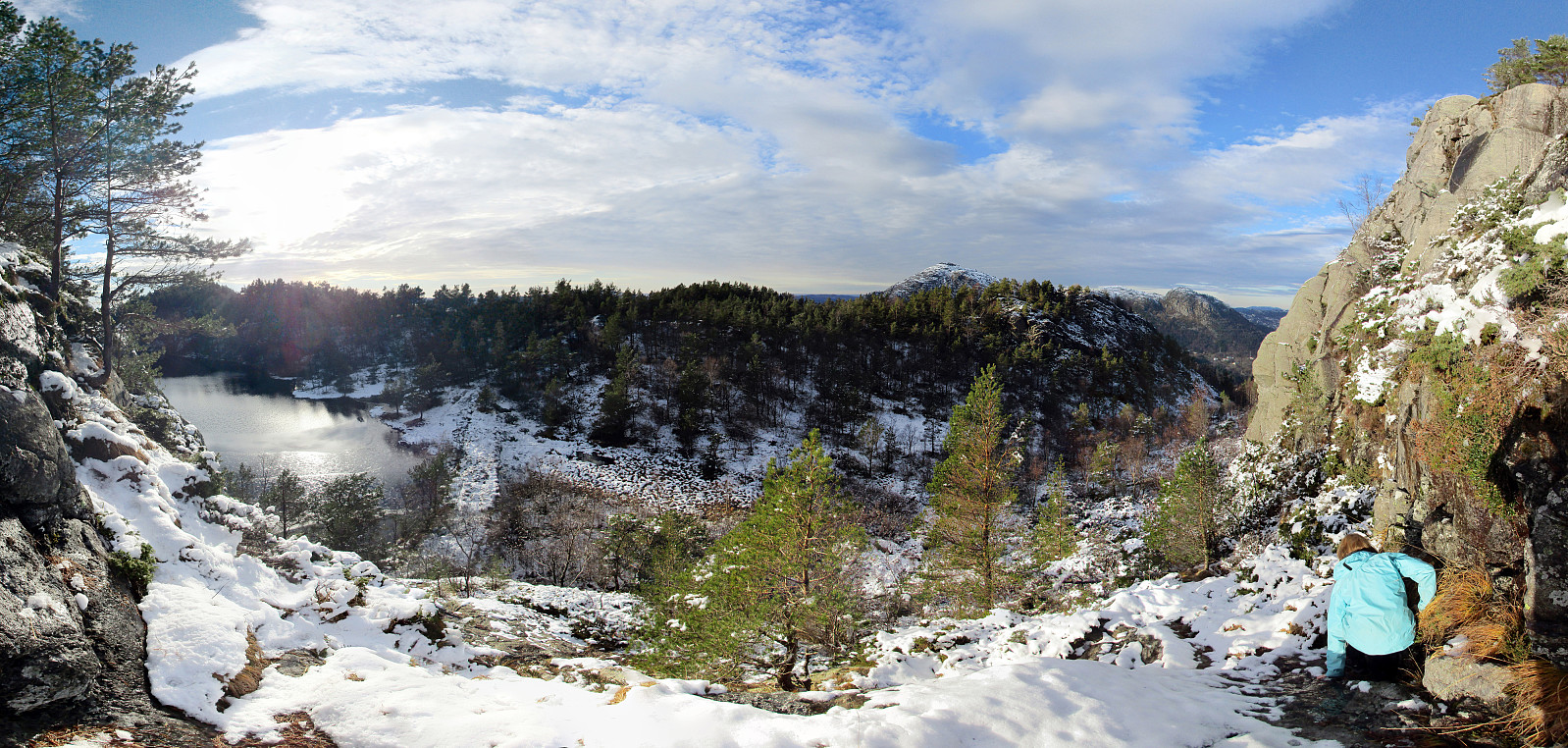
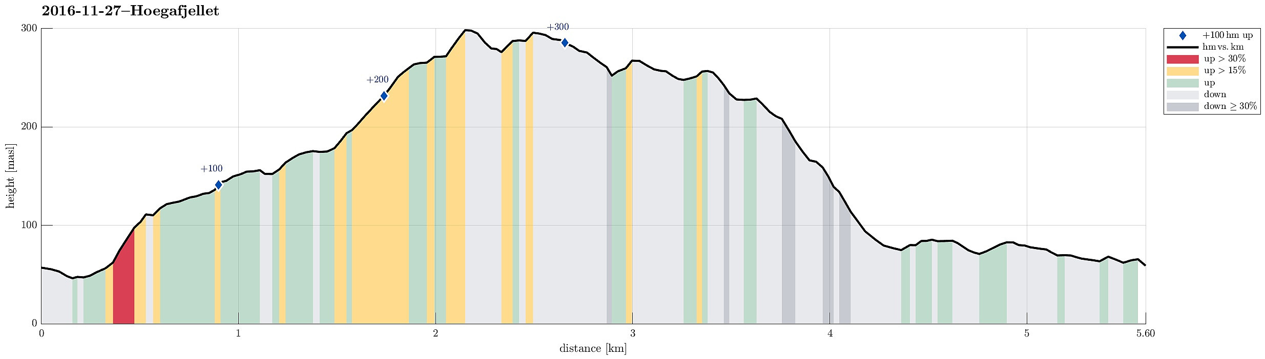 Since we were two families with one car each, this day, we decided to traverse Høgafjellet (from the south to the north), instead of going a round. We took road 555 from Bergen to the west (across the large Sotra-bridge) and then continued further southwards, passing through Fjell. At about N60.312, E5.082, we left one car at the parking place, from which one can access the ruins of previous fortifications (fjellfestningen). Driving further southwards, we connected then to road 204, which leads to Haganes. Instead of driving all the way to Haganes, however, we stopped at about N60.286, E5.103 and started our hike from there. We first crossed over Storhaugmyra (mostly in eastern direction), getting into a small valley, which leads upwards to Kattatjørna. There, we basically changed direction >>>
Ulriken from Montana
- Date:
- 26.11.2016
- Characteristic:
- Hillwalk
- Duration:
- 1:15h
- Distance:
- 3.4km
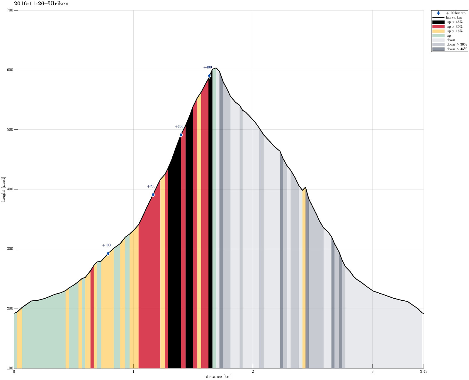 We drove up to Montana and started to hike along Johan Blytts vei, crossing over a little stream and heading further upwards in southeastern direction until we met another forrest road that comes up from the south. We followed then this forrest road for a few steps (mostly in northeastern direction) until the next turn of this road (back into southern direction). At this turn, a whole section of new stone stairs have been built recently, leading upwards in northern direction and towards Ulriken. It was these new stone stairs, which we were eager to see for the first time, of course! :-) We stepped up and reached the top of Ulriken not long after (a little over half an hour, alltogether, from the parking place). Instead of taking the same route down, again, we instead followed the higher >>>
Løvstakken (steep way up)
- Date:
- 19.11.2016
- Characteristic:
- Hillwalk
- Duration:
- 1:10h
- Distance:
- 4.0km
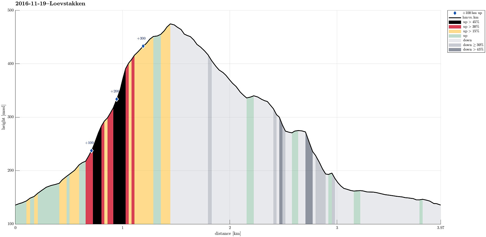 We parked at the upper end of Kirsten Flagstads vei and walked from there (in light rain that soon would change into web snow). We walked up Rosenlundveien until we reached a major turn near house #43. Right after the turn, a small path leaves to the left and upwards. First, one steps a few meters up through the forrest, before then continuing underneath a power or telephone line that leads straight up, almost directly towards the summit of Løvstakken. Somehwere near the tree line, the path then turns a bit left (then in northern direction), where it continues steeply upwards over some rumble. Some meters higher up, one gets (if the weather is nice!) a great view over Fyllingsdalen. From there, it is then less steeply up towards the not far high-point of Løvstakken. From Løstakken, >>>
Erstadfjellet and Stemmeseggi
- Date:
- 13.11.2016
- Characteristic:
- Hillwalk
- Duration:
- 2:30h
- Distance:
- 7.2km
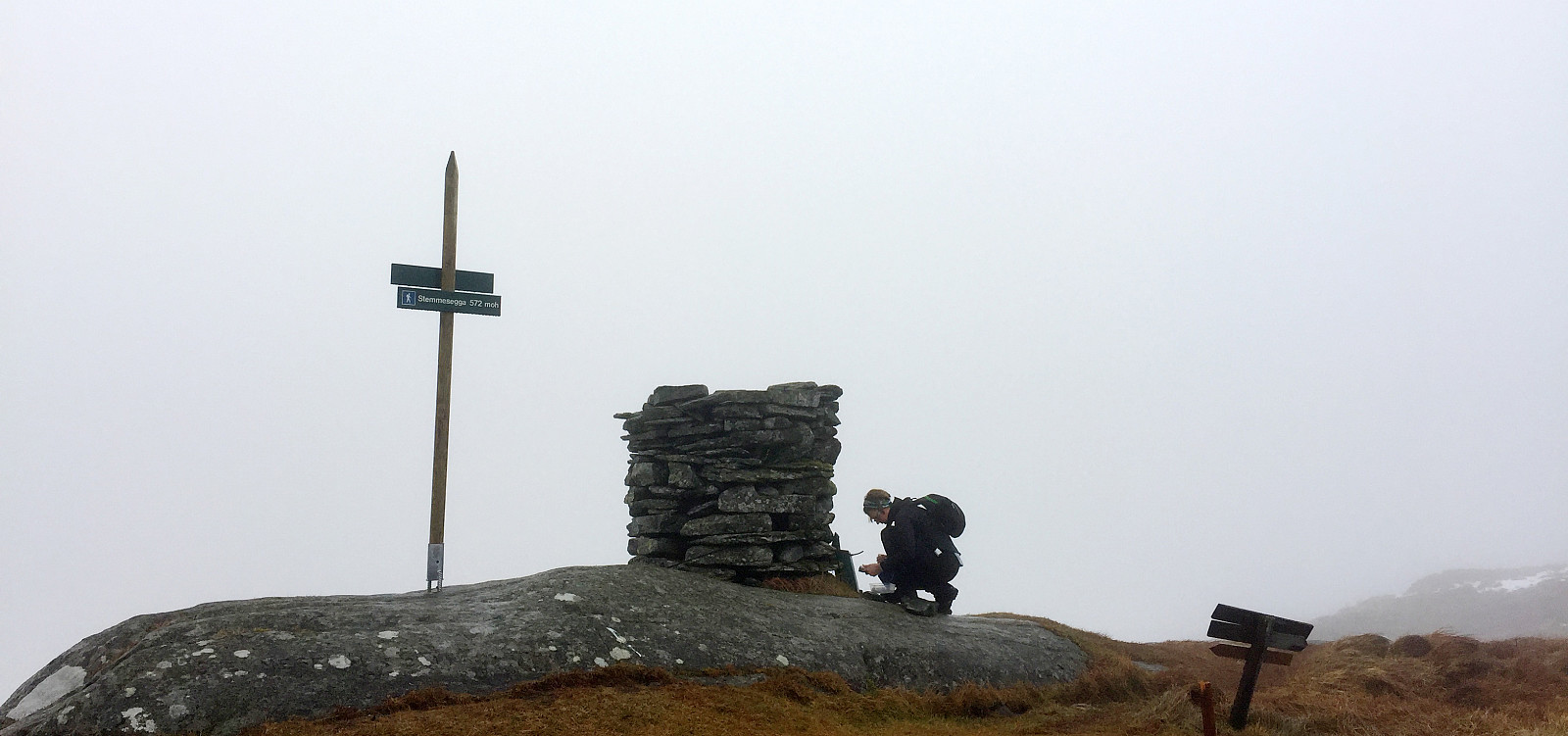 We drove from Bergen towards the East and left the E16 to cross Sørfjorden towards Osterøy on the large bridge. We drove then to Haus and further to Votlo, where we continued a few turns upwards (towards Askeland). We parked near the spot, where the street (towards Askeland) crosses the little stream, which comes down Askelandsdalen. From there, we started hiking; first into northwestern direction (further towards Askeland, somehow upwards, also). Only a few steps up this road, we found the path, which departed to the right, now in eastern direction (leading further upwards). This path clearly was a well-made path before, probably serving a little hut not far up the mountain-side. When we reached this hut (more the ruins of it), we turned left and ascended (now more steeply) over some >>>
Gravdalsfjellet via Eikelifjellet
- Date:
- 06.11.2016
- Characteristic:
- Hillwalk
- Duration:
- 1:45h
- Distance:
- 5.0km
 We started from the parking spot at the very end of Spelhaugen in Fyllingsdalen and ascended towards Eikelifjellet at once (we did not start along the major gravel road, which leads up to Tennebekktjørnet, but in parallel to this road, right a little bit to its north). Once over the top of Eikelifjellet, we continued in northern direction and towards Nipetjørna. We crossed over near the southeastern end of Nipetjørna and then continued towards the renewed Viggohytten. From there, it is only a few meters further up to the top of Gravdalsfjellet (not so clear, after all, where the actual top of Gravdalsfjellet is, really). We then decided to take another path down. Even though the terrain is steep, it is well possible to follow a minor path down from Gravdalsfjellet across its western >>>
