Archive - Date
Archive - Activity
-
Bike trip (137)
- Bike trip - mixed (51)
- Bike trip - road (9)
-
Other trip (1)
- Kayaking (1)
-
Other winter trip (4)
- Snowshoe trip (4)
- Ski trip (4)
- Trip by foot (740)
Archive - Geography
Peakbook-Friends


Collected lists
-
Bergen ≥ 50m pf. og ≥ 100 m.o.h.
(87/89)
 97%
97% -
Most dominating tops of the Bergen peninsula
(68/75)
90%
-
Utvalgte topper og turmål i Bergen
(316/352)
89%
-
Alle topper i Bergen
(357/400)
89%
-
Opptur Bergen
(100/113)
88%
-
De syv fjell rundt Bergen
(6/7)
85%
-
Sund ≥ 50m pf.
(14/18)
77%
-
Os ≥ 50m pf.
(25/34)
73%
-
Søyler (fastmerker) i Bergen
(68/100)
68%
-
Fjell ≥ 50m pf.
(21/32)
65%

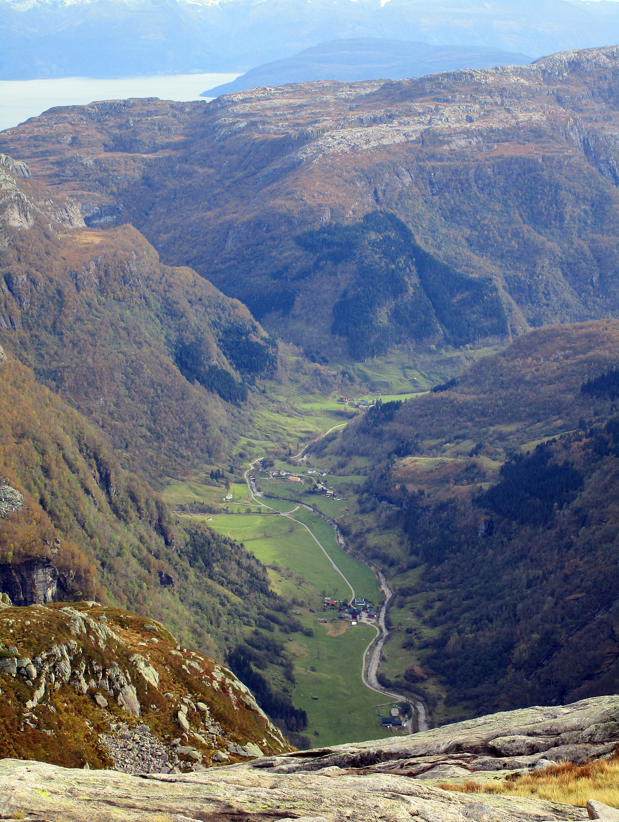
Finnbunuten
- Date:
- 15.10.2016
- Characteristic:
- Hillwalk
- Duration:
- 5:00h
- Distance:
- 10.2km
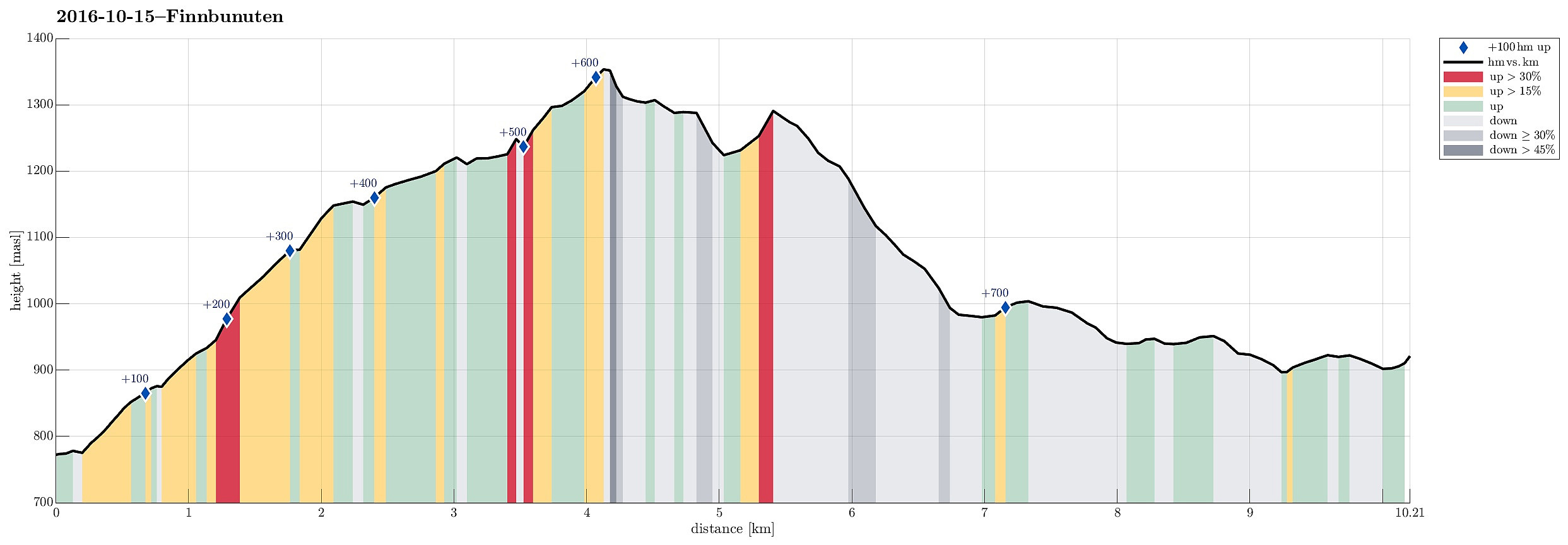 We left E16 northeast of Voss and took road 13 to the north in the direction of Myrkdalen, Vikafjellet. We passed Myrkdalen and the ski center north of it, driving into Holedalen. At the very end of that valley, the road winds steeply upwards at Halsabakkane with the help of four u-turns. Only shortly after, we parked (near Samecampen at Vikafjellet) and crossed the Sendo stream using the rest of a small bridge that leads over to the other, southwestern side. A few minutes later, we reached a place called Finnbuene, where previously people stayed in summer. From there, we continued in southeastern direction towards the edge above Holedalen. While ascending, we slowing changed to a more southern course, heading into the direction of Kaldavatnet. Hiking this part of this trip is straight >>>
Tveitakvitingen from Tveita
- Date:
- 09.10.2016
- Characteristic:
- Hillwalk
- Duration:
- 7:00h
- Distance:
- 16.4km
 We took E16 from Bergen to Trengereid, then following road number 7 to Samnanger, before changing over to road number 48 right after Hagaåstunnelen. We passed through Eikelandsosen and continued to Holdhus, where we changed to a small road, which would lead us into the Tveita valley. Once there, we continued almost all the way in and parked near Bratthus, close to Indre Tveita. From there, we walked the rest of the road into the end of this nice valley, passing the last farm at Brekka soon after. The way continues into Tveitaskaret, where it becomes steep very soon (but easy to hike---mostly, because a gravel road has been constructed---probably to help maintaining a small power station that was opened in Tveitaskaret in 2009). At the end of the gravel road, one can further ascend through >>>
Knappskogfjellet
- Date:
- 02.10.2016
- Characteristic:
- Hillwalk
- Duration:
- 2:00h
- Distance:
- 6.4km
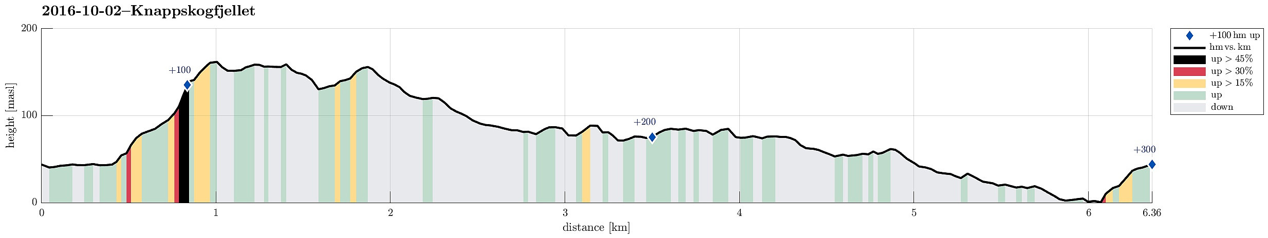 We drove to Sotra and turned right (northwards) after Kolltveittunnelen. We continued on road 561 northwards until we came to Knappskog. There, we turned left and followed a narrow road to Fjæreide. We parked right next to the cross, where one enters Dalane (in southern direction). We first wished to get to a path at the southern end of Dalane, but when we got close, a man (the owner of house #194?) informed us that we were not supposed to continue, but return and aim at another path that connects to Knappskogfjellet on the eastern side of Dalane. About half the path back to the main road, we detected this path and used it to get up above Dalane and towards Knappskogfjellet. Proceeding towards Knappskogfjellet was then straight-forward (partially steep, but easy to climb up). On Knappskogfjellet >>>
Tennebekk
- Date:
- 01.10.2016
- Characteristic:
- Hillwalk
- Duration:
- 1:30h
- Distance:
- 5.6km
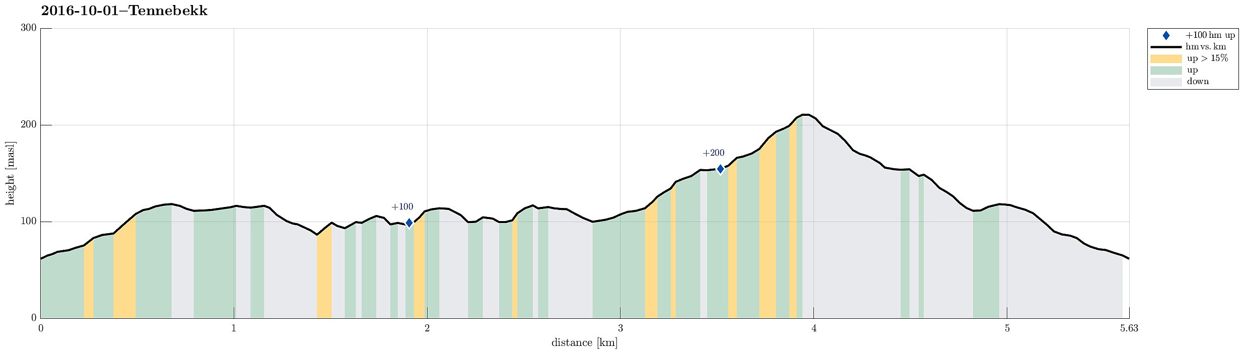 We parked at the northwestern end of Spelhaugen and walked the forrest road up to Tennebekktjørna. We then rounded the little lake (in clockwise direction). When back to Langedalen, after one round, we decided to walk the forrest road, which leads up to Eikelifjellet up and down, before returning to our car.
Selected photos are available as Google photo album .
See also the related FB-page Hiking around Bergen, Norway .
We parked at the northwestern end of Spelhaugen and walked the forrest road up to Tennebekktjørna. We then rounded the little lake (in clockwise direction). When back to Langedalen, after one round, we decided to walk the forrest road, which leads up to Eikelifjellet up and down, before returning to our car.
Selected photos are available as Google photo album .
See also the related FB-page Hiking around Bergen, Norway .
