Archive - Date
Archive - Activity
-
Bike trip (137)
- Bike trip - mixed (51)
- Bike trip - road (9)
-
Other trip (1)
- Kayaking (1)
-
Other winter trip (4)
- Snowshoe trip (4)
- Ski trip (4)
- Trip by foot (740)
Archive - Geography
Peakbook-Friends


Collected lists
-
Bergen ≥ 50m pf. og ≥ 100 m.o.h.
(87/89)
 97%
97% -
Most dominating tops of the Bergen peninsula
(68/75)
90%
-
Utvalgte topper og turmål i Bergen
(316/351)
90%
-
Alle topper i Bergen
(357/400)
89%
-
Opptur Bergen
(100/113)
88%
-
De syv fjell rundt Bergen
(6/7)
85%
-
Sund ≥ 50m pf.
(14/18)
77%
-
Os ≥ 50m pf.
(25/34)
73%
-
Søyler (fastmerker) i Bergen
(68/100)
68%
-
Fjell ≥ 50m pf.
(21/32)
65%

Gåssand
- Date:
- 27.08.2016
- Characteristic:
- Hillwalk
- Duration:
- 1:30h
- Distance:
- 3.7km
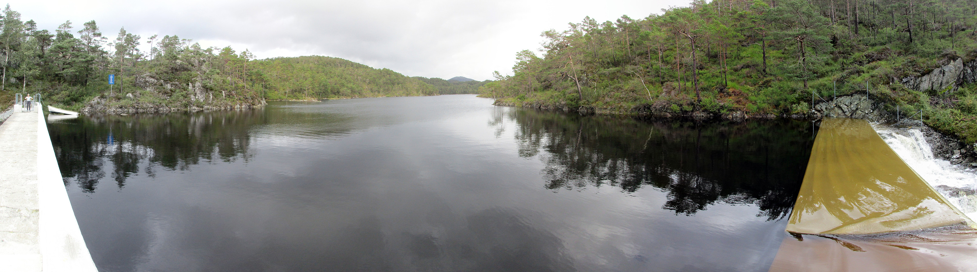 We used E39 towards Os from Bergen, taking a small road, Gåssandvegen, to the left, right before Søfteland. We then followed this narrow road to Hatlelia, where the road is taking a sharp turn to the right, crossing Nordelva there and then leading back to a farm that lies near Gåssandvatnet (where Sagelva comes down). We parked near to the lake and started to hike from there, following a forrest road that parallels Sagelva. After only a few steps, this forrest road passes Os El-verk, before it becomes a litte more steep. Eventually, we came over a small saddle with Krokvatnet right beneath us. We followed the pretty new road down to the dam, which holds back Krokvatnet, just to learn that there was no way to cross over the dam as we had planned. The southeastern side of this dam is >>>
Høgafjellet
- Date:
- 21.08.2016
- Characteristic:
- Hillwalk
- Duration:
- 5:45h
- Distance:
- 15.2km
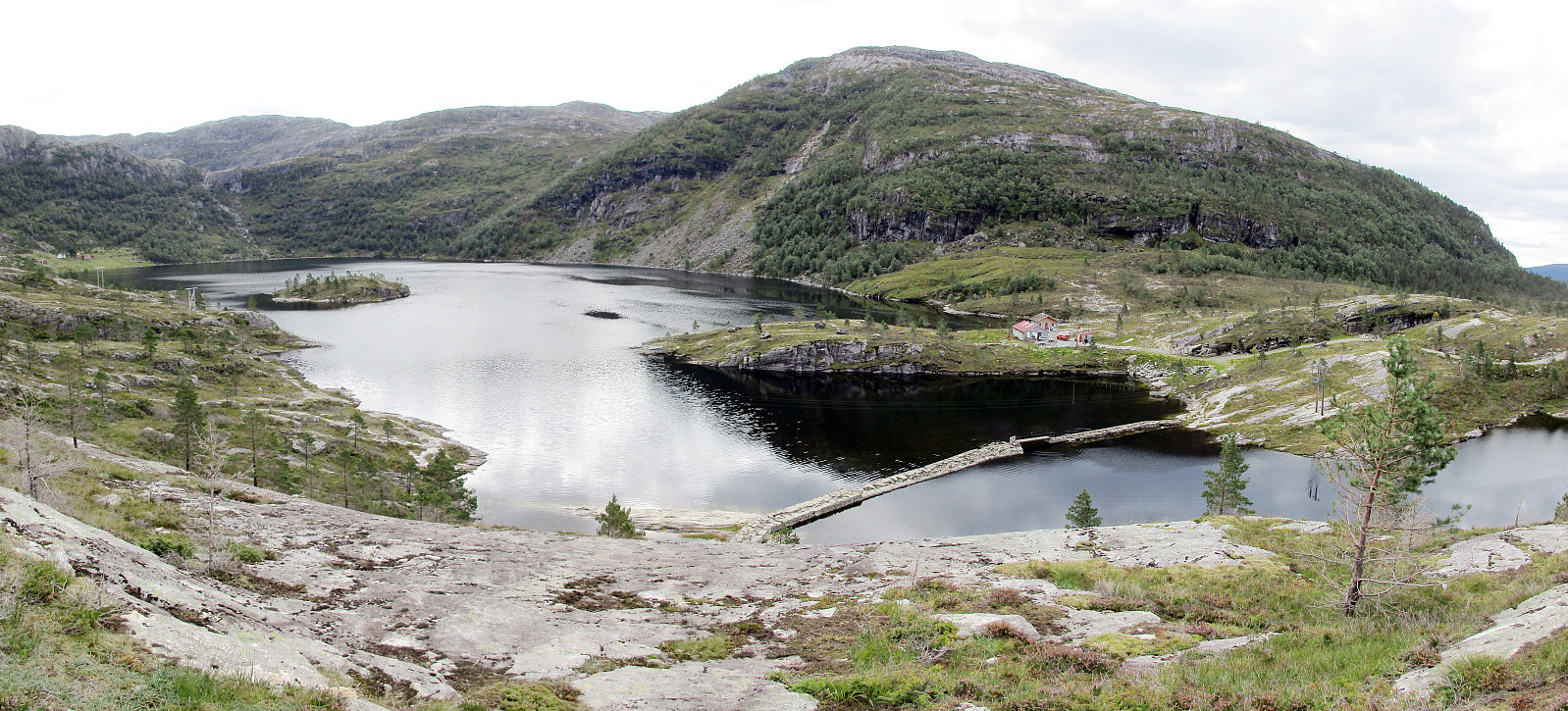 We took the car to Osterøy and there to Tysso, where we followed a narrow road up to Osvatnet, parking at the end of this road, right next to the power station house. We knew already that the old route via the many wooden stairs right next to the water pipe that leads down to the power station house was closed and we followed the alternative route, which first leads into the valley of Kupelva, right underneath Preikestolen. All the efforts that were made to make this track welcoming and easy to go are highly appreciated! Near some moor, right underneath Preikestolen, the path splits and the ones, who wish to ascend towards Høgafjellet, take the path to the right, turning southwards. Via some stairs that help through a small, narrow valley, one gets up to the level of Nedra Botnavatnet. >>>
Bergen-Løvstakken-Fyllingsdalen
- Date:
- 19.08.2016
- Characteristic:
- Hillwalk
- Duration:
- 3:00h
- Distance:
- 9.0km
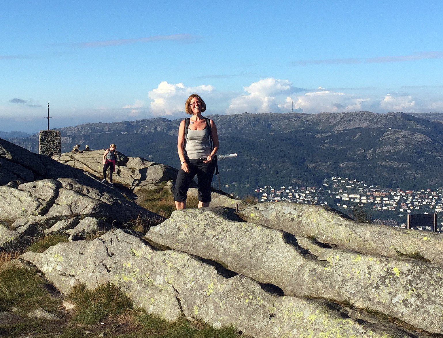 Friday, afternoon, and nice weather in Bergen---why not walking home via Løvstakken?! :-) To Puddefjordsbroen, first, then over the bridge (on the southeastern side to optimize the connection on the other side). Using the pedestrians path, bridge, and tunnel one connects to Gyldenprisveien and from there, right above where Løvstakktunnelen has its northern end, further to Frydenbølien (upwards to the west, after crossing over the tunnel). Right where Frydenbølien makes a sharp turn to the left, a simple path leads into the hillside behind the buildings. Ascending in southern direction brings one close to the new Løvstien (in particular, when one heads a bit more to the left/east, while ascending). At the upper end of this little valley, near to where Løvstien connects to Riplegården >>>
Liafjellet from Moberg
- Date:
- 14.08.2016
- Characteristic:
- Hillwalk
- Duration:
- 2:00h
- Distance:
- 4.9km
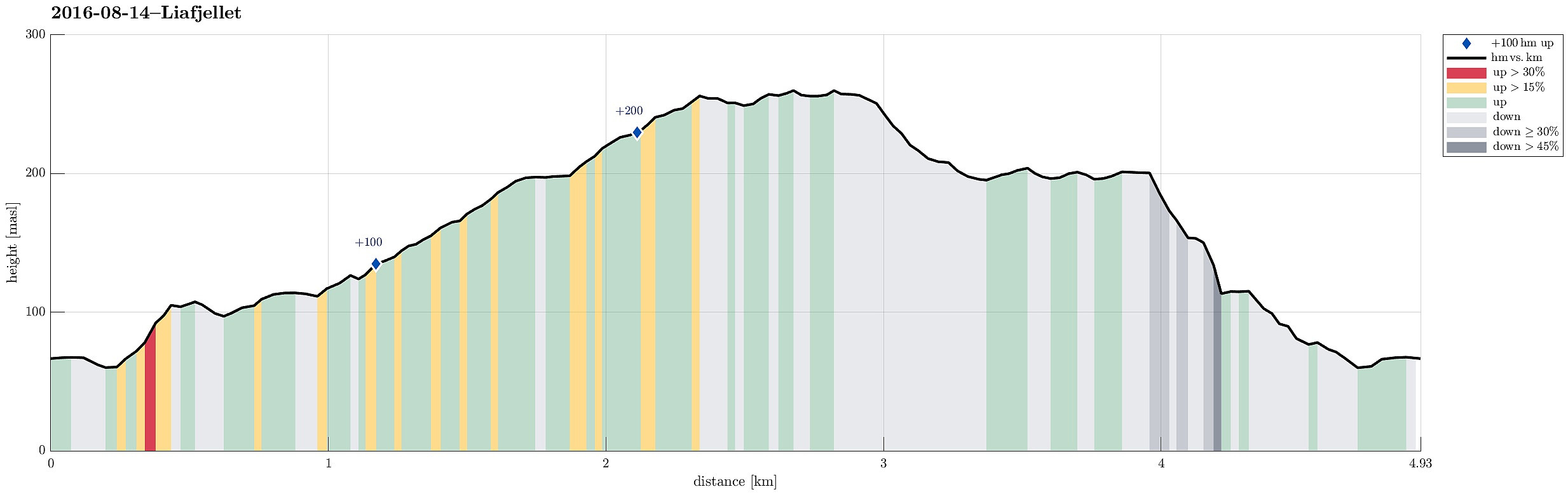 South of Bergen, we crossed Ulvenvatnet near Os on the E39 and drove off it near Os Brannstasjonen in Moberg, right after coming through Liafjellstunnelen. We parked right next to the firestation and started to walk from there. Due to some construction work there, we could not use Halhjemsvegen, where it meets Mobergsbakken. Following a substitution path (leaving Mobergsbakken between Halhjemsvegen and Olavegen), we surrounded the construction site and connected to Liafjellstunnelen. When coming there, right in the beginning of this hike, we did not understand that crossing the E39 first on the lower gravel road (and turning left doing so) leads one to another forrest road that brings one back to the top of Liafjellstunnelen. We therefore ascended Liafjellstunnelen directly, connecting >>>
