Archive - Date
Archive - Activity
-
Bike trip (137)
- Bike trip - mixed (51)
- Bike trip - road (9)
-
Other trip (1)
- Kayaking (1)
-
Other winter trip (4)
- Snowshoe trip (4)
- Ski trip (4)
- Trip by foot (740)
Archive - Geography
Peakbook-Friends


Collected lists
-
Bergen ≥ 50m pf. og ≥ 100 m.o.h.
(87/89)
 97%
97% -
Most dominating tops of the Bergen peninsula
(68/75)
90%
-
Utvalgte topper og turmål i Bergen
(316/352)
89%
-
Alle topper i Bergen
(357/400)
89%
-
Opptur Bergen
(100/113)
88%
-
De syv fjell rundt Bergen
(6/7)
85%
-
Sund ≥ 50m pf.
(14/18)
77%
-
Os ≥ 50m pf.
(25/34)
73%
-
Søyler (fastmerker) i Bergen
(68/100)
68%
-
Fjell ≥ 50m pf.
(21/32)
65%

Møsnuken
- Date:
- 17.04.2016
- Characteristic:
- Hillwalk
- Duration:
- 5:00h
- Distance:
- 11.8km
 We took road E39 southwards from Bergen, passing by Kalandsvatnet and driving all the way to Ulven (near Os), where we turned left (right next to a gas station), finding the small road connecting to Tyssdal. On the other side of Oselva, near the point, where Tyssdalselva is coming down from Møsnuken, we found a parking place and started to hike from there. Since we wished to start with Borgafjellet, this time, we first tried to connect to the gravel road that connects Tyssdal with Os (right next to Oselva, on its eastern side). We could have done this "the easy way" :-) -- instead, we walked up to the houses on the hillside south of Tyssdal. Up there, we understood that we were too high and descended the few meters down to the gravel road through the forest. Following the gravel >>>
Tveitafjellet
- Date:
- 16.04.2016
- Characteristic:
- Hillwalk
- Duration:
- 2:00h
- Distance:
- 6.3km
 We were driving to Osterøy near Bergen and on Osterøy further, first to Lonevåg and then to Hosanger. There, we turned right (into the direction of Kossdalen, actually!), but continued a small road upwards on the Eastern side of the valley until we came to the junction, where one road continues to the left (up to Åsheim) and the other goes to the right (up to Tveiten). From there, we started hiking, first following the road up to Åsheim. The path up to Åsheimveten leaves from the road to the right (near the houses of Åsheim)---it's good to not follow the temptation of hiking along the path to Tveitafjellet, which is well marked a little underneath the houses. Once on the right path, it's quick and straight-forward to hike up Åsheimveten, which offers fantastic views of Osterfjorden >>>
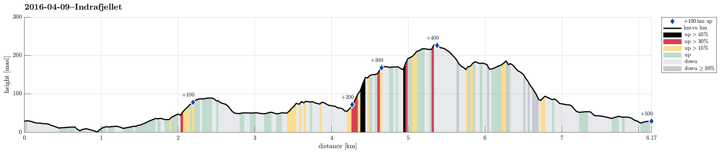
Indrafjellet from Liaskjæret
- Date:
- 09.04.2016
- Characteristic:
- Hillwalk
- Duration:
- 3:30h
- Distance:
- 8.2km
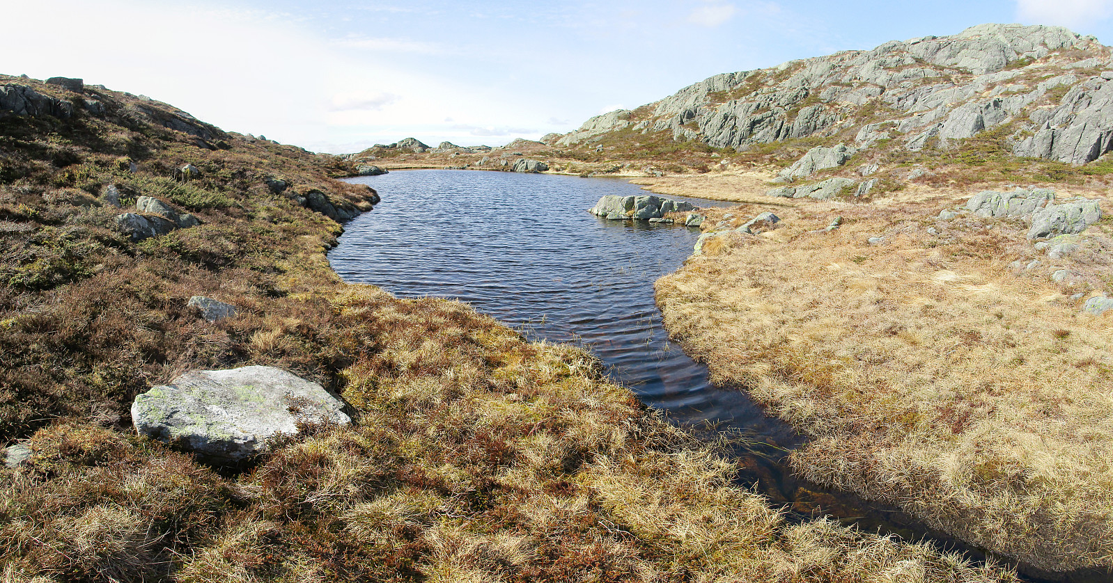
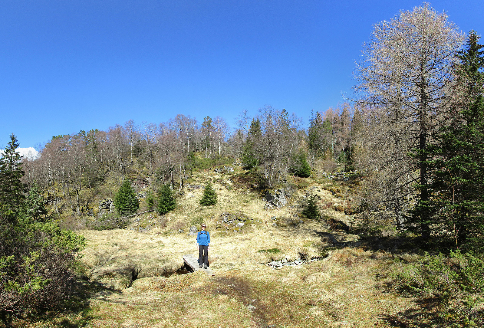
 We drove from Bergen to Sotra, turning left before entering the tunnel and driving south to Liaskjæret on the eastside of the island. We parked near Liaskjervegen 182, i.e., very close to the point at the street, where the bus turns around. We followed the street southwards, basically to its end---very near to a small harbor for private boats. We went around the last houses and came soon to a small bay (called Nordra Skagavika). From there, we followed a very simple path that leads up to a small lake (Røssevikvatnet). We continued on the western side of this small lake, approaching Hansafjellet. It's straight-forward to hike there, even though we could not see any paths (occasionally, it's wet, yes). It was good to change over to Hansafjellet on its northern end---ascending to this >>>
