Archiv - Nach Datum
Archiv - Nach Aktivität
-
Andere Tour (1)
- Kayaking (1)
-
Andere Wintertour (4)
- Schneeschuhtour (4)
-
Fahrradtour (137)
- Fahrradtour Straße (9)
- Fahrradtour gemischt (51)
-
Fußtour (740)
- Bergtour (363)
- Jogging (18)
- Spaziergang (89)
- Wanderung (270)
-
Skitour (4)
- Tourenskilauf (4)
Archiv - Nach Geografie
Peakbookfreunde


Gesammelte Listen
-
Bergen ≥ 50m pf. og ≥ 100 m.o.h.
(87/89)
 97%
97% -
Most dominating tops of the Bergen peninsula
(68/75)
90%
-
Utvalgte topper og turmål i Bergen
(316/350)
90%
-
Alle topper i Bergen
(357/398)
89%
-
Opptur Bergen
(100/113)
88%
-
De syv fjell rundt Bergen
(6/7)
85%
-
Sund ≥ 50m pf.
(14/18)
77%
-
Os ≥ 50m pf.
(25/34)
73%
-
Søyler (fastmerker) i Bergen
(68/100)
68%
-
Fjell ≥ 50m pf.
(21/32)
65%

Skiing Livarden
- Datum:
- 28.02.2016
- Tourcharakter:
- Tourenskilauf
- Tourlänge:
- 3:15h
- Entfernung:
- 10,8km
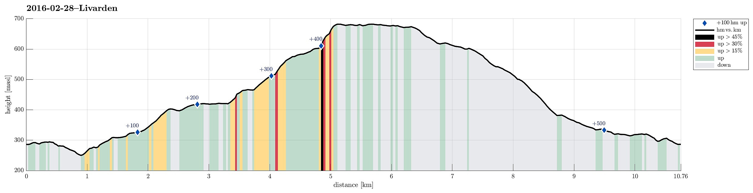 We parked near Fanahytten, went a few steps, passing Fanahytten, before we crossed over to the other side (Totlandsfjellet), walking down the road for a few meters. Parallel to Totlandsvegen as well as Totlandsfjellet, we ascended in the direction of Livarden, following a track that others had used before us (not too many, but some). Instead of skiing on the top of Totlandsfjellet, we proceeded below it, somehow on middle-height between the valley and the mountain ridge. At the point, where we switched over from Totlandsfjellet to Livarden, basically, we ascended through a narrow, little valley, called Gråsmoget. From there, we followed the track, ascending step by step to the height of Livarden. Particularly this stretch, from Gråsmoget up to the top of Livarden, was especially nice---winter >>>
Around Jordalen
- Datum:
- 13.02.2016
- Tourcharakter:
- Bergtour
- Tourlänge:
- 6:45h
- Entfernung:
- 19,4km
 Having delivered our son in Tertnes, we parked very near at Storbotn (where Den Trondhjemske Postvegen comes by). We walked first along Den Trondhjemske Postvegen towards northeast, before we departed to the left and up Eikhøyen (and from there to the top of Rollandsoksen---not really a big hill, but with a nice view over Tertnes!). From there, we hiked down to Kolåsen, from where we took Rollandsvegen up to where a path leaves, leading to the southeast. We ascended to the saddle (near Steindalen), right below Litlanipa, from there. Instead of following the main route (via Stornipa and Nukane to Storsåta), we crossed the saddle to the other side, descending into Traudalen. Near two masts of the power line which runs through this valley, we crossed Nedgardselva and continued (along the >>>
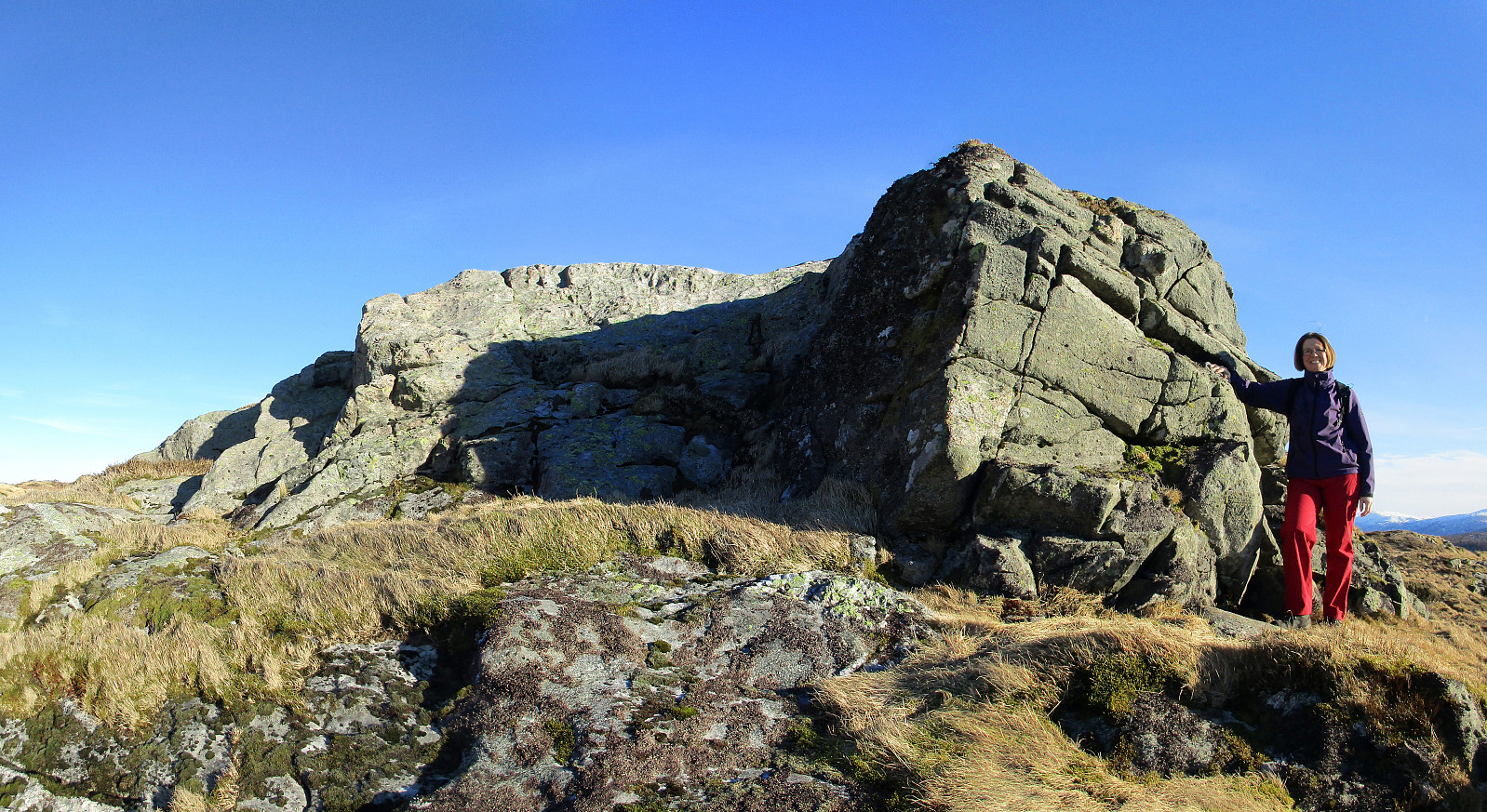
Around Toppe via Toppenipa and Geitanuken
- Datum:
- 06.02.2016
- Tourcharakter:
- Bergtour
- Tourlänge:
- 2:15h
- Entfernung:
- 6,7km
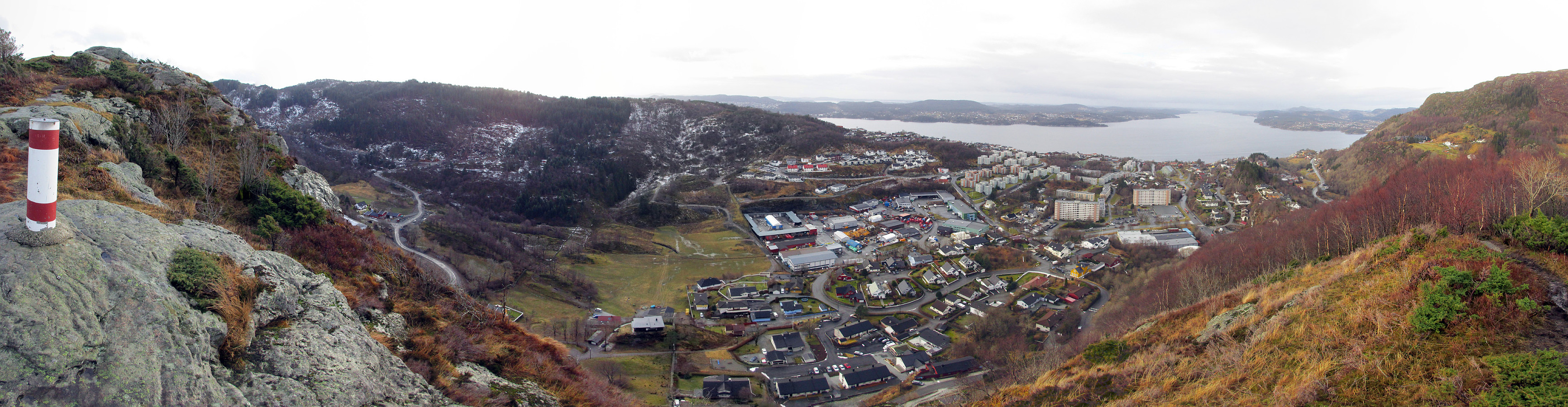 We took the road that leads from Åsane to Salhus and turned left towards Toppe shortly before coming near to Salhus (near Hitland) and passed through a short tunnel right afterwards. Next, we turned left and parked near a commercial area in the middle of Nordre Toppe. From there, we first walked along Toppevegen in northeastern direction until we ended up right above the tunnel that we had taken before (we could have taken a small side-road already earlier, leading directly to the trail head above, but we thought that it only connected to a private house there). Instead we ascended over some green from right above the tunnel and found the trail head also this way, easily. Then we continued upwards towards the top of Toppenipa, following a very nice path that leads upwards steeply. On >>>
