Archive - Date
Archive - Activity
-
Bike trip (137)
- Bike trip - mixed (51)
- Bike trip - road (9)
-
Other trip (1)
- Kayaking (1)
-
Other winter trip (4)
- Snowshoe trip (4)
- Ski trip (4)
- Trip by foot (740)
Archive - Geography
Peakbook-Friends


Collected lists
-
Bergen ≥ 50m pf. og ≥ 100 m.o.h.
(87/89)
 97%
97% -
Most dominating tops of the Bergen peninsula
(68/75)
90%
-
Utvalgte topper og turmål i Bergen
(316/352)
89%
-
Alle topper i Bergen
(357/400)
89%
-
Opptur Bergen
(100/113)
88%
-
De syv fjell rundt Bergen
(6/7)
85%
-
Sund ≥ 50m pf.
(14/18)
77%
-
Os ≥ 50m pf.
(25/34)
73%
-
Søyler (fastmerker) i Bergen
(68/100)
68%
-
Fjell ≥ 50m pf.
(21/32)
65%

Viggohytten from Spelhaugen
- Date:
- 22.02.2015
- Characteristic:
- Hillwalk
- Duration:
- 1:30h
- Distance:
- 5.1km
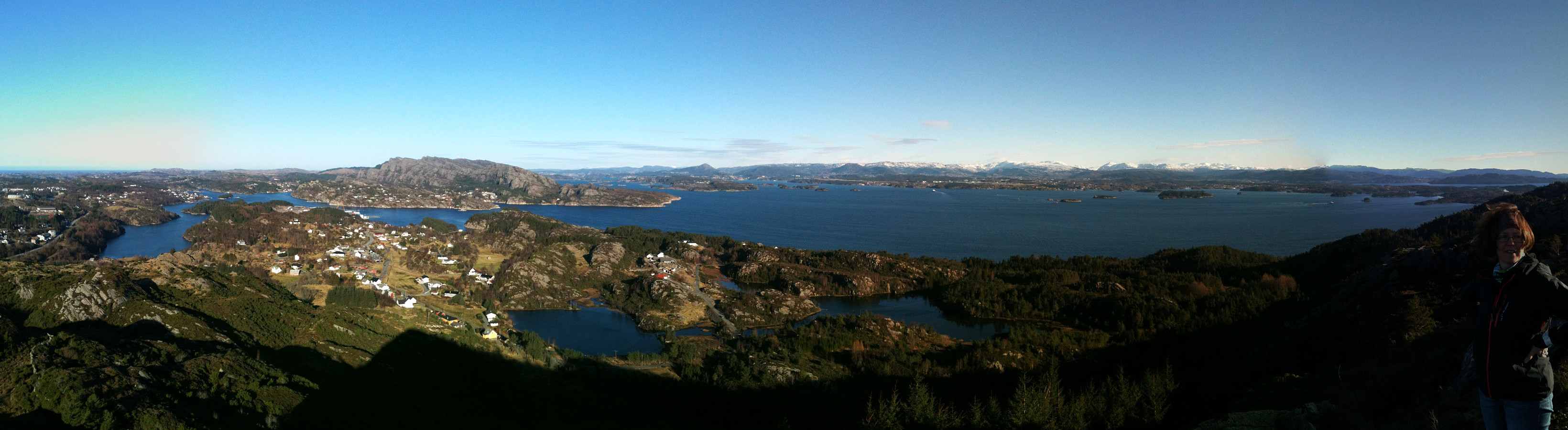
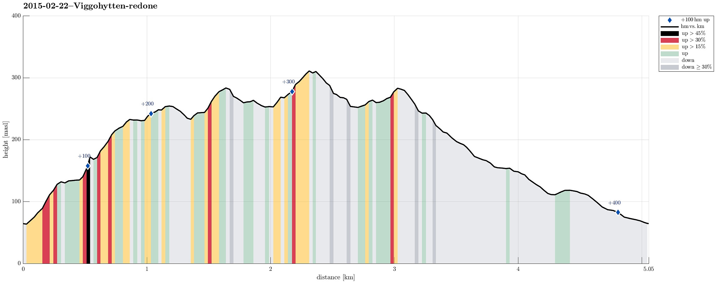 Starting from the parking lot at the end of Spelhaugen, we ascended right to Eikelifjellet (with the interesting, large rock on the top!). From there, with some up and down, we continued towards Viggohytten (or so -- the cabin itself does no longer exist, after it burned to the ground, recently!). Then, we basically returned on the same path, but before we came back to Eikelifjellet, we descended towards a forest road above Tennebekkvatnet, leading us back to the parking lot.
Sangoltshornet
- Date:
- 15.02.2015
- Characteristic:
- Hillwalk
- Duration:
- 1:30h
- Distance:
- 4.0km
 We started right next to Sangoltvatnet and quickly found a path that led us up to Sangoltshornet. This really is no difficult, nor demanding hike. Still, one can enjoy nice views, for example, over Raunefjorden. From Sangoltshornet, we then continued -- without path, mostly -- in a south-easterly direction, passing over three, four additional, minor heights. Eventually, we decended -- also without any path (not 100% recommended) in direction NE (basically towards Sangoltvatnet). Once back down, however, we completed a slightly larger round, including a place near the coast with name Sangolthella / Helleskaget. All in all, the hike was refreshing in nice winter weather! :-)
Petter Bjørstad has a useful page about Sangoltshornet .
Web page UT.no from the Norwegian Trekking Association recommends another hike up and down Sangoltshornet (also via Mannen).
We started right next to Sangoltvatnet and quickly found a path that led us up to Sangoltshornet. This really is no difficult, nor demanding hike. Still, one can enjoy nice views, for example, over Raunefjorden. From Sangoltshornet, we then continued -- without path, mostly -- in a south-easterly direction, passing over three, four additional, minor heights. Eventually, we decended -- also without any path (not 100% recommended) in direction NE (basically towards Sangoltvatnet). Once back down, however, we completed a slightly larger round, including a place near the coast with name Sangolthella / Helleskaget. All in all, the hike was refreshing in nice winter weather! :-)
Petter Bjørstad has a useful page about Sangoltshornet .
Web page UT.no from the Norwegian Trekking Association recommends another hike up and down Sangoltshornet (also via Mannen).
