Archive - Date
Archive - Activity
-
Bike trip (137)
- Bike trip - mixed (51)
- Bike trip - road (9)
-
Other trip (1)
- Kayaking (1)
-
Other winter trip (4)
- Snowshoe trip (4)
- Ski trip (4)
- Trip by foot (740)
Archive - Geography
Peakbook-Friends


Collected lists
-
Bergen ≥ 50m pf. og ≥ 100 m.o.h.
(87/89)
 97%
97% -
Most dominating tops of the Bergen peninsula
(68/75)
90%
-
Utvalgte topper og turmål i Bergen
(316/352)
89%
-
Alle topper i Bergen
(357/400)
89%
-
Opptur Bergen
(100/113)
88%
-
De syv fjell rundt Bergen
(6/7)
85%
-
Sund ≥ 50m pf.
(14/18)
77%
-
Os ≥ 50m pf.
(25/34)
73%
-
Søyler (fastmerker) i Bergen
(68/100)
68%
-
Fjell ≥ 50m pf.
(21/32)
65%

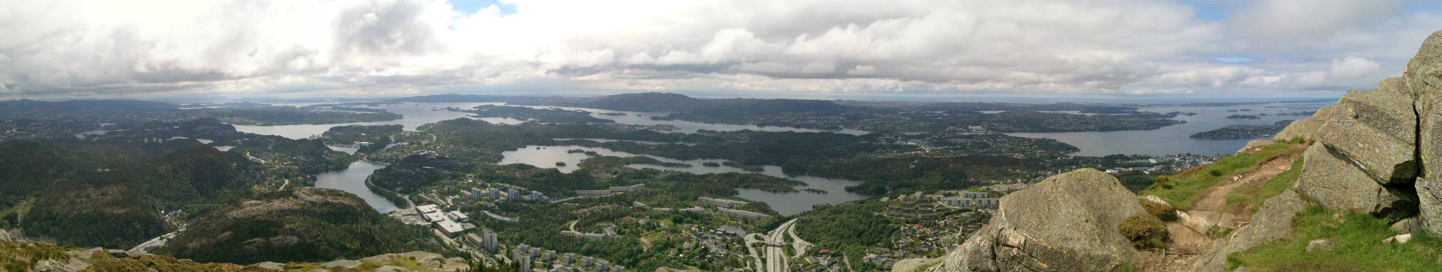
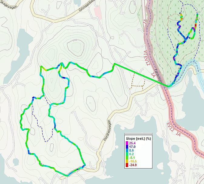
Gullfjellet
- Date:
- 09.06.2013
- Characteristic:
- Hillwalk
- Duration:
- 4:30h
- Distance:
- 13.8km
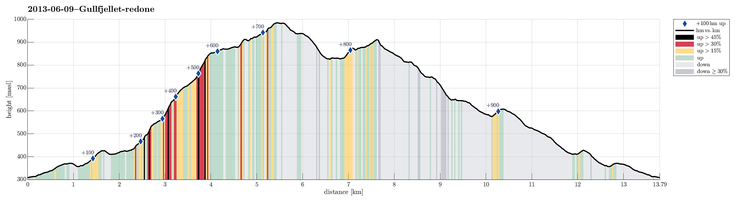 Great hike from Osavatnet (315m) to Gullfjelltoppen (987m) with the boys and then down, again, via Redningshytten. The ascent via Ronamanen (leaving the main track, which would connect to Redningshytten from Osacatnet, a few meters above Svartavatnet to the left, then along Småhaugane and up the ridge, passing Markskilfossen) is really a good alternative to the main "Autobahn" up Gullfjellet! :-)
Lyderhorn
- Date:
- 08.06.2013
- Characteristic:
- Hillwalk
 Quick and rewarding hike up and down Lyderhorn (from Kjøkkelvik skole) -- not the "main" route, but right north of it, quite steeply (the starting point if behind the higher buildings up in Olderdalen).
Web page WestCoastPeaks.com provides useful information about Lyderhorn and Ørnafjellet
and also Petter Bjørstad has a page about Lyderhorn .
Quick and rewarding hike up and down Lyderhorn (from Kjøkkelvik skole) -- not the "main" route, but right north of it, quite steeply (the starting point if behind the higher buildings up in Olderdalen).
Web page WestCoastPeaks.com provides useful information about Lyderhorn and Ørnafjellet
and also Petter Bjørstad has a page about Lyderhorn .
Jogging in Hordnesskogen and then up Stendafjellet
- Date:
- 01.06.2013
- Characteristic:
- Jogging
- Duration:
- 1:30h
- Distance:
- 13.2km
 Jogging in Hordnesskogen and then up Stendafjellet -- not the shortest run! :-)
