Traunstein (08.08.2014)

| Startpunkt | Gmunden (450m) |
|---|---|
| Endpunkt | Gmunden (450m) |
| Tourcharakter | Bergtour |
| Tourlänge | 6h 00min |
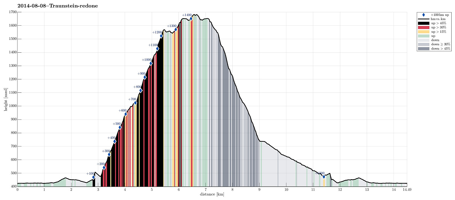
| Entfernung | 14,5km |
| Höhenmeter | 1.584m |
| GPS |
|
| Besteigungen | Traunstein (1.691m) | 08.08.2014 |
|---|---|---|
| Besuche anderer PBE | Gmundner Hütte (1.660m) | 08.08.2014 |
| Traunsteinhaus (1.575m) | 08.08.2014 |
Trip Summary
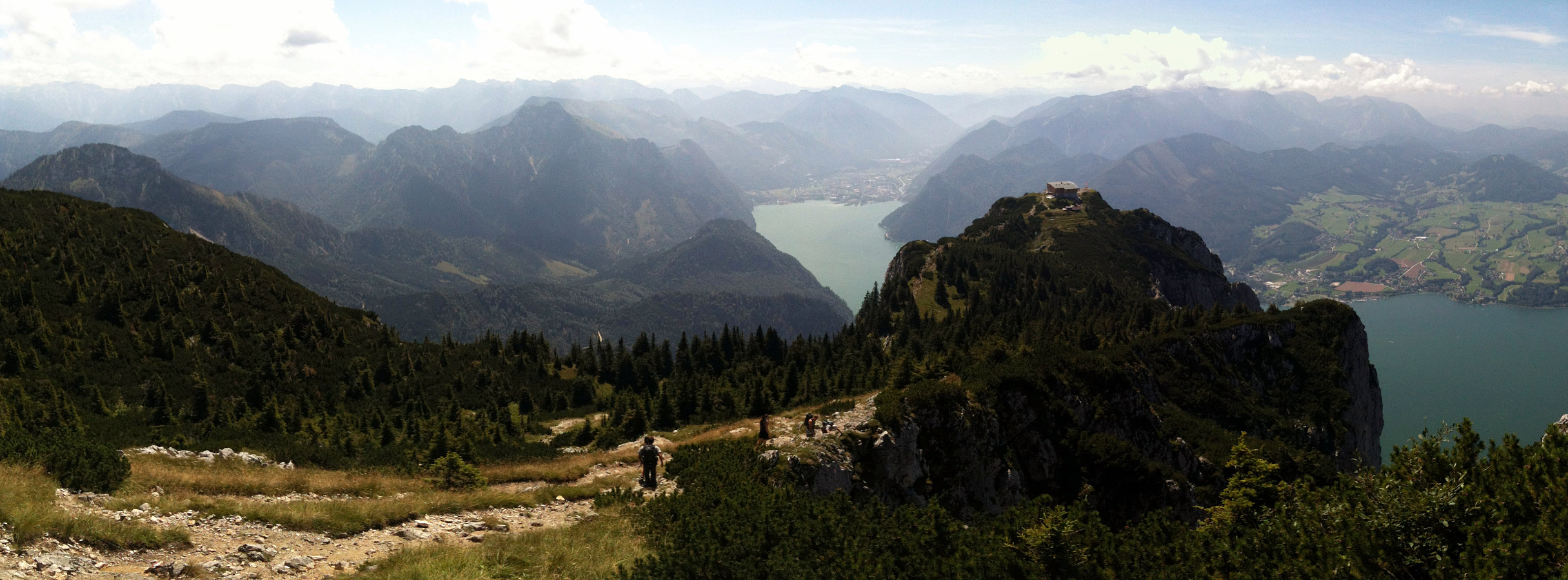
Starting from Traunsee (~450m, southeast from Gmunden), up the Naturfreundesteig (climbing trail, category A/B), we first reached Traunsteinhaus (1575m, still quite new after a recent upgrading). It took a bit more than 2 hours, but easily this could be more, depending on the climbing conditions -- it's more than 1000m up a substantially steep climbing path! Then, we connected to Gmundner Hütte (1660m), another impressive house on top of this prominent mountain! The actual top, Traunstein (1691m) is then quite near and easy to reach. Down we took the trail towards Mair Alm, which is very steep, but good to go. All in all, including an extended break on Gmundner Hütte, this was about 6+ hours of hiking. Very rewarding!
Photos
Selected photos are available as Google photo album.

Benutzerkommentare