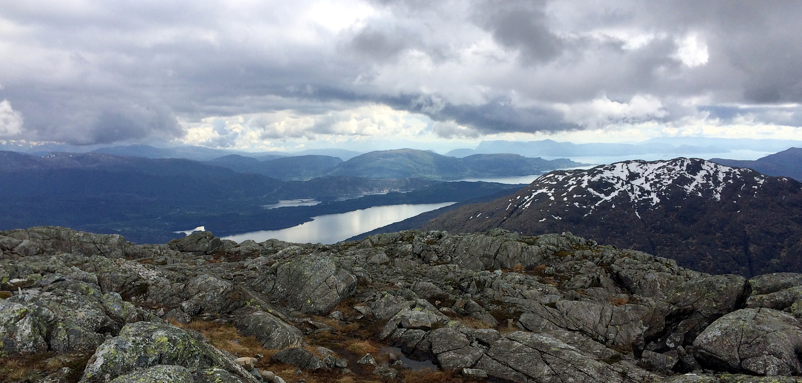
Sydpolen (24.05.2014)

| Start point | Parking place at the end of Haugsdalen (95m) |
|---|---|
| Endpoint | Parking place at the end of Haugsdalen (95m) |
| Characteristic | Hillwalk |
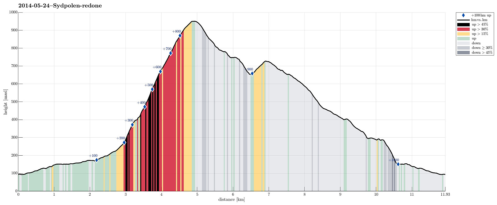
| Duration | 4h 00min |
| Distance | 11.9km |
| Vertical meters | 1,014m |
| GPS |
|
| Ascents | Sydpolen (952m) | 24.05.2014 |
|---|---|---|
| Toro (733m) | 24.05.2014 | |
| Visits of other PBEs | Hausdalen parkering (94m) | 24.05.2014 |
Note that this track has been created a posteriori, i.e., from memory, not automatically recorded.
Trip Summary
Sydpolen from Brekkjedalen is again and again a very nice tour!
Useful Resources
Web page WestCoastPeaks.com provides useful information about S. Gullfjellstoppen (Sydpolen)
and also Petter Bjørstad has a useful page about Sydpolen.

User comments