Round around Fyllingsdalen (03.04.2026)

| Start point | Varden (45m) |
|---|---|
| Endpoint | Varden (45m) |
| Characteristic | Bike trip - mixed |
| Duration | 4h 00min |
| Distance | 27.5km |
| Vertical meters | 746m |
| GPS |
|
| Visits of other PBEs | Hetlevikstraumen bro (3m) | 03.04.2026 |
|---|---|---|
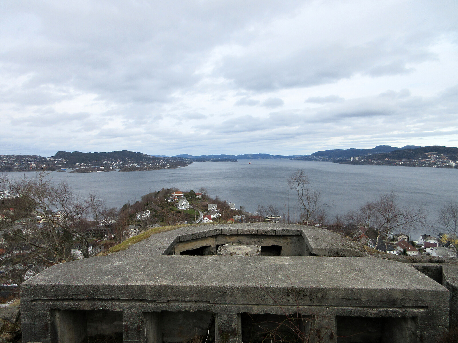
| Laksevåg fort - Noven (110m) | 03.04.2026 | |
| Parkering for Lyderhorn fra østsiden (30m) | 03.04.2026 | |
| Solheim søyle (27m) | 03.04.2026 | |
| Vågedalen barnehage (54m) | 03.04.2026 |

Trip Summary
With a prediction of rain in the early afternoon, we decided to just cycle a little (towards Bergen and back), instead of aiming for a mountain top. First, we headed northwards along Bjørgeveien. Instead of cycling directly to Bjørndalen, however, we decided to make a simple detour around Bjørndalspollen, taking advantage of the little bridge at Hetlevikstraumen. At Loddefjord, we turned right and continued towards Laksevåg on the southeasern side of Lyderhorn (along Liavatnet). In the north of Holefjellet, we then parked our bikes for a few minutes to walk up to Noven and take a look at the historic relics from WWII there. Especially in times, when war seems to become "normal" again, it's moving particularly to be reminded of the major catastrophy that unfolded when a four-digit number of bombs were dropped onto Holen in 1944. From Holen, we then cycled along Puddefjorden towards Småpudden. After enjoying some nice coffee there for a break, we then headed back towards Fyllingsdalen -- this time, however, around the southeast of Løvstakken. The only variation from "the normal tracks" was this time that we followed some higher streets (instead of cycling "down" in Kanalveien). Also at Fjøsanger, we decided to continue upwards (to Løvstien), instead of cycling along Straumeveien. On the other side of Øvre Kråkenes, however, we "ended up" at Straumeveien, which we followed for the last stretch along Nordåsvatnet.
Photos
Selected photos are available as Google photo album.
Useful Resources
See also the related FB-page Hiking around Bergen, Norway.

User comments