Lyderhorn via Skarpafjellet (06.12.2025)

| Startsted | Bjørndalen (35moh) |
|---|---|
| Sluttsted | Bjørndalen (35moh) |
| Turtype | Fottur |
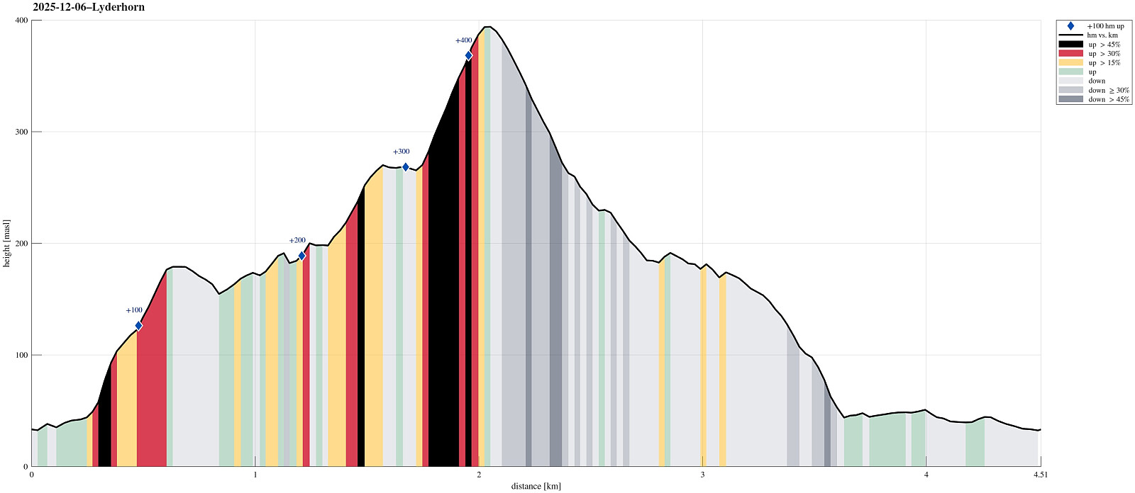
| Turlengde | 1t 30min |
| Distanse | 4,5km |
| Høydemeter | 475m |
| GPS |
|
| Bestigninger | Lyderhorn (396moh) | 06.12.2025 |
|---|---|---|
| Skarpafjellet (180moh) | 06.12.2025 | |
| Andre besøkte PBE'er | Lyderhornhytten (lokalitet) (396moh) | 06.12.2025 |
| Små-Lyderhorn (273moh) | 06.12.2025 |
Trip Summary
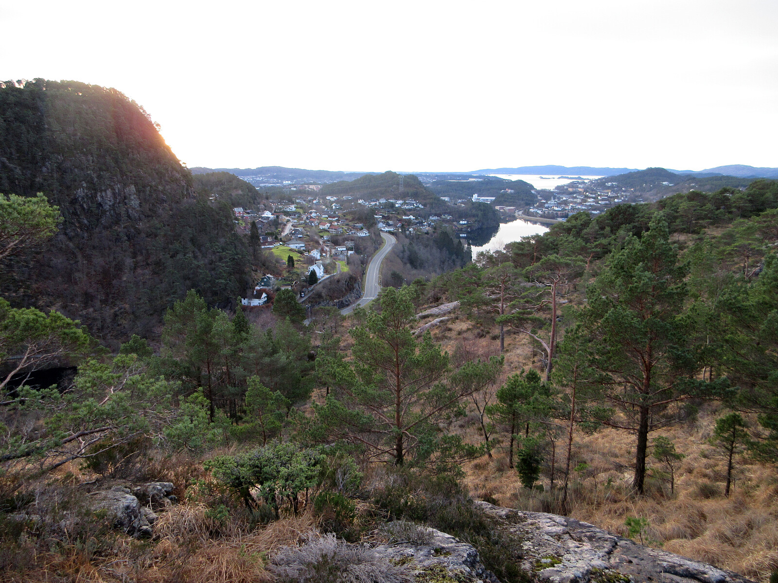
Aiming at some nice but not too long weekend hike, we decided to visit Lyderhorn (again). The plan was to ascend via Skarpafjellet in the south of Lyderhorn. We parked at Bjørndalen and tried an as direct as possible (off-trail) ascent to Skarpafjellet, first. As soon as we had left road Sildaberget (right next to Lyderhornsveien), we immediately found ourselves (not unexpectedly, though) in rather steep terrain, which required a bit of hand help to make it up between the rocks. As soon as we were up to about 90masl, however, progress became easier and rather straight-forward -- all the way to the top of Skarpafjellet. This southern flank of Skarpafjellet is actually very nice, offering some nice views over Bjørndalen and Bjørndalspollen. From Skarpafjellet, we then followed the main trail towards Lyderhorn, but chose to continue our ascent via Små-Lyderhorn, where we enjoyed some nice views (is it correct to assume that most hikers, who come up from Kjøkkelvikveien, there, disregard Små-Lyderhorn while storming towards the top of Lyderhorn?). From Små-Lyderhorn, it was then via the most used southern route up to Lyderhorn (yes, this ascent is steep, but without any problems). To get back down, again, we then followed the slight more eastwards route, which turned out to be all fine on this day (no ice, good grip). After following trails "all the way down" to the north of Skarpafjellet, again, we then decided to descend towards Lyderhornveien (in eastward direction), opposite of where it goes down into Grøvledalen in the west. All in all, a very satisfying nice hike, espcially also with this new ascent to Skarpafjellet in the beginning.
Photos
Selected photos are available as Google photo album.
Useful Resources
See also the related FB-page Hiking around Bergen, Norway.
Web page WestCoastPeaks.com provides useful information about Lyderhorn and Ørnafjellet
and also Petter Bjørstad has a page about Lyderhorn.
On Bergentopp 200 there is a page (in Norwegian) about Lyderhorn.

Kommentarer