Kubrekka from/to Sandven (23.11.2025)

| Start point | Sandven (65m) |
|---|---|
| Endpoint | Sandven (65m) |
| Characteristic | Hike |
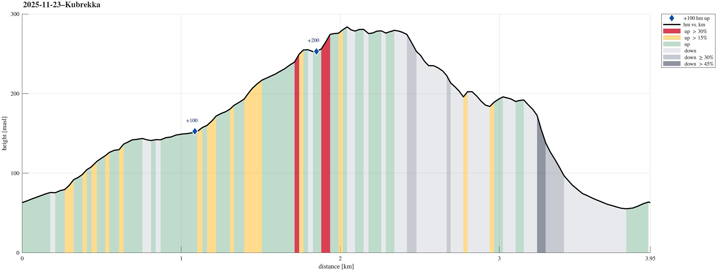
| Duration | 1h 30min |
| Distance | 3.9km |
| Vertical meters | 287m |
| GPS |
|
| Ascents | Kubrekka (286m) | 23.11.2025 |
|---|
Trip Summary
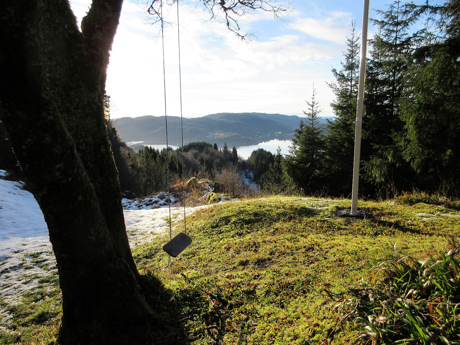
We had time for a relatively short walk but still were interested in exploring opportunities to do something new. Expecting chances for some low-standing November sun from the southwest, we thought that hiking up to Kubrekka from Sandven right next to Kalandsvatnet could be a reasonable option (yes, when "digging deeper", we read in Harald's trip report that the top had no views and is of no interest to normal hikers; but then: are we normal hikers? :-)). The main idea was to go up via Stemmedalen, then cross over Kubrekka from the northwest to the southeast, before then walking down Høgerinden in parallel to Tjørnadalen to get back to Sandven. When aiming for Stemmedalen from Osvegen, however, we faced a sign informing us that someone would not like us to proceed further towards Stemmedalen along the road that leads to house no. 250. We thus took a simple detour, passing this house in its west. After stepping up the hillside in the north of the house, we connected with another forest road and from there found a very nice trail that lead us further up the ridge (instead of getting down into Stemmedalen at once). Following this trail, we connected with Stemmedalen further north (at about 140masl). In Stemmedalen, we then followed the forest road further northwards until we found ourselves right in the west of a hill in the northwest of Kubrekka. There, we thought that it was time to leave the forest road (and any trail, for that matter) behind, aiming to cross over Kubrekka "hill by hill" as originally planned. While making progress was not difficult, really -- just involving a few slightly steeper sections for a few meters here or there --, we still can confirm that the highest point on Kubrekka is not exactly exciting (lots of tight standing trees, no views). A bit further to the southeast, we then passed by some cabins, enjoying some nice views across Kalandsvatnet and towards Fanafjorden in the distance! We then connected to Høgerinden as planned and walking down this ridge was also without any difficulties (no trail, though). A bit further down the ridge, we had the choice of either continuing via Stigadalen or trying also the ridge in the south of Litlenipen. We had seen on the map that this ridge would come with some steep section(s), but decided to give it a try nonetheless. Passing by Litlenipen (with some buildings on it) in the south, we easily made it to the ridge and first it was just nice to walk it down. At about 175masl, however, the terrain really became very steep (including some cliffs, also) and choosing a proper route downwards was essential. Luckily, we found a good way to get down (using our hands a little to help out). From just about 30 height meters further down, it then got easy again and we completed our round well satisfied (even though Kubrekka is not the most exciting hill in the area)! :-)
Photos
Selected photos are available as Google photo album.
Useful Resources
See also the related FB-page Hiking around Bergen, Norway.

User comments
... are we normal hikers? :-)
Written by hbar 09.12.2025 17:52Nope, I'm afraid that ship has sailed a long time ago for most of us. ;)