Up to the Mangart saddle, from/to Bovec (20.10.2025)

| Startpunkt | Bovec (460m) |
|---|---|
| Endpunkt | Bovec (460m) |
| Tourcharakter | Fahrradtour |
| Tourlänge | 7h 00min |
| Entfernung | 53,4km |
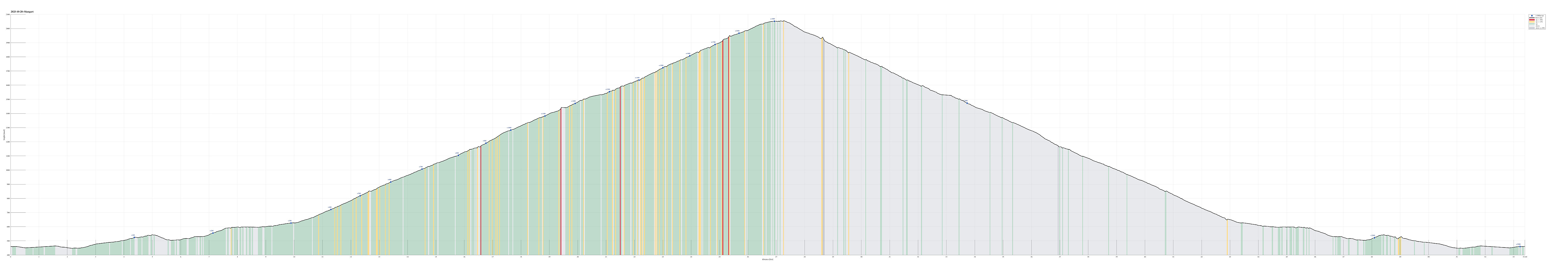
| Höhenmeter | 2.205m |
| GPS |
|
| Besuche anderer PBE | Fort Kluže (525m) | 20.10.2025 |
|---|---|---|
| Mangart saddle (2.050m) | 20.10.2025 | |
| Mangartski slap (1.080m) | 20.10.2025 |
Trip Summary
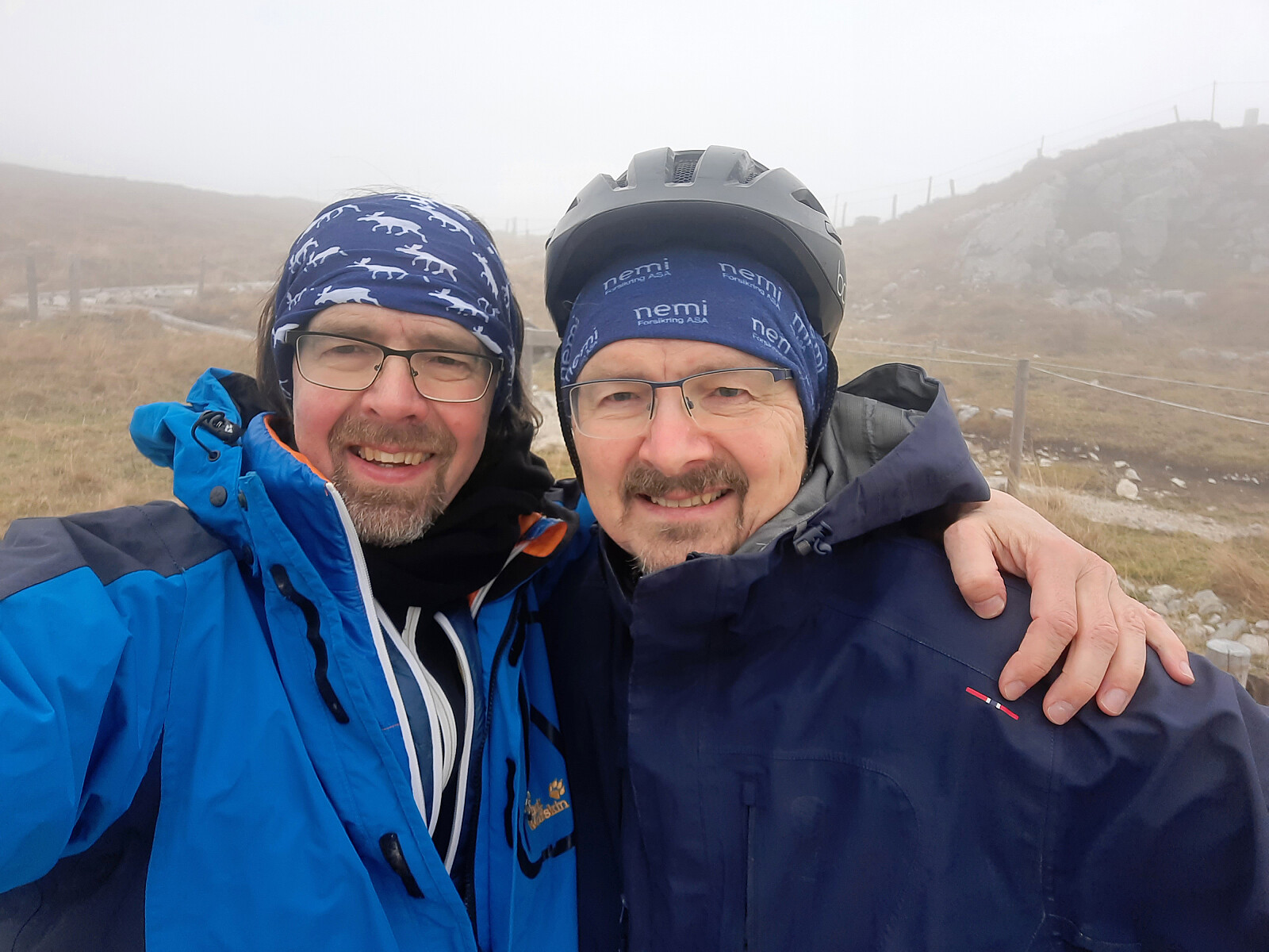
The idea for the second day of our four-days bike ride through the Julian Alps was to ascend to Mangart from Bovec and then return back to Bovec. The weather report was not 100% promising, predicting rain for the afternoon. It was very clear to us that attempting a very steep mountain road in wet and cold conditions would not be wise at all. To thus account for the weather uncertainy, we also had made a backup plan: ride up to Predel, instead, and then back to Bovec from there. We started from Bovec at around 8h30 and quickly hit the road northwards. Soon we passed the junction, where one could follow the road through the Soča valley, eventually up to Vršič, which we had come down the day before. This day, we instead continued further upwards into the Koritnica valley. A bit more than 4km into our ride, we then inspected Fort Kluže, which very prominently is placed at a place, where Koritnica is cutting through a gorge from the north. All of these memorials, reminding the visitor of gruesome battles in the not so far past, cast a grim shadow over this otherwise very beautiful region! Following Koritnica then further northwards, we quickly made it to Log pod Mangartom at about 650masl, where the valley opens up a little, given place for some agriculture. Basically from Log pod Mangartom, the steep part of this day's ride started. The first stretch, all the way up to the bridge at Mangartski slap, is the road to Predel, which win altitude steadily (and steeply) from Log pod Mangartom. About 300 height meters higher, one then finds Strmec na Predelu with only a handful of houses, being located on an outpost, high above the Koritnica valley. About 1.5km further up the road, one then crosses over a high bridge over Mangartski potok, which offers impressive views both to the northeast and to the southwest. Having arrived at the bridge, we reevaluated our plans: the original plan would let us turn right and further up to the pass at Mangart; the alternative plan would let us turn left and continue to Predel, not far away. Given that we had hopes that the weather would hold, we decided to start towards the saddle on Mangart (and turn around, should it start raining). This 12km long mountain road, up to Mangart saddle, is truly impressive, given the very steep terrain all around it. It was built, apparently, by Italian soldiers in 1938 and one does not wish to imagine under which circumstances they must have done this. The mountain has also very steep sections -- up to 22%! Furthermore, it requires several tunnels (all narrow and without any electrical light) in addition to many hairpin curves to gain enough height meters. Cycling this road up in autumn was just breath-taking (both literally and metaphorically). Especially all the different autumn colors throughout the different altitude stretches were wonderful to look at! Slowly, but steadily, we made height meter after height meter (and it did not start to rain). Eventually, we indeed made it all the way up to the saddle -- wow! :-) While we did not have good enough weather to see the top of Mangart, hidden in thick clouds instead, we still enjoyed nice views (mostly downwards). On the highest point, however, at the saddle, we faced an ice-cold storm, blowing the low-hanging clouds over the saddle with fierce strength. This meant that we did not stay on the saddle for any prolonged time. Instead, we quickly dressed up (basically all the clothes that we had brought along) and then started our descent, following the same road down that we had come up. Down, of course, was much faster (even though we made serious efforts to descend carefully), and not much over one hour, after leaving the saddle at Mangart, we were back in Bovec. Altogether, this day really was very impressive -- both for our souls as well as for our legs! :-)
Photos
Selected photos are available as Google photo album.
Useful Resources
See also the related FB-page Hiking around Bergen, Norway.
See also another page about this four-(five-)days bike trip.

Benutzerkommentare