Lysehornet from Kismulvegen (07.09.2025)

| Startpunkt | Kismulvegen (55m) |
|---|---|
| Endpunkt | Kismulvegen (55m) |
| Tourcharakter | Bergtour |
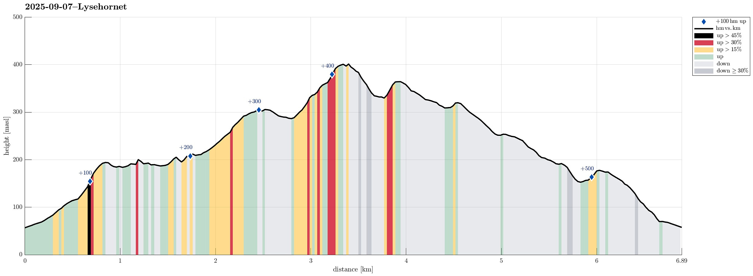
| Tourlänge | 4h 00min |
| Entfernung | 6,9km |
| Höhenmeter | 519m |
| GPS |
|
| Besteigungen | Hovåsen (197m) | 07.09.2025 |
|---|---|---|
| Hovåsen Sør (207m) | 07.09.2025 | |
| Lyshornet (405m) | 07.09.2025 | |
| Vetla Lyshornet (366m) | 07.09.2025 | |
| Nordre Gamletjørnhaugen (181m) | 07.09.2025 | |
| Vardahaugane (309m) | 07.09.2025 |
Trip Summary
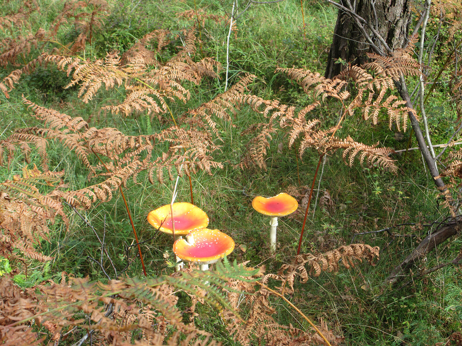
We had the idea to hike Lysehornet from the northeast (from Kismulvegen) and thus drove via Fana to Kalandsvatnet. Near house #47 along Kismulvegen, we parked -- not without an interaction with a man, who made it explicit that he'd wish us to park in Bygarasjen instead. We then started our hike into southwestern direction, first following a side-part of Kismulvegen up and towards Lindedalen. At large, the plan was to get to Lysehornet without a trail, while then taking a trail back down. After passing the upper houses (and quite a bit of rusting garbage of small to large sizes), we eventually made into the forest of Lindedalen. The first high point to reach was Hovåsen and the ascent from the northeast was a bit steep (but well doable). From Hovåsen, the plan was to hike around the shooting range at Kolhushaugen. Directly in the east of the shooting range, we crossed over a rather particular hill with steep sides in the north and south. Instead of scaling those steep sides, one can choose an easier route in the east of the hill. Walking further around the shooting range, then in its southeast, we approached a nice little stream that jumps down in northerly direction. Crossing over this stream, we made it up to a small ridge that then brought us further to the west (while passing right under the power line there). The next goal was to make it up to Vardahaugane from the north and indeed doing this was rather straight-forward. Once near the heights of Vardahaugane, we also enjoyed some nice views towards the north, the east, and also the west. From Vardahaugane, the plan was to cross over to Lysehornet. Our map study at home had not fully revealed whether stepping up rather directly from the north would be possible (Lysehornet indeed has some impressive cliffs on its northern side). In the west of Blomlitjørna, however, we found a nice ramp that enabled us to conveniently get around some cliffs there and up "to the next level". Once that was achieved, continuing all the way to Lysehornet was not a big deal anymore. Near the very top of Lysehornet, vegetation became a bit dense at times, but we found our way around/through. At Lysehornet, we then enjoyed a nice little break, also seeing two eagles right above us -- wow! Next, we then took the trail towards the east and down into Lyshornskaret. From there, we then followed another trail over to Vetle Lysehornet. Continuing along the trail, after passing over the top of Vetle Lysehornet, we then made rather quick progress on our way back to Kismulvegen. The trail is well marked (with yellow markers) all the way and thus easy to find. After stepping over Nordre Gamletjørnhaugen, we then descended towards Kismulvegen from the south. All in all, we returned nicely satisfied with this excursion. The choice of first going off-trail up to Lysehornet and then back down on a nice trail appeared to us as a good one! :-)
Photos
Selected photos are available as Google photo album.
Useful Resources
See also the related FB-page Hiking around Bergen, Norway.
Petter Bjørstad has a useful page about Lysehornet and also web page WestCoastPeaks.com provides useful information about Lysehornet.

Benutzerkommentare