Ulriken via Ulrikseggen (23.02.2025)

| Startsted | Haukeland (45moh) |
|---|---|
| Sluttsted | Michael Krohns gate (10moh) |
| Turtype | Fottur |
| Turlengde | 3t 30min |
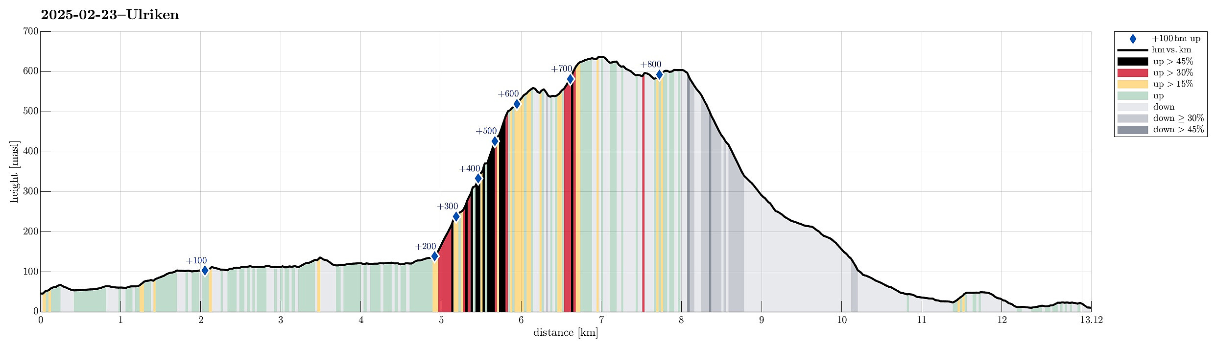
| Distanse | 13,1km |
| Høydemeter | 875m |
| GPS |
|
| Bestigninger | Lægdetjerntoppen (601moh) | 23.02.2025 |
|---|---|---|
| Ulriken (643moh) | 23.02.2025 | |
| Ulriken Vest (607moh) | 23.02.2025 | |
| Andre besøkte PBE'er | Fort Williams (ruin), Ulriken (635moh) | 23.02.2025 |
| Lappen p-plass (60moh) | 23.02.2025 | |
| Ravnegrind (228moh) | 23.02.2025 | |
| Solhaugen søyle (107moh) | 23.02.2025 | |
| Ulriksbanen (99moh) | 23.02.2025 |
Note that this track has been created from memory, i.e., it was not recorded automatically.
Trip Summary
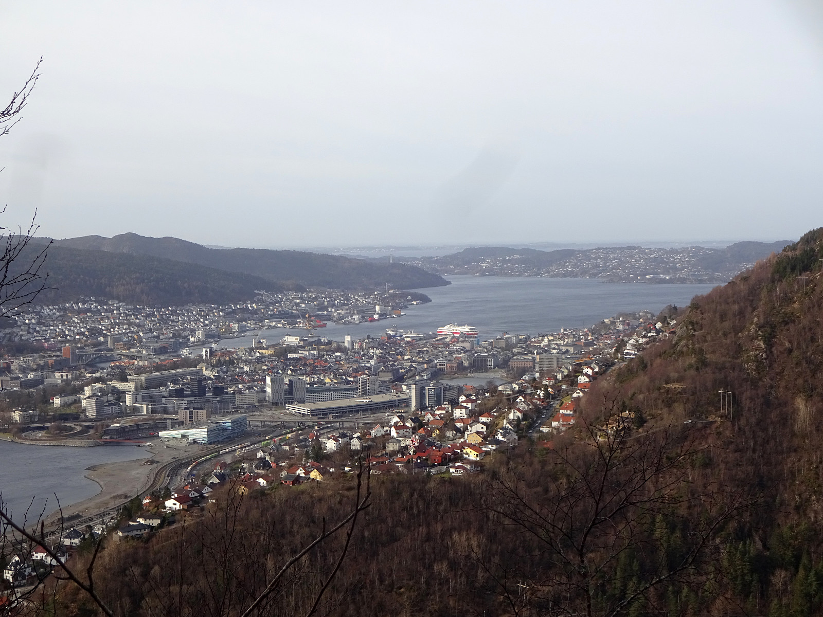
We started near Haukeland hospital in Bergen and first walked around Svartediket to get to the trail head north of Ulrikseggen. While ascending the ridge, we repeatedly enjoyed the amazing vierws across Svartediket and towards Bergen! Once on the heights of Ulriken, the hiking party split into two with one part including the actual top of Ulriken, also (via Ulriksskaret). At the upper end of Ulriksbanen, we refreshed ourselves a little, before walking down the Sherpa trail. Clearly, stepping up to Ulriken via Ulrikseggen is one of the nicer variants up! :-)
Photos
Selected photos are available as Google photo album.
Useful Resources
See also the related FB-page Hiking around Bergen, Norway.

Kommentarer