Kongsberg north of Ulvik (04.08.2024)

| Startpunkt | Espelandsvegen (250m) |
|---|---|
| Endpunkt | Espelandsvegen (250m) |
| Tourcharakter | Wanderung |
| Tourlänge | 4h 00min |
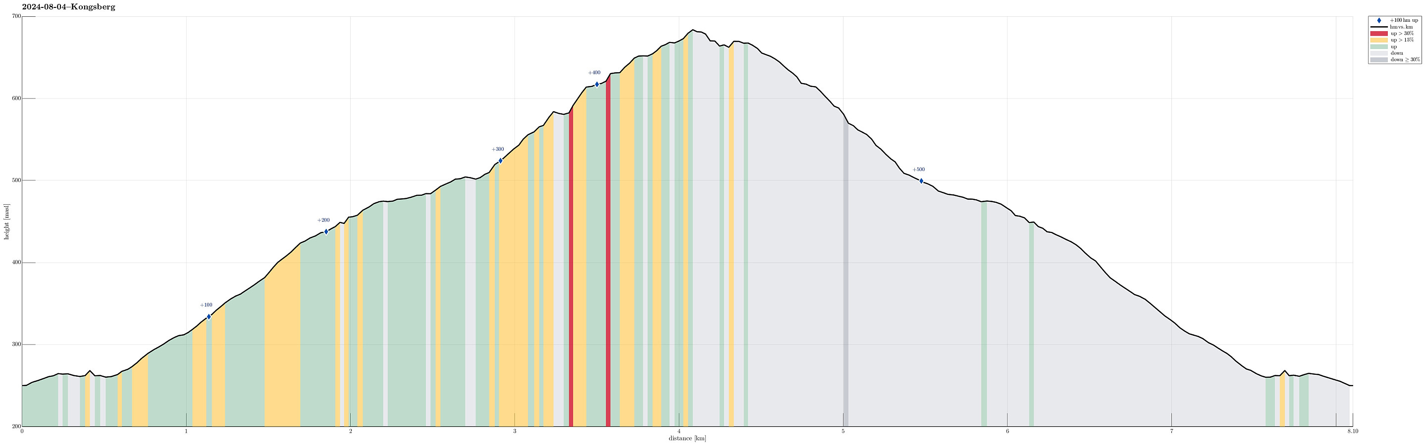
| Entfernung | 8,1km |
| Höhenmeter | 527m |
| GPS |
|
| Besteigungen | Kongsberg (685m) | 04.08.2024 |
|---|---|---|
| Besuche anderer PBE | Kongsberg utsiktspunkt (670m) | 04.08.2024 |
Trip Summary
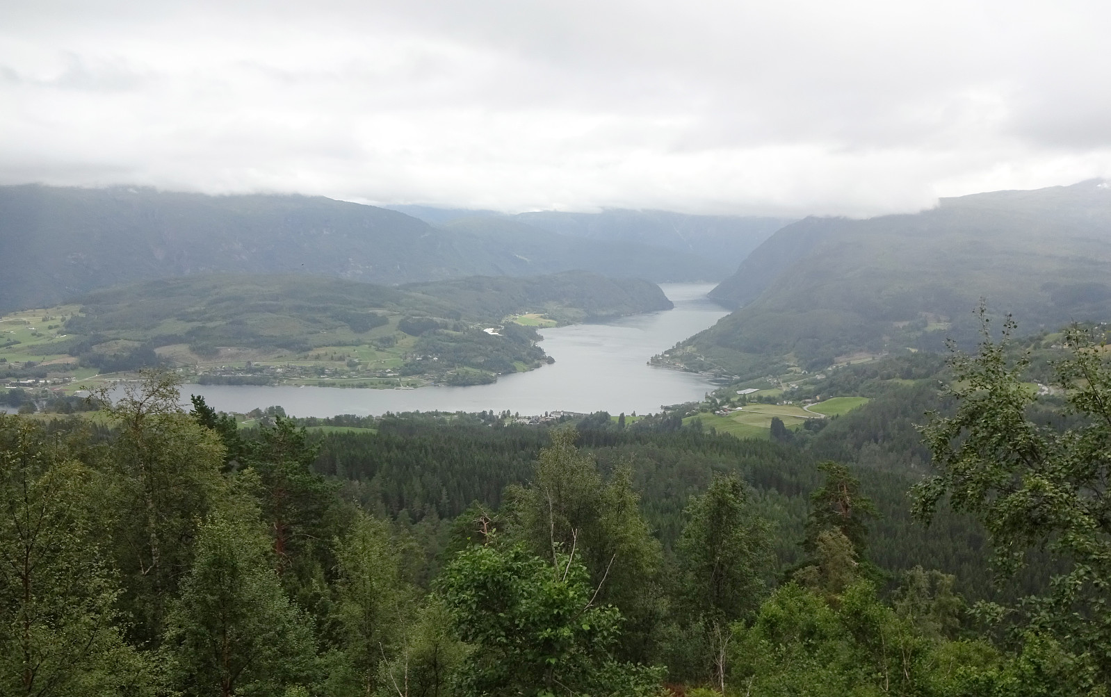
With relatively low-hanging clouds, we aimed at a simple hike that would remain beneath the clouds, but still offer some nice views, hopefully. After some consideration, we thought that hiking up to Kongsberg near Ulvik could be a good solution. We took the road up from Ulvik to Aurdal and parked right next to the road right after passing over Verafossen. From there, we then followed a forest road that lead initially into Seljestidalen, before then winding up towards Klyvhals on the southeastern side of this valley. South of Røyneskor, this forest road leads then westwards (to Vestrheimskleppe). There, one eventually gets to see over the treetops further below and down to Ulvikafjorden. To continue further upwards to Kongsberg it is then mostly to just follow the forest road further. Eventually, this brings one up to a rather wet area near the top of Kongsberg. There, it's first not fully obvious, which of the hilltops actually are the highest, but then finding out was/is neither difficult. If one wishes to avoid stepping over a fence that stretching across there, one can walk "all the way" along the fence towards the southeast -- there, a gate can be used to conveniently get to the other side. After exploring the top(s) of Kongsberg a little (not exactly below the clouds, but almost), we then basically walked down more or less the same forest road that we earlier had taken up.
Photos
Selected photos are available as Google photo album.
Useful Resources
See also the related FB-page Hiking around Bergen, Norway.
Web page WestCoastPeaks.com provides useful information about Kongsberg.

Benutzerkommentare