Hisdalen from Rød (14.01.2023)

| Startsted | Rød (50moh) |
|---|---|
| Sluttsted | Rød (50moh) |
| Turtype | Fottur |
| Turlengde | 4t 00min |
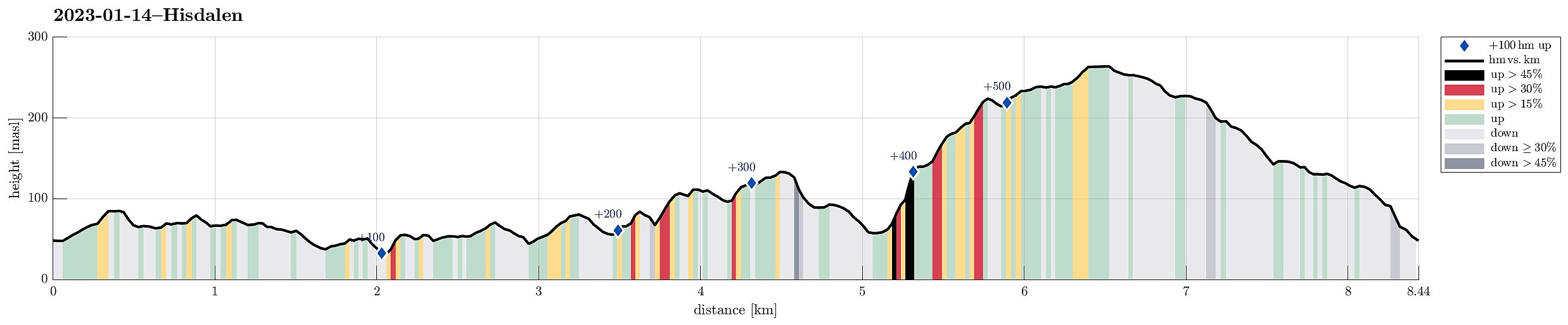
| Distanse | 8,4km |
| Høydemeter | 575m |
| GPS |
|
| Bestigninger | Insta Ospevikfjellet (139moh) | 14.01.2023 |
|---|
Trip Summary
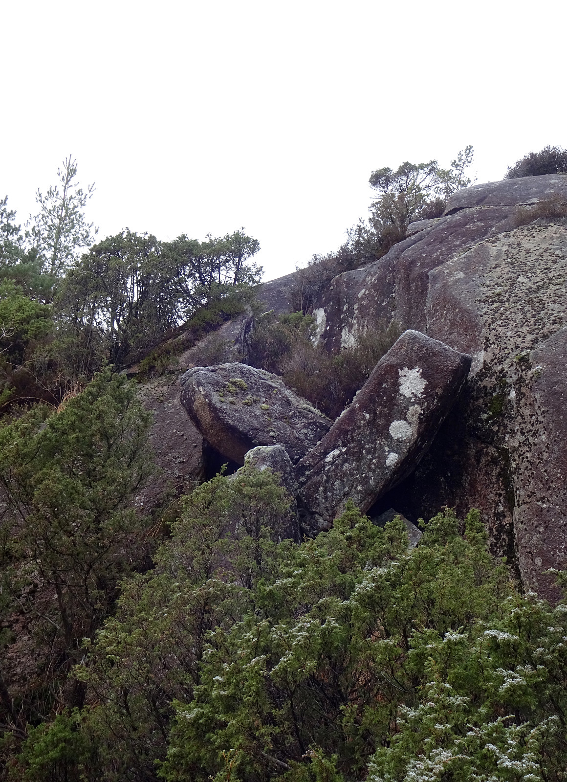
I had never passed by Rosemyrane in the west of Fanafjellet, so why not hiking into Hisdalen via Rosemyrane? I parked along the road from Fana to Krokeide near Rød and entered the terrain behind house 432, where I had seen something like an old trail before (you need a bit of phantasy, though, to respect it as a trail). This way, I got to the saddle in the west of Rødsaksla quickly and easily, entering the valley with Rosemyrane from its north there. Keeping to the east-side of this valley, I could nicely pass by Rosemyrane without getting all too wet shoes right in the beginning of this hike. :-) Not ascending much, altogether, I continued somewhat in southwestern direction (southeast of Vasslibekken). Instead of descending to Austrevågen at house 110, I tried to find a "half-high" connection to the southwestern end of Hisdalsvatnet. At first, this was easy (more or less until I crossed the main trail up to Fanafjellet). Then, I got into terrain that was a bit too steep for my taste and I included a few small detours to continue. This stretch (between Jubileumsstien and the gravel road up to Hisdalsvatnet) was more like an exploration adventure than a convenient short-cut (I'd try something else next time). After some "fight" with the elements, I nicely connected to the gravel road which then lead me to Hisdalvatnet. From there, I first continued in southward direction (up to Vardehaugen), considering a detour also to Austneset. I then, however, continued too much into eastern direction (up on some hills in the south of Hisdalsvatnet), which lead to my decision to drop Austneset for this time. Instead, focused on my continuation towards Ytsta and Insta Ospevikfjellet. To get there, I decided to first hike up a small (but steep) hill in the north of Langedalen. The terrain is quite steep there, but connecting further to Ytsta Ospevikfjellet was then possible. Once up there, I continued "over the heights" towards Insta Ospevikfjellet. Quite satisfied with this traverse, I then decided to get down to Storamyra to start my connection back to Rød via Fanafjellet. The northeast of Insta Ospevikfjellet is also quite steep and one has to look out for a suitable descent towards Storamyra. Once down again, it was then nice and easy to pass by Storamyra on my way towards Hisdalen (now northeast of Hisdalsvatnet). My hope was to find a way to cross the stream in Hisdalen and then ascend up to Fanafjellet on the other, northern side (I had seen on the map that this side of Hisdalen is also very steep, but I had deemed an ascent still possible). I considered myself fortunate to then indeed find a place where I could cross the stream through Hisdalen without stepping right into it (in some other places, this stream is a little bit to wide for an easy crossing). Once on the other side, I immediately started with my ascent. Quickly, this ascent became quite a bit steep (as expected), but I could find a route that brought me "all the way up" to a little nose at about 140masl. From there, ascending further into the direction of Bankesteinshaugen and Brattebergshaugen was then nice and enjoyable. This, eventually, brought me up to Brunane from where I started to aim at my descent towards Rød. I knew of a trail that passes by Grønafjellet to bring one down towards Rød, but I failed to find it. Instead, I hiked a bit too much north (into the north of Grønafjellet). Assuming that I had missed to connect to the trail, I decided to connect westwards on my own, instead. The terrain in the north of Grønafjellet is richly varied, with some cliffs and steps, but otherwise not difficult to traverse. Eventually, I managed to find the trail through Krokakvilet, which I knew would lead me down to Rød (actually I later saw on the map that I had be off just one terrain step (one too low) before reaching Krokakvilet. I was, however, good to then have the trail as it started to get dark already. All in all, this hike was a bit more like an adventure then my average hikes, but still very enjoyable. :-)
Photos
Selected photos are available as Google photo album.
Useful Resources
See also the related FB-page Hiking around Bergen, Norway.
Petter Bjørstad has a useful page about Fanafjellet and also web page WestCoastPeaks.com provides useful information about Fanafjellet.
Web page UT.no from the Norwegian Trekking Association recommends the first stretch of Jubileumsstien across Fanafjellet.

Kommentarer