XMas hike to Fyllingsnipa (24.12.2022)

| Startpunkt | Spelhaugen (60m) |
|---|---|
| Endpunkt | Spelhaugen (60m) |
| Tourcharakter | Wanderung |
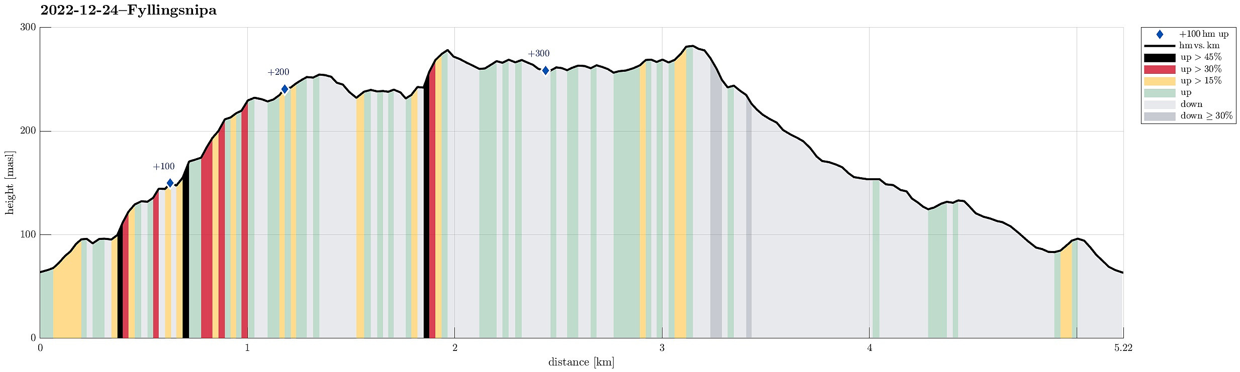
| Tourlänge | 1h 30min |
| Entfernung | 5,2km |
| Höhenmeter | 379m |
| GPS |
|
| Besteigungen | Eikelifjellet i Bergen (258m) | 24.12.2022 |
|---|---|---|
| Fyllingsnipa (286m) | 24.12.2022 | |
| Vest for Fyllingsnipa (286m) | 24.12.2022 | |
| Besuche anderer PBE | Eikelisteinen (250m) | 24.12.2022 |
| Spelhaugen p-plass (60m) | 24.12.2022 |
Trip Summary
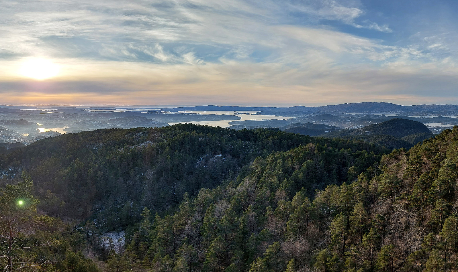
We started from the parking place at the northern end of Spelhaugen, heading for Eikelifjellet, first. Once across Eikelifjellet, we decided that it was the right day for exploring Fyllingsnipa -- a hill that we usually just pass by. To get there, we crossed over the valley in the east of Eikelifjellet a bit northwest of Tøshaugen, then ascending up to Fyllingsnipa from its south (this ascent is well possible, but a bit steep at times). From Fyllingsnipa, we then continued further northwards, passing by Nipetjørna on its western side. This brought us to a side-top of Lyngbønipa, where we had a good overview of Nipedalen and further towards the west. Thereafter, we just returned back to our car, taking a different route back (a bit further to the west).
Photos
Selected photos are available as Google photo album.
Useful Resources
See also the related FB-page Hiking around Bergen, Norway.

Benutzerkommentare