Nice evening hike on Batalden (27.07.2022)

| Startpunkt | Batalden (5m) |
|---|---|
| Endpunkt | Batalden (5m) |
| Tourcharakter | Wanderung |
| Tourlänge | 3h 00min |
| Entfernung | 5,8km |
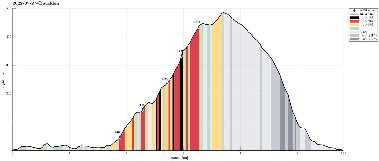
| Höhenmeter | 568m |
| GPS |
|
| Besteigungen | Store Batalden (492m) | 27.07.2022 |
|---|---|---|
| Besuche anderer PBE | Batalden kai (1m) | 27.07.2022 |
| Utsikt Tjeldneshamrane (172m) | 27.07.2022 |
Trip Summary
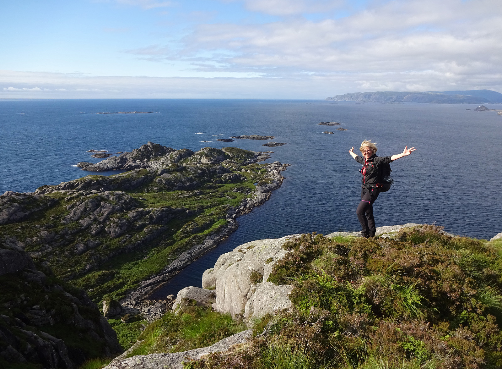
We had taken the car from Bergen to Florø with the plan to enjoy the evening on island Batalden in the northwest of the town. The last two ferries that would stop on the island had a spacing of roughly four hours between them, providing sufficient time for a nice, extended hike. Note that it's important to call the ferries up-front in order to arrange that they actually stop at Batalden. After drop off in the southeast of the island, we started our hike first in northern direction (along the eastern shore of Batalden) to make our hike a nice round (not just up and down the same trail). While it did not really look like a trail (along the shore), we still had the clear impression that at least sheep seemed to use this "trail" and following in their "steps" was quite OK to approach Stokksneset in the northeast of Batalden. Instead of actually getting to the very northeast of the island, however, we started to ascent "in a diagonal fashion", surrouding the rather pronounced cliff in the east/southeast of Tjeldshamrane. After reaching about 100mosl, we then started to enjoy some very nice views towards the north, Tjednesvika and Tjeldneset. At about 130mosl, then, we crossed over the north-south running "cut" through Batalden (called Svedalen a little further south). On the other, western side, then, we first ascended to a very nice vista point right south of Tjeldneset. From there, we then continued steeply upwards (in southwestern direction along the ridge), following (at large) a small valley that runs down from Batalden "right along the ridge". Once above 350mosl, the continuation became easier, and soon after we arrived at a little "fake top" (at 450mosl) with a vertical western cliff side. Following the southern ridge of this "fake top", we then got to another cut (this time in southwest--northeast direction). On its southern side, ascending the last meters to the top of Batalden was then easy and nice. After enjoying a nice break on Batalden, we then started our descent along the "main trail" in southeastern direction. This brings one into the vicinity of Novene (on the south edge of Batalden) with spectacular views down very steep gullies. Below about 225mosl, the terrain is even steeper and we lost the trail for a few minutes (the trail markers are occasionally hard to see). With some careful steps, however, we soon made it back to the trail (and then on the trail back down to the starting point). All in all, we never ever got into any time troubles (to catch the last ferry back to Florø!) and thus thoroughly enjoyed this very nice evening hike up and down Batalden! :-)
Photos
Selected photos are available as Google photo album.
Useful Resources
See also the related FB-page Hiking around Bergen, Norway.
Web page UT.no from the Norwegian Trekking Association recommends a similar hike.

Benutzerkommentare