Høgafjellet (and Hikletten) from Lonadalen (05.06.2022)

| Startpunkt | Blomdalsleitet (235m) |
|---|---|
| Endpunkt | Blomdalsleitet (235m) |
| Tourcharakter | Wanderung |
| Tourlänge | 5h 30min |
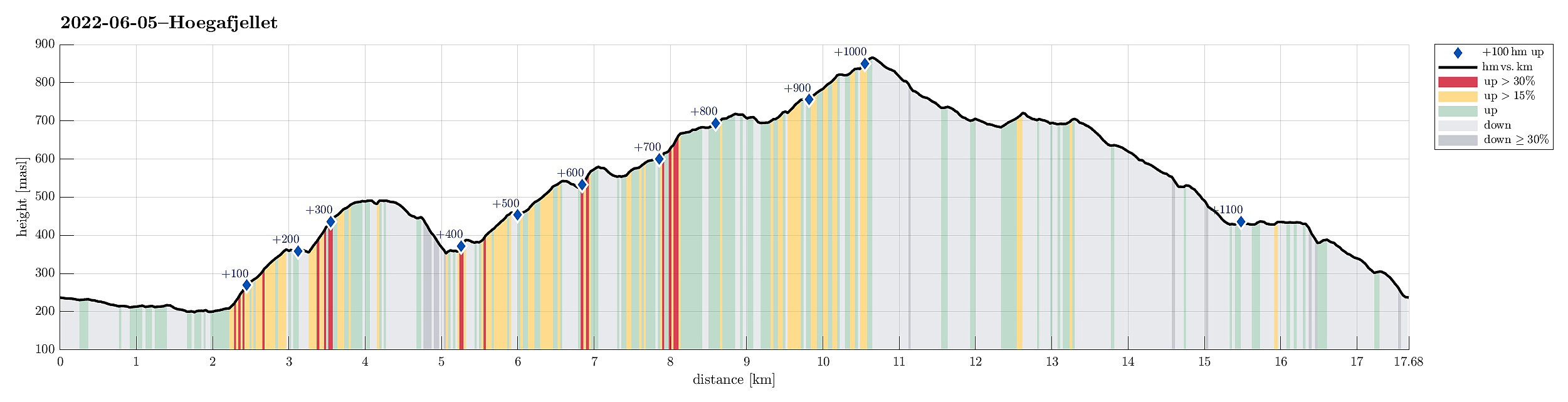
| Entfernung | 17,7km |
| Höhenmeter | 1.135m |
| GPS |
|
| Besteigungen | Fjellsnova (723m) | 05.06.2022 |
|---|---|---|
| Hikletten (494m) | 05.06.2022 | |
| Høgafjellet (868m) | 05.06.2022 | |
| Setnipa (710m) | 05.06.2022 | |
| Vassahaugen (582m) | 05.06.2022 | |
| Besuche anderer PBE | Blomdalsleitet p-plass (235m) | 05.06.2022 |
| Træet gård (220m) | 05.06.2022 |
Trip Summary
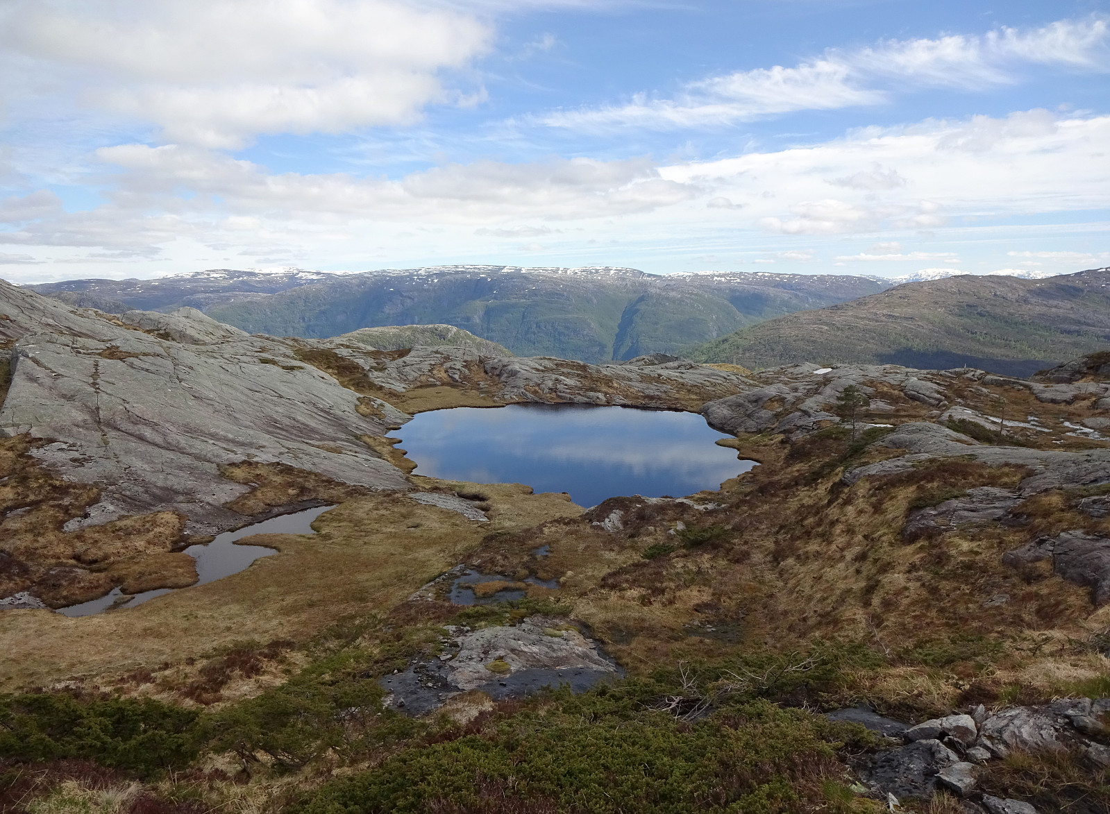
Very nice round including Høgafjellet on Osterøy, starting from its south, i.e., Lonadalen. Using Osterøybrua to conveniently cross over to Osterøy, we turn right before entering the tunnel, driving to Bruvik from there. Leaving the fjord there, we ascended to the saddle in the north of Bruvik (and in the east of Brøknipa) to connect to the interior of Osterøy along road 5418. Before getting all the way down to the large lakes in the middle of Osterøy, we turned right, entering a gravel road that would bring us to Lonadalen, passing by Sagatjørna, Midtvatnet, and Blomdalsvatnet. Near the saddle in Lonadalen, where also the trail from Høgafjellet comes down, we parked and started our hike in northeastern direction, following Lonadalen a bit further, first. At Midttun, we passed by Træet gård, where one also can stay overnight. We then passed by Torvavatnet and Botnavatnet, still following the gravel road. At Botnen, we found the trail that would bring us to Hikletten and soon after we could enjoy some wonderful views from its top. To then connect to Høgafjellet, we first took the same trail down from Hikletten until we were back on the saddle in its north. From there, we crossed over (without a trail), passing by Hunnetjørnane in the northeast of Hikletten. After a traverse of some minor heights north of Hunnetjørnane, we connected to the trail that comes up from Botnavatnet via Åsen. Continuing further northwards (on the western side of Moldargjela), we gain additional height into the direction of Fjellsnova. Vassahaugen, just on the other side of Moldargjela, appeared attractive enough to be included, also (not a must, though, after having been there, even though it offers some nice views). Passing by Storavatnet in its east (and a cabin at Grova), we soon got up to Fjellsnova. From there, we continued along the trail to ascend further to Høgafjellet (in the northwest of Fjellsnova). We then followed the trail back to Lonadalen, stepping over Setnipa along the way. All in all, this round really was very nice, and including Hikletten provided us with some bonus views over Veafjorden!
Photos
Selected photos are available as Google photo album.
Useful Resources
See also the related FB-page Hiking around Bergen, Norway.
Petter Bjørstad has a useful page about Høgafjellet and also web page WestCoastPeaks.com provides useful information about Høgafjellet.
Web page UT.no from the Norwegian Trekking Association recommends a similar hike.

Benutzerkommentare