Visiting TOBRIK (19.12.2021)

| Startpunkt | Varden (45m) |
|---|---|
| Endpunkt | Varden (45m) |
| Tourcharakter | Wanderung |
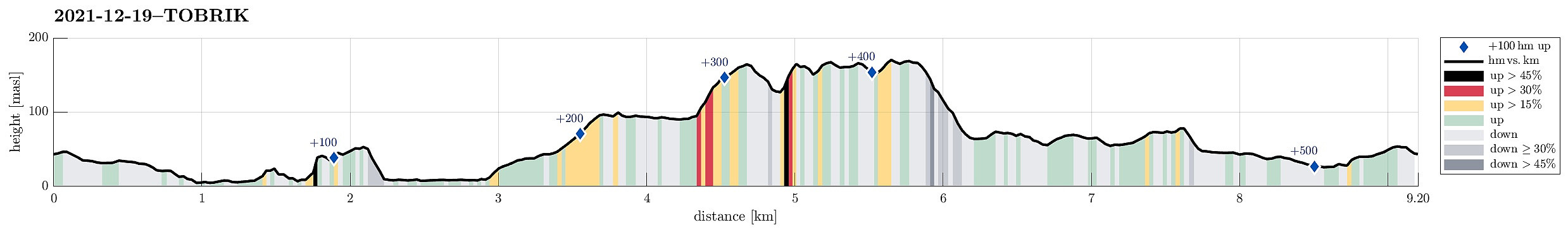
| Tourlänge | 3h 30min |
| Entfernung | 9,2km |
| Höhenmeter | 530m |
| GPS |
|
| Besteigungen | Nord for Storhovden (168m) | 19.12.2021 |
|---|---|---|
| Storhovden (174m) | 19.12.2021 | |
| Besuche anderer PBE | Storhovden utsiktspunkt (172m) | 19.12.2021 |
| Tjørnahuk (91m) | 19.12.2021 | |
| Tobrik (139m) | 19.12.2021 | |
| Øst for Elvareidet (60m) | 19.12.2021 |
Trip Summary
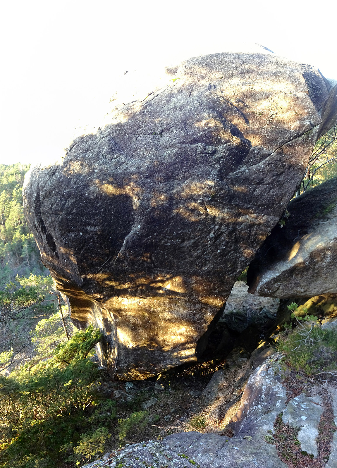
After discussing a few different ideas, we eventually settled on something quite basic: a little round through Kanadaskogen to enjoy the nice December day that also happened to be a Sunday! :-) Starting from Varden in the south of Fyllingsdalen, we headed first to Gjeddevatnet. Following its shoreline for a bit, we rounded Gjerdsvika to get to Fueneset. From there, and in order to get further north (to Bjørndalsvatnet), we had to pass by Elvareidet. While the one of us, who's smart, respected our knowledge of the cliffs in the east of Elvareidet, which require that one passes "over the top" instead of "down around", and started this small ascent right away from Furuneset, the other one, who wished to "double-check", descended again to Gjeddevatnet, just to end up in a "corner" with high cliffs in the east and north (and Gjeddevatnet in the southwest). At first it looked as if the only way to proceed would be to go back (and follow the wise one). After looking a little more carefully, though, a crack in the northern cliff invited a more detailed exploration. Indeed, it was possible to get into the crack and also up it, at least for a few meters. Then, however, it seemed once again that this was the end of this route. The only chance to get further up would have required to use one foot each on either side of the crack to push the rest of the body upwards in the middle; further up, one would then have to "swing over" to one of the two sides and exit the crack to a section, which then would be easier again. Since this looked like a LOT of fun, the not so wise hiker decided to try just this (and, surprisingly, it worked without seeing the guy falling down into the crack, once again!). Once above the crack, progress was easy again and soon later the two explorers were reunited. :-) Continuing from there further northwards brought us then down to Bjørndalsvatnet and along its shore further north. Once at the northernmost end of this lake, we continued along a proper trail even further north, to Svartatjørna. After rounding Svartatjørna on its western side, we crossed over Storamyra, looking up to TOBRIK from there. Without difficulties, we re-found "our" ascent-diagonal to TOBRIK in the northeast of Storamyra. Compared to the last time, we got the impression that quite a few others must have taken this route up to TOBRIK in the meantime, as the ascent via this diagonal had become quite a bit easier. After saying "Hello!" to TOBRIK from close-by, we continued to the hill a little further east of TOBRIK. From there, the goal was then to connect to Storehovden, but this via a more northern route, including a little (west-facing) cliff right south of Gamle Tennebekksveien. Getting there was nice and easy. From down below, it wasn't obvious at all which option to ascend to the top of the cliff would be doable or best. Instead of exploring these options in detail, we just followed our gut-feeling and started in northeastern direction, first. Once through the first few trees, we identified (again) a steep upwards-diagonal that did not look impossible right away. While not really sure whether this diagonal would indeed bring us all the way up, we still decided to give it a try. While quite steep, it eventually turned out to be indeed possible and some minutes later we had ascended to easier terrain, again, leading us to the top of cliff within short time from there. And what a nice viewpoint there is, right on top of the cliff! One get a really nice view across Tennebekkstjørna in the north with Lyderhorn and Ørnafjellet as a brackdrop! :-) From there, it was then only back over the hills to Storhovden. After a short break at the viewpoint in the south of Storhovden, we descended further southwards (in the west of Syningen, this time). Continuing further southwards (in the west of Stora Krokatjørna), we attempted a connection to Hesjaholtet, passing by Litla Krokatjørna. For reasons impossible to identify, we did so, but with an extra-loop in the northwest of Litla Krokatjørna. Don't ask why! :-) Once back on track (and a bit confused, also!), we then got to Hesjaholtet following one of the trails. Eventually, it was no more then just following one of the standard connections between Hesjaholtet and Varden to get back to where we had started. Really a nice little excursion to use the (short) December sun! :-)
Photos
Selected photos are available as Google photo album.
Useful Resources
See also the related FB-page Hiking around Bergen, Norway.

Benutzerkommentare