Møsnuken from Tyssdalen (13.11.2021)

| Start point | Tyssdalen (45m) |
|---|---|
| Endpoint | Tyssdalen (45m) |
| Characteristic | Hike |
| Duration | 4h 30min |
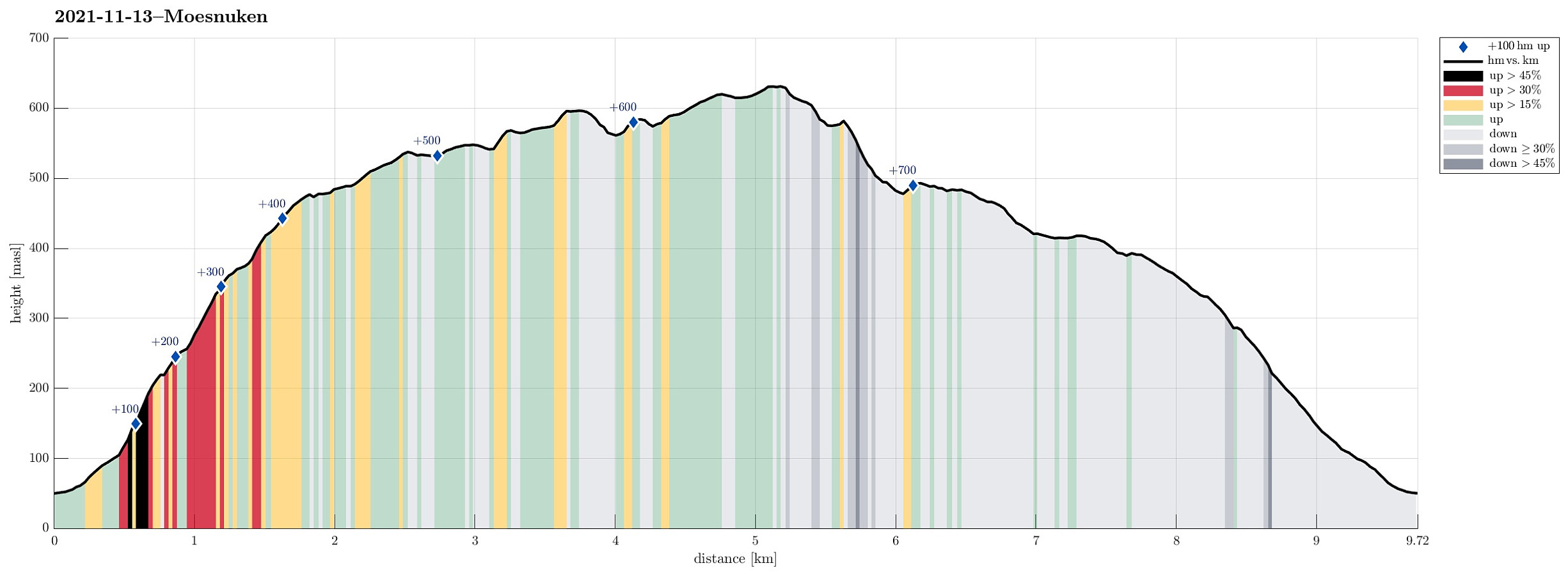
| Distance | 9.7km |
| Vertical meters | 730m |
| GPS |
|
| Ascents | Møsnuken (639m) | 13.11.2021 |
|---|---|---|
| Storafjellet (592m) | 13.11.2021 | |
| Søre Såta (578m) | 13.11.2021 | |
| Tyssdalsfjellet (605m) | 13.11.2021 | |
| Visits of other PBEs | Linken (486m) | 13.11.2021 |
| Tøsdalen parkering (60m) | 13.11.2021 |
Trip Summary
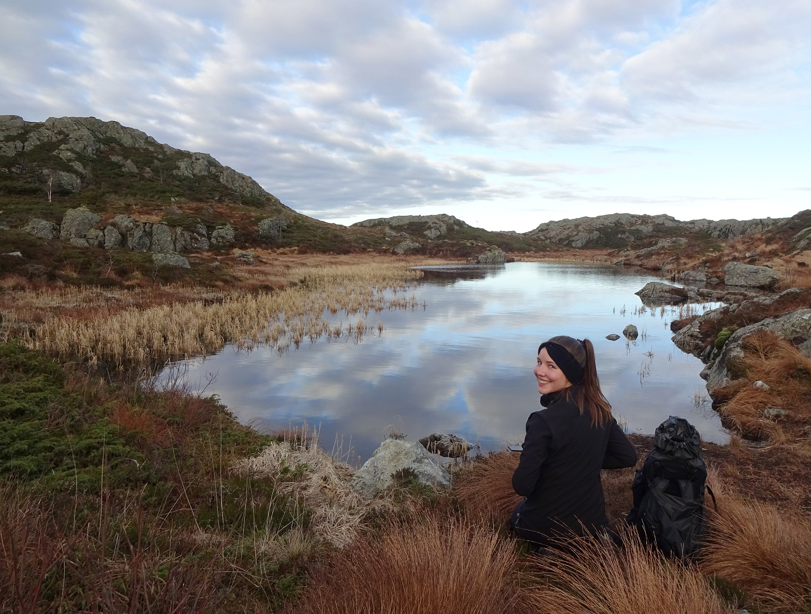
As a small group of four, we wished to some nice autumn hiking in quite fine weather. To also enjoy some views across the nice fjord-landscape around Bergen, we decided to make "the standard hike" up to Møsnuken. Taking E39 south from Bergen, we soon passed by Kalandsvatnet and then Syfteland. A little further south, just before the roundabout at Ulven, we turned left and onto Tøsdalsvegen. In the south of Tyssdalsvatnet, we crossed over a small bridge and parked soon after at the parking spot for hikers right next to Tyssdalselva. Starting our hike on the main trail towards Møsnuken, we crossed Tyssdalselva after just a few meters. Then, after just following the main trail for a few further meters, we turned left to do the ascent to Møsnuken via Linken. This (also very nice) trail leads quickly out of the valley with Tyssdalselva and up towards the ridge in the north of the valley. We then followed this trail upwards and about 450mosl we had come over the tree line, enjoying our first extended views. We then continued further towards Møsnuken over the heights in the west of Møsnuken. This brought us to Mjelkehaugane, Søre Såta, and Tyssdalsfjellet, before continuing further to Møsnuken. While three of us followed the main trail over these heights, one of us deviated a little bit and included the small top of Søre Såta and the one of Tyssdalsfjellet, also. All this is easy and straight-forward as the heights in the west of Møsnuken are easy to traverse, even without a trail. On the very top of Møsnuken we then enjoyed a short break, before starting our way back, this time through the valley that we had left early in the beginning of the hike. To get there, we followed the trail that surrounds Møsnuken in its northeast and southeast. This brings one around the quite steep southern side of Møsnuken and down to about 490mosl (this descent is reasonably steep, but following the trail is not really difficult, especially not when the conditions are not icy). At about 490mosl, where another trail comes up from Tveitaskaret, we then started the less steep continuation of our descent (first through Øvste Stemmedalen and then, after passing by Midtfjellet, into the valley of Tyssdalselva). All of this descent is along a proper trail, which can be quite a bit wet in multiple places. All in all, we returned very satisfied to the car.
Photos
Selected photos are available as Google photo album.
Useful Resources
See also the related FB-page Hiking around Bergen, Norway.
Petter Bjørstad has a useful page about Møsnuken and also web page WestCoastPeaks.com provides useful information about Møsnuken and Tyssdalsfjellet.
Web page UT.no from the Norwegian Trekking Association recommends a similar hike (also via Linken).

User comments