Micro-tops south of Fyllingsdalen (05.09.2021)

| Start point | Varden (45m) |
|---|---|
| Endpoint | Varden (45m) |
| Characteristic | Bike trip - mixed |
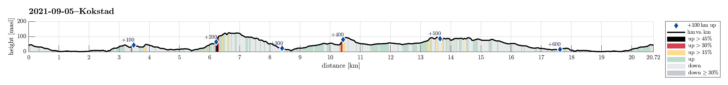
| Duration | 3h 00min |
| Distance | 20.7km |
| Vertical meters | 682m |
| GPS |
|
| Ascents | Dolvikfjellet (128m) | 05.09.2021 |
|---|---|---|
| Kokstadhaugen (100m) | 05.09.2021 | |
| Ruskeneshaugen (51m) | 05.09.2021 | |
| Skranehovden (97m) | 05.09.2021 | |
| Visits of other PBEs | Straume bro (5m) | 05.09.2021 |
Trip Summary
I took the chance to "round up" a few micro-"tops" in the vicinity. This combined eBiking-hiking trip brought me first to Ruskeneshaugen (I do not recommend to follow my track there; all in all, I'm unsure whether there's any good way to get there; and further, it's unclear, why one would get there in the first place), before I continued into the direction of Grimstad (my next goal was to cross over Dolvikfjellet). At Hammarsland, I followed Hammarslandbakken up (basically to where it then also ends) and ascended from there (first into the direction of Dansehaugen in southwestern direction). At about 100mosl, I connected to a trail, which brought me further up to the saddle (with Dolvikfjellet in the east). Crossing over "all the heights" of Dolvikfjellet in southeastern direction, I came out of the forest not far from Nukatippen (just where the power line is). There, I left the trail, heading "back" towards Hammarsland along the northeastern slopes of Dolvikfjellet. Next, I aimed at Skranehovden. I first tried to find a spot for ascending from the north, but had the impression that nowhere between the houses any proper connection to the hill behind them was available to me. I thus biked around the hill and found an opportunity to get up to it from its southeastern end (I'm sure, though, that there must be better ways to get up to Skranehovden!). After stepping over its "top", I inspected the surprisingly rich evidence for various activities on it, involving likely locals from the youngest age on! :-) After finding a good way down (around its western slopes), I ended up on Skranevegen, which I took back to my bike. Last (on this "round up" mission), I wished to give Kokstadhaugen a chance! :-) I thus biked over to Kokstad, using the bike lane in parallel to Bybanen, and parked my bike along Kokstadvegen (near the area with number 30). I then stepped around this industrial area to get to Kokstadhaugen in its north. Apparently, some use the "southern slopes" of Kokstadhaugen for adventurous off-road motorcycle challenges; some of the routes that are marked there in the forest look indeed "impossible" to do with a motorcycle! :-) Before heading back, I made a short detour to Birkelandsskjenet, learning that I best had to go back the route that I had first taken there (instead of trying some traverse of the industrial area below me in the east. All in all, it was good to get out for some time, while the "tops" visited all are kind of moderately exciting, if at all.
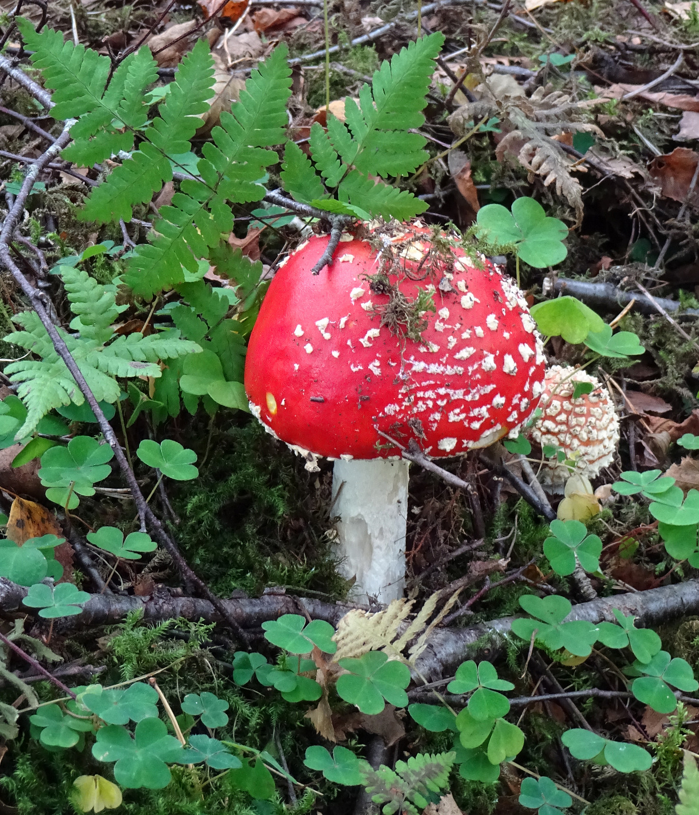
Photos
Selected photos are available as Google photo album.
Useful Resources
See also the related FB-page Hiking around Bergen, Norway.

User comments