Naknesåta, Austefjellet, and Landåsfjellet (04.09.2021)

| Start point | Sædalssvingene (150m) |
|---|---|
| Endpoint | Sædalssvingene (150m) |
| Characteristic | Hike |
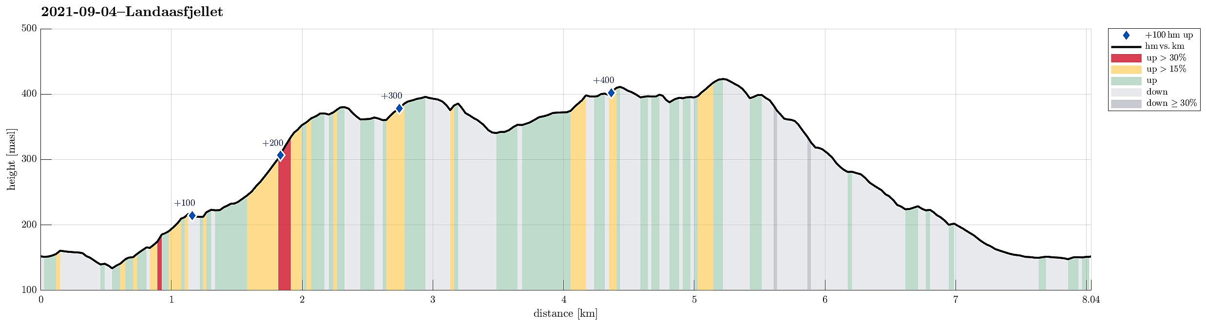
| Duration | 3h 00min |
| Distance | 8.0km |
| Vertical meters | 482m |
| GPS |
|
| Ascents | Austefjellet (399m) | 04.09.2021 |
|---|---|---|
| Landåsfjellet trigpunkt (427m) | 04.09.2021 | |
| Ormhaugen (414m) | 04.09.2021 | |
| Visits of other PBEs | Baunehytten (390m) | 04.09.2021 |
| Indre Sædal p-plass (165m) | 04.09.2021 |
Trip Summary
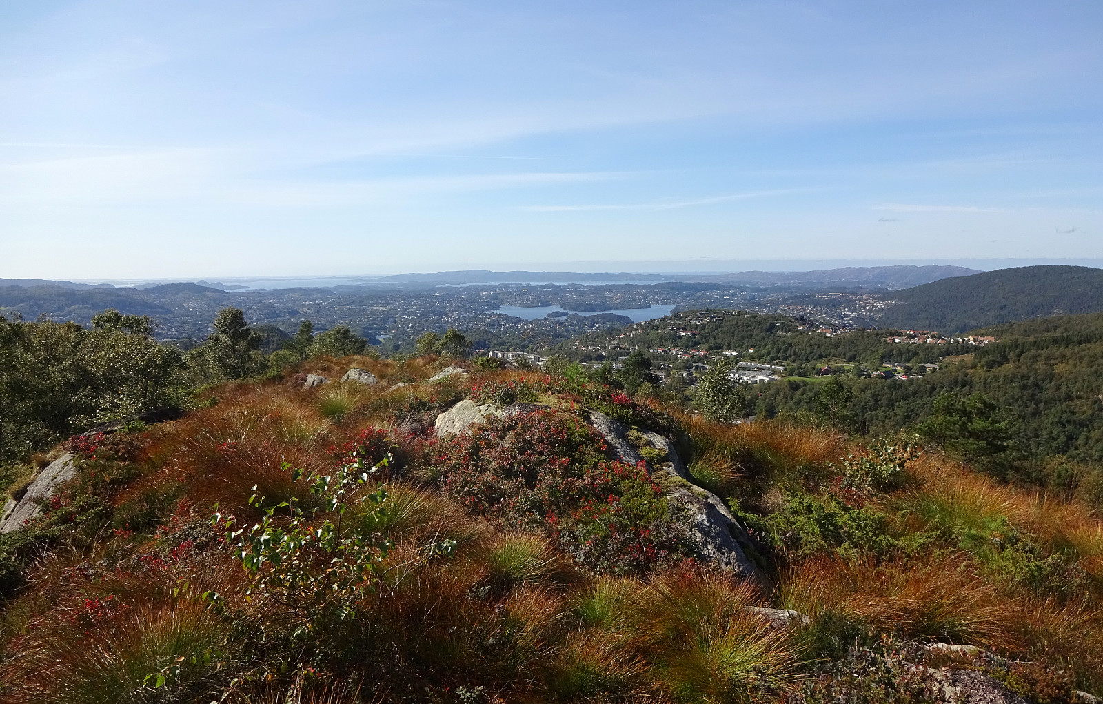
On my Helldal hike from the previous weekend, I had followed the lowest bit of a trail that appeared to lead further up into the direction of Søre Gløvrevatnet. This time, we wanted to look deeper into this and find out! :-) We drove up Sanddalsringen and parked near the saddle, where Sædalssvingene leaves to the east. From there, we first walked along Helldalslia (almost all the way down to house #45) to connect to a proper trail head. In the last swing of Helldalslia, a path for pedestrians, who wish to connect Helldalslia with Hardangervegen further down in the valley, leaves to the east. We first followed this path a little too long, before going back a few steps and taking the right trail that leads through the forest (slightly upwards in northeastern direction). Once under the power line, we "found" the trail that we were heading for and started following it (first a short stretch in western direction, but soon upwards in northeastern direction). This very nice trail brings one through the forest up to a little ridge in the south of Store Løypingsdalen. Following this ridge quite a bit (in northeastern direction), we surrounded Store Løypingsdalen to get over to the southeastern slopes of Løypingsberget. Ascending Løypingsberget (in northeastern direction, then again) through the forest is also very nice. When no longer far from "the top" (Naknesåta), the forest opens up and one can enjoy some nice views over Helldalen and Helldalssåta. We then crossed over Naknesåta (in northern direction), starting this way our passage of Søre Gløvrevatnet (on its western side). After walking over the dam, which holds quite a bit of Søre Gløvrevatnet back from jumping down as Austlibekken, we tried to find a trail that would bring us up to Austefjellet (in the northwest of Søre Gløvrevatnet). Since we could not see any such trail, we just stepped there through the open grass landscape of Austefjellet. After crossing over its top, we first tried to find a "way" down on its northern side, but then concluded that it was a bit too steep for our taste. Therefore, we took an eastward route, instead, which lead us down to Indre Sædal "in a diagonal fashion". After following this road down for a short stretch, we left it for a trail across Vasstølen (basically parallel to the power line). While we "in principle" were heading to Landåsfjellet already then, we still thought that including Ormhaugen would be nice. And so we did, enjoying some very nice panoramic overview of Bergen from there! :-) From Ormhaugen, we then went back (towards Landåsfjellet!), surrounding Nubbevatnet in its north, passing by Baunehytten there. We then crossed over Landåsfjellet and started to look out for a good way to descend back into Sædalen from there. After a bit of exploration, we soon decided to simply follow down the "main trail", which leads southwards (and later southwestwards) from Landåsfjellet. After descending to about 315mosl (in the southeast of Stulihaugen), we took a turn to the left (then in southeastern direction) to descend further along Ørebekken (on its southwestern side). From about 280mosl, this trail departs from Ørebekken, leading further down along a little southwards-facing ridge. At about 245mosl, this trail then bends back (then in northeastern direction), leading to Indre Sædal at about 22mosl (without much down or up along this stretch). Once on Indre Sædal, we just walked this road out to where we had parked.
Photos
Selected photos are available as Google photo album.
Useful Resources
See also the related FB-page Hiking around Bergen, Norway.

User comments