Rounding Storavatnet in the south of Kallestad (24.01.2021)

| Startpunkt | Kallestad (45m) |
|---|---|
| Endpunkt | Kallestad (45m) |
| Tourcharakter | Wanderung |
| Tourlänge | 3h 30min |
| Entfernung | 10,3km |
| Höhenmeter | 483m |
| GPS |
|
| Besteigungen | Migemaurhelleren (95m) | 24.01.2021 |
|---|---|---|
| Rundehaugen (85m) | 24.01.2021 |

Trip Summary
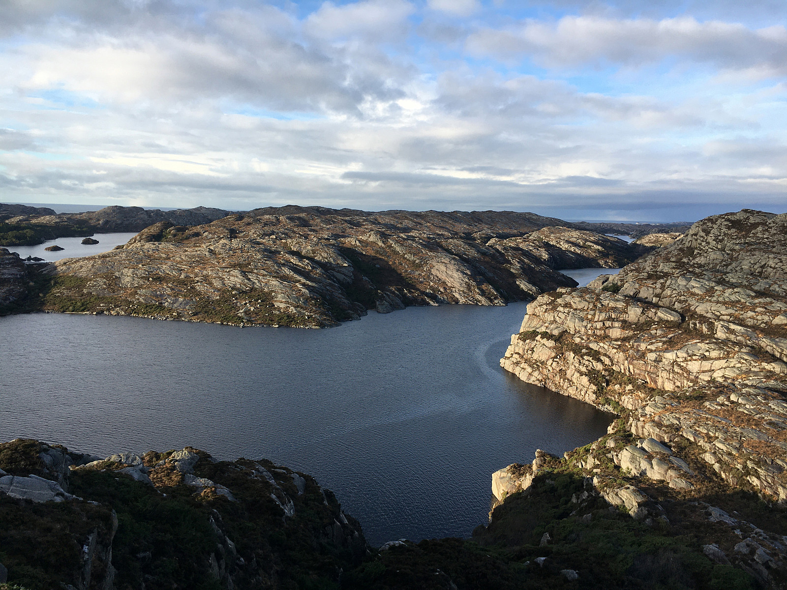
After discussing a few ideas for another nice hike, we eventually decided to drive out to Øygarden, once again, and explore the region near Kallestad again. We thought that the available daylight should be enough to attempt a round around Storavatnet in the southwest of Kallestad. Driving west from Bergen, you get, after a bit, to Sotra. There, turning left, brings one via Fjell further south. At Trengereid, we then turned right in order to drive out to Kallestad, where we parked near Grendahuset. Since our plan was to round Storavatnet in counterclockwise direction, we first walked out of Kallestad in western direction, passing by Vassenden, south of Stølstjørna. There, instead of further following the trail into the direction of Kjereidet, we just walked up the first little hill, then turning left (in southwestern direction). Directly west of the most northern point of Vassenden, we then crossed a little valley (to get over to Svarthelleren and Glamshaugen). Attempting this crossing right at a point, where the valley was quite a bit filled with ica and water, we had to see for a moment, how to actually get over to the other side (the whole "valley" is not really much of a valley, but half a meter of ice water can still pose some challenges, when you appreciate at least mostly dry shoes along your hike). Once on Svarthelleren, progress was easy, once again, and we ascnded (in western direction) first to Glamshaugen. From there, while including a nice cliff with a good view in western direction, we then turned southwards (and towards Migemaurhelleren). From Migemaurhelleren we indeed enjoyed some nice views before then continuing our hike further southwards. The west and south of Migemaurhelleren is characterized by quite some cliffs, so watching out for good opportunities to proceed is necessary. After first descending from Migemaurhelleren (in southern direction), we passed three small lakes in their east, entering Stordalen from its north. Stordalen is actually a valley that seems difficult (or practically impossible) to cross on its western end. We thus walked quite a bit in southeastern direction, crossing Stordalen basically where its saddle is (in the northeast of Manen and in the west of Revursmyra). We then decided to also include Manen, even though this was a bit of a detour. Still, one easily could say that we had the best views from Manen, after all, so stepping up there was definitely a good idea. After enjoying the nice views from Manen, in particular from the cliff-top in the very west of Manen, we then turned back (again in southeastern direction). Walking along the southern cliff of Manen offered more nice views over Kørelen. South of Gamlasveda, we crossed a wet area before descending further down to Kvernelva. There, we were surprised to find both some trail markers as well as a registry near an old dam that crosses over Kvernelva there. After signing into the registry, we crossed Kvernelva via the dam, ascending quite steeply on the other side. Once up the first "step", one crosses a little wet area, facing another, also very pronounced step up. When studying the map in advance, we had thought to round this cliff in its north, but as it seemed as if there was (something like) a trail directly up the cliff, we took this opportunity, arriving "on top" shortly after. Since we wanted to pass Isbragdtjørna in its south in order to further round Storavatnet, we headed southwards (into the direction of Lotafjellet). Crossing Rindsfjellet, we then started our descend in eastern direction. Before actually getting down to a little forest in the south of Isbragdtjørna, we had to find a way of stepping down a quite pronounced cliff. After first trying a bit further south, we then turned back north, finding "an idea of" a trail there, leading us down well. To cross over through this little forest in the south of Isbragdtjørna, we needed to first head a bit south, again, before then, on the other side, head back north. There, we "reconnected" with a minor trail, leading us up onto the heights in the southeast of Isbragdtjørna. Knowing that we had to cross over near Skinkevatnet, we first followed this minor trail in northeastern direction. In the west of the northernmost part of Vardavika, we entered a little forest, crossing over a little hill there (from south to north). First thinking that we could cross over into the direction of Skinkevatnet near the shoreline of Vardavika (at its northern end), we descended the slightly steepish norther hillside there. Once down at the water, we concluded that crossing over to Skinkevatnet there would require a bit of climbing. We thus decided to instead go back up (in northwestern direction) and seek a better opportunity for getting over to Skinkevatnet there. Back up at the saddle, we again found what can be called a simple trail, leading us up and over towards Skinkevatnet. Once back down on the other, eastern side, we turned northwards, again, into the direction of Eikelifjellet. Crossing over some wet area in the northwest of Skinkevatnet, we ascend to some intermediate heights in the west of Eikelifjellet (one needs to be thinking VERY positively to accept that what we followed there is indeed a trail). Once up there, however, proceeding (in northern direction) got easier again. At the very northwestern end of Borddalen, we crossed over, again, proceeding further northwards into the direction of Helgetjørna. Roughly at the saddle, before descending further towards Helgetjørna, we started wondering whether the remaining daylight would be enough to find our "way" through the somewhat rough terrain south of Kallestad. To avoid any possibly stupid situation, we decided to "bail out" towards the road further east. Following what looked, at least for a while, like a minor trail, again, we ascended quickly towards the south of Skadtjørna, where we connected with Nordsjøløypa (to be honest, we really were surprised to find this trail there!). We then followed this trail down, in eastern direction, to get down to the road, which we then followed back to Kallestad. All in all, we really enjoyed exploring the west of Storavatnet, especially the views from Manen. Then, however, we were surprised to not find better trails in the south/southeast of Kallestad, connecting Kallestad/Trengereid with the heights between Storavatnet and Kørelen.
Photos
Selected photos are available as Google photo album.
Useful Resources
See also the related FB-page Hiking around Bergen, Norway.
Web page UT.no from the Norwegian Trekking Association recommends another hike from Kallestad to Kvedna.

Benutzerkommentare