Krampane and Hamlagrøhornet (04.10.2020)

| Startpunkt | Hamlagrøvegen (640m) |
|---|---|
| Endpunkt | Hamlagrøvegen (640m) |
| Tourcharakter | Wanderung |
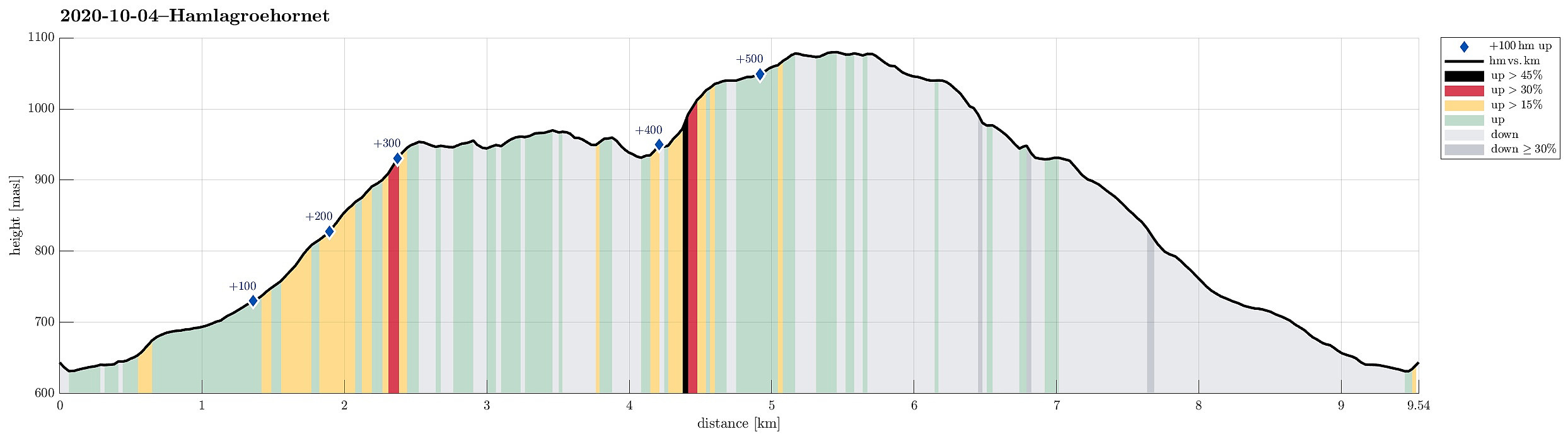
| Tourlänge | 4h 00min |
| Entfernung | 9,6km |
| Höhenmeter | 560m |
| GPS |
|
| Besteigungen | Hamlagrøhornet (1.083m) | 04.10.2020 |
|---|---|---|
| Krampane (972m) | 04.10.2020 |
Trip Summary
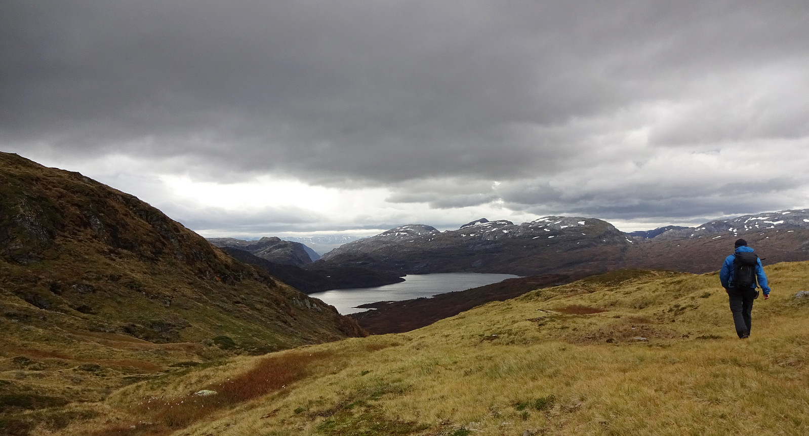
The day after our hike to Kjerringafjellet, we again started from Hamlagrøvegen -- this time, however, into the other, northeastern direction. Our first goal was Krampane, north of the cabin named after Alexander Grieg at Holeberg. We first walked along the western slope of Røvhaugane, before then crossing over to Svartagrovi in northwestern direction. Just a few height meters below 700mosl, we crossed the stream and continued (for a not very long stretch) along the marked trail in northern direction. Roughly where we crossed 700mosl, we diverted from this trail to the left and continued (in northwestern direction) towards the southern ridge of Krampane. Just a bit above 800mosl, then, we had connected to that ridge and continued along it upwards (all the way to Krampane). Up there, we then enjoyed some really nice views over Bergsdalen! With plenty of time left, we decided that we would continue towards Hamlagrøhornet from Krampane. To do so, we first followed the high, northeasern ridge of Krampane, passing by a number of nice lakes (including Mjøstøltjørni and Kalvatjørn). Turning more and more right (and eventually into southeastern direction), we soon arrived at the main saddle between Krampane and Hamlagrøhornet (a litte higher than 900mosl). The following ascent to the heights of Hamlagrøhornet (further east) is steep, but well possible, when choosing appropriate slopes. Soon later (and about 100 height meters higher), we arrived at the heights of Hamlagrøhornet. From there, it's then smooth and easy towards the actual top of this mountain (Hamlagrøhornet has quite pronounced cliffs in its south, southwest, and west, making its smooth and king of level "top" almost an unexpected surprise!). Since we had chosen a windy (stormy, actually) day, we did not rest at the top, but just turned around and walked back down (more or less along the same route that we had come up first). From the saddle, however, we then continued "straight back", i.e., in southern direction (but west of Kvanngjelet that extends along some of the significant cliffs of Hamlagrøhornet). From Bakkeggi, we then headed towards the western slope of Røvhaugane, again, bringing us back to where we had started. Very nice to explore the mountains around Bergsdalen in colorful autumn times!
Photos
Selected photos are available as Google photo album.
Useful Resources
See also the related FB-page Hiking around Bergen, Norway.
Petter Bjørstad has a useful page about Hamlagrøhornet and also web page WestCoastPeaks.com provides useful information about Mykletveitveten, Hardfjellet, and Hamlagrøhornet.

Benutzerkommentare