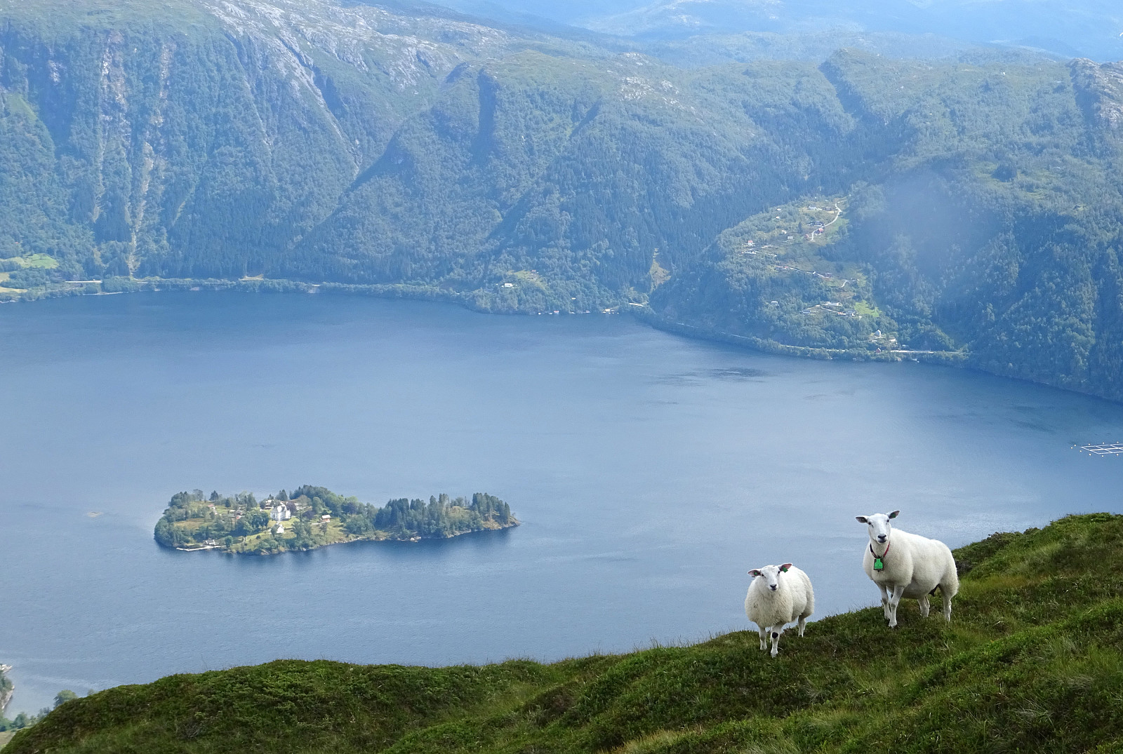
Brøknipa from Båtaleitet parking (19.07.2019)

| Startpunkt | Båtaleitet parking (350m) |
|---|---|
| Endpunkt | Båtaleitet parking (350m) |
| Tourcharakter | Bergtour |
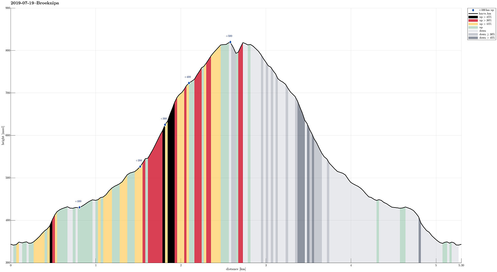
| Tourlänge | 3h 00min |
| Entfernung | 5,3km |
| Höhenmeter | 553m |
| GPS |
|
| Besteigungen | Bruviknipa (822m) | 19.07.2019 |
|---|---|---|
| Besuche anderer PBE | Båtaleitet p-plass (350m) | 19.07.2019 |
Trip Summary
We started from Båtaleitet parking, quite a bit above Bruvik on Osterøy (to the right, right after crossing the bridge). Following the easy-to-find trail, we soon arrived at the top of Brøknipa (Bruviknipa), enjoying some very nice views over Sørfjorden from up there (it's always wonderful to stand on top of Brøknipa -- very much recommended!). After spending a bit of time on the top, we then returned back down on the same trail that we had taken up. A nice (not too long) hike with great views! :-)
Photos
Selected photos are available as Google photo album.
Useful Resources
See also the related FB-page Hiking around Bergen, Norway.
Petter Bjørstad has a a useful page about Brøknipa; and also web page WestCoastPeaks.com provides useful information about Brøknipa (he writes "In my personal opinion, Brøknipa is one of Hordaland's finest mountains").

Benutzerkommentare