Kanadaskogen and Straumsfjellet (05.05.2019)

| Startsted | Varden (45moh) |
|---|---|
| Sluttsted | Varden (45moh) |
| Turtype | Fjelltur |
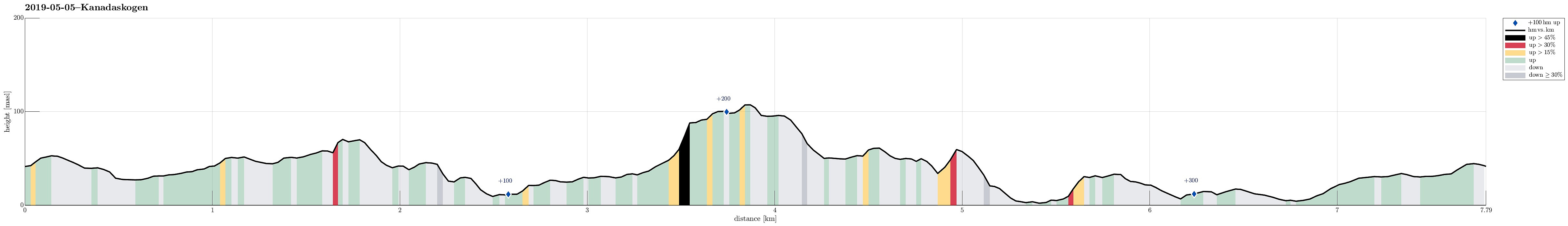
| Turlengde | 2t 00min |
| Distanse | 7,8km |
| Høydemeter | 357m |
| GPS |
|
| Bestigninger | Straumsfjellet (111moh) | 05.05.2019 |
|---|
Trip Summary
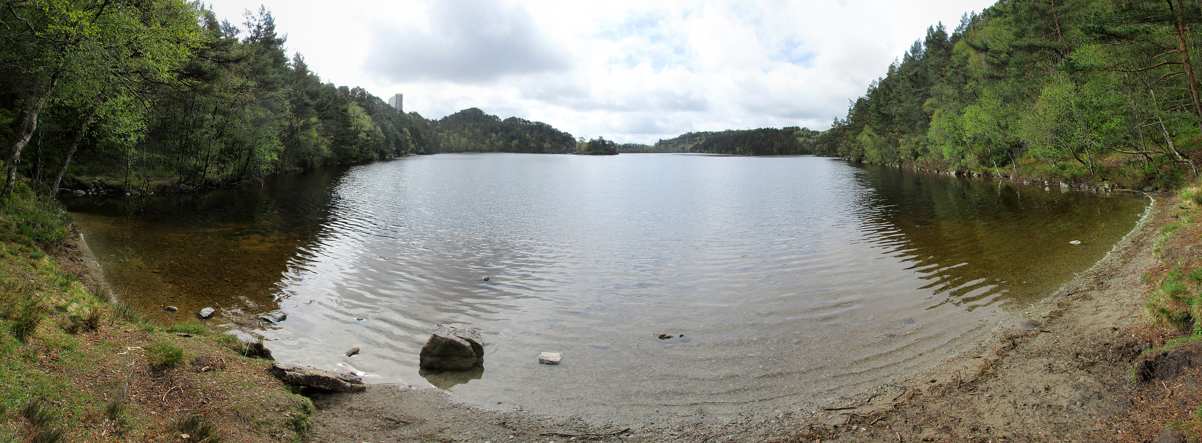
We started from Varden with no particular plan (except for getting some fresh air). We headed towards Kanadaskogen, crossing over the soccer fields north of Varden. We first followed some beaten paths between the houses until we reached Hesjaholtet. There, we eventually left streets and houses and entered the forest (Kanadaskogen). We started with some smaller heights north of Hesjaholtet, including some nice views down to Bjørndalsvatnet. After crossing some further (small) heights, we descended down to the place in the very north of Bjørndalsvatnet, where previously some building was standing (a mill?). From there, we followed a trail towards the west along the lake (in its north). This way, we rounded the southern ridge of Træshovden near the lake and then chose a gently ascending path (in northwestern direction) that bring one to Bjørndalsstølen. There, we followed the road for a bit (and to find the tunnel under Bjørgeveien that provides an easy way to get to the other side of the street. On the other side, we first followed Bjørndalsbrotet (just for a few meters), before turning left (then in southern direction), finding a connection for pedestrians (and cyclists) to Bjørndalsskogen. Instead of following this path for any much longer, we took the first chance to get off (to the right / to the west), steeply ascending towards Straumsfjellet from there (not really with a trail there). At about 85mosl, we connected to a proper track and followed it around a little top, starting in northern direction (and in counterclockwise rotation). On the other side, we found a convenient way to connect to Straumsfjellet. We then followed the trails across the heights of Straumsfjellet in southern direction. This brought us to the western-most point of Bjørndalsskogen. There, we continued further southwards (on the western side of Bjørndalsskogen). Staying near the "high ridge" (and west of the houses), we continued further south. After crossing Ørnahaugen, we then descended along its southern ridge to Kjerreidvika. Curious, whether it is possible to continue further on the other side of Kjerreidvika, we found a possibility to ascend (without any trail, however) to Kjerreidhaugane. From there, we just returned to Varden via Bjørgeveien.
Useful Resources
See also the related FB-page Hiking around Bergen, Norway.

Kommentarer