Ørnafjellet, Skjenafjellet, and Lyderhorn (01.05.2019)

| Startsted | Nutec, Gravdal (5moh) |
|---|---|
| Sluttsted | Nutec, Gravdal (5moh) |
| Turtype | Fjelltur |
| Turlengde | 2t 30min |
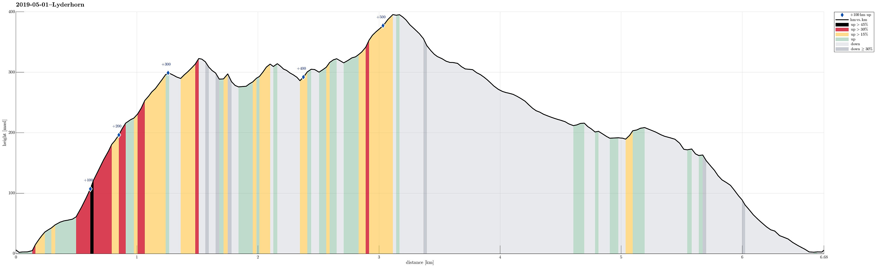
| Distanse | 6,7km |
| Høydemeter | 561m |
| GPS |
|
| Bestigninger | Lyderhorn (396moh) | 01.05.2019 |
|---|---|---|
| Skjenafjellet (319moh) | 01.05.2019 | |
| Ørnafjellet (329moh) | 01.05.2019 | |
| Ørnafjellet Nord (304moh) | 01.05.2019 |

Trip Summary
Even though the weather was not as nice as during many of the days before, we still wished to get a bit of fresh air. Since time was also limited, we decided to make a short hike on Lyderhorn. We started from the north of Gravdal, where also the street up to Kvarven leaves. Instead of starting with Kvarven, however, we decided to include Ørnafjellet (via Mördarbakka), first. To do so, we started with the stairs that lead upwards from the southern end of the industrial area at the northwestern end of Gravdal. This brings one onto a nice trail that leads through the forest in southern direction to a small soccer field (north of Øvrebø). Directly from this playing field, then in western direction and steeply upwards, you can find the trail up to Ørnafjellet. Before actually getting to the top of Ørnafjellet, however, one first gets to the saddle north of Ørnafjellet (and east of Skåleviksvatnet). Once on the saddle, the continued ascent to Ørnafjellet is straight-forward (in southern direction then). Ørnafjellet itself is (very) steep on most of its sides. Therefore, it is basically required to ascend and descend along the same path (on the northern ridge). After having visited Ørnafjellet, we continued into the direction of Lyderhorn (overall in southwestern direction). We included Skjenafjellet "on the way" with its impressive cliff on its western side and some very nice views from its top. After then passing over Litlasåta, we connected to the main trail to Lyderhorn (the one that comes up via Kvarven). We then hiked to Lyderhorn along this main trail (on the northern side of Lyderhorn). To return, we took the main trail (to Kvarven), passing by Søre Skåleviksvatnet and Skåleviksvatnet on their western side. Near Orfallet, we took the wooden stairs up to Kvarvenbakken. Instead of walking the street down to the car, we took a trail that amounts to a nice shortcut through the forest. Following this trail, on ends up at the uppermost parking spot along Kvarvenbakken (and near to the industrial area, where we had parked the car). Within a few minutes from there, we had returned to the car after a nice and not-too-long hike in the immediate vicinity of Bergen.
Photos
Selected photos are available as Google photo album.
Useful Resources
See also the related FB-page Hiking around Bergen, Norway.
Petter Bjørstad has a useful page about Lyderhorn and also web page WestCoastPeaks.com provides useful information about Lyderhorn and Ørnafjellet.
Web page SpillBy.com describes Ørnafjellet and
web page FotTurer.com describes a tour up Ørnafjellet.

Kommentarer