Husdalsfjellet via Husdalen from Kanalen (13.04.2019)

| Startsted | Bridge across Kanalen (55moh) |
|---|---|
| Sluttsted | Bridge across Kanalen (55moh) |
| Turtype | Fjelltur |
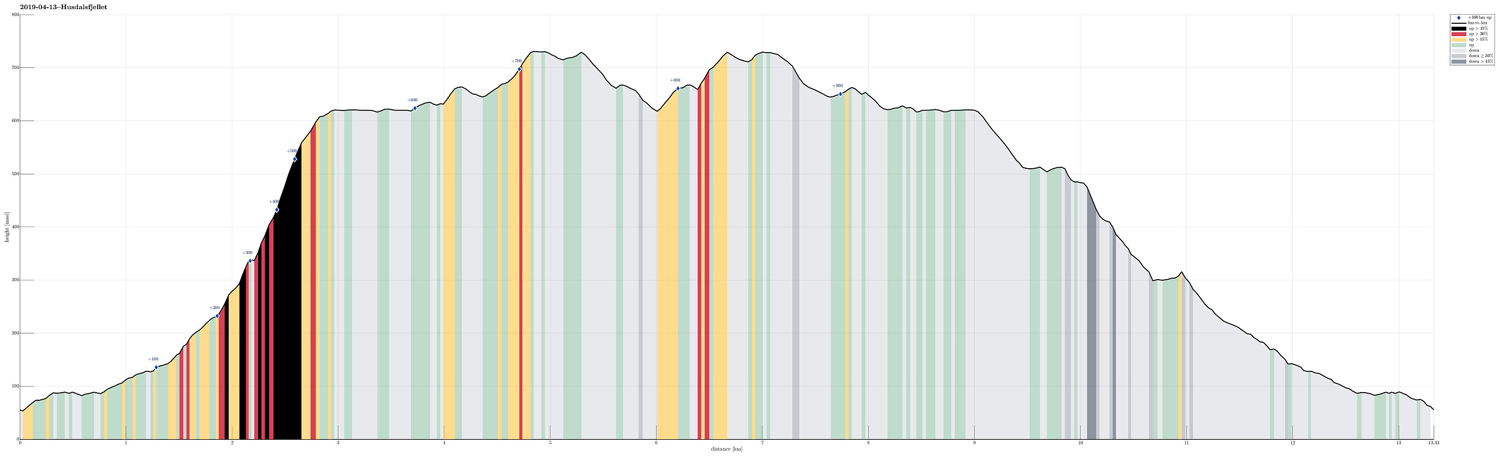
| Turlengde | 5t 00min |
| Distanse | 13,3km |
| Høydemeter | 988m |
| GPS |
|
| Bestigninger | Husdalsfjellet (734moh) | 13.04.2019 |
|---|---|---|
| Andre besøkte PBE'er | Rustadfjellet trigpunkt 623 (623moh) | 13.04.2019 |
Trip Summary
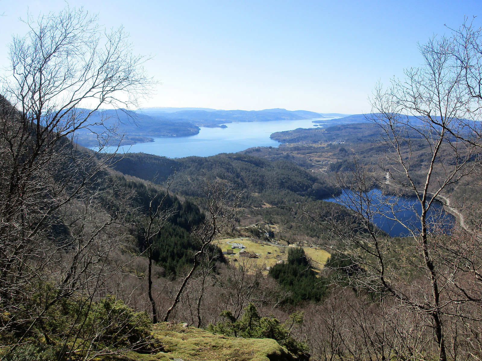
We took the E39 to the north of Bergen, crossing over to Knarvik over Nordhordlandsbrua. We then continued along E39 (in the direction of Førde) along the northern side of Osterfjorden. Right after Bjørsviktunnelen, we turned right at the second opportunity (marked towards Molvik there). Note that this exit comes almost immediately after the one to Bjørsviki, so it's good to keep your eyes open right after leaving the tunnel! :-) We then followed Molvikavegen for only a very short stretch until we crossed over the little bridge over Kanalen. Right after the bridge, we found a little place on the left, where we could park for a while. Just meters above the parking, a private road to Husdalen leaves to the northeast (left), locked behind a bar. We hiked along this road then, in the southeast of Husdalsvatnet, coming by Husdaltjørna (on the right/south). Before actually arriving at Husdalen, we found what looked like the old trail up to Husdalen and used this one instead of the road. At Husdalen, a somewhat too vague memory of another similar hike on Peakbook, we tried to find the trail head for the steep ascent on the northern side of Husdalen. Instead of keeping to the left at the last/highest building of the farm at Husdalen (what one should do!), we tried to find the trail head on the right side. This made us ascend first without a path (still well possible there even though steep). Realizing that we had not yet found the real trail, we continuously crossed towards the left (north), while ascending, until we connected with the trail. This trail is indeed spectacular! Not only is it steep and thus exciting; also lots of efforts have been put (previously) into preparing it (with many stone steps on the way up) -- clearly an impressive experience to hike up there! After the steep ascent, we soon arrived on Husdalsfjellet, enjoying some amazing views of the nearby fjords. At 623mosl, we visited the cairn with a log book, before continuing further towards the actual top of Husdalsfjellet (further in the north). Hikes like this are great, where you first get up into the heights quickly and then can enjoy hours of hiking "on top" with great views in all directions! :-) To reach the real top of Husdalsfjellet, we kept to the right (east), visiting a small top in between (east of Rustadfjellet). The views down into Molvikadalen (and beyond) are really nice! :-) We then continued to the actual top of Husdalsfjellet and continued also beyond it (further north) in order to catch some more views (in particular across Gryteskaret towards Kjellrusen / Austlendingen, but also down onto Hiklettane). We then decided to call it a day and started our return from there. This time, we kept a little more to the west, visiting Rustadfjellet along the descent. Coming by the cairn with the log book, again, we found a very nice trail that brought us further down. Coming by Stortjørna was then definitely another highlight of the hike -- what a lovely little lake high up there! :-) From there, it was then relatively easy to follow the trail until we connected to a forest road through Matendalen, which leads back to Husdalen. All in all, this was a very lovely hike in amazing weather and with lots of great views. Highly recommended! :-)
Photos
Selected photos are available as Google photo album.
Useful Resources
See also the related FB-page Hiking around Bergen, Norway.
Web page WestCoastPeaks.com provides useful information about Husdalsfjellet.
Web page UT.no from the Norwegian Trekking Association recommends a similar hike (to the cairn and back).

Kommentarer